Category:1552 maps
Jump to navigation
Jump to search
| ← · 1550 · 1551 · 1552 · 1553 · 1554 · 1555 · 1556 · 1557 · 1558 · 1559 · → |
Deutsch: Karten mit Bezug zum Jahr 1552
English: Maps related to the year 1552
Español: Mapas relativos al año 1552
Français : Cartes concernant l’an 1552
Русский: Карты 1552 года
Subcategories
This category has the following 4 subcategories, out of 4 total.
Media in category "1552 maps"
The following 28 files are in this category, out of 28 total.
-
 1552 Ptolemy's 7th Asian Map by Sebastian Münster.jpg 4,534 × 3,437; 3.66 MB
-
 1552 Ptolemy's 9th Asian Map by Sebastian Münster.jpg 4,460 × 3,409; 3.27 MB
-
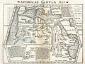 Aphricae Tabula IIII.jpg 1,431 × 1,078; 2.11 MB
-
 Fotothek df tg 0005101 Geographie ^ Karte ^ Erde.jpg 800 × 649; 305 KB
-
 Fotothek df tg 0005111 Geographie ^ Karte.jpg 800 × 672; 302 KB
-
 Fotothek df tg 0005112 Geographie ^ Karte.jpg 800 × 659; 285 KB
-
 Fotothek df tg 0005113 Geographie ^ Karte.jpg 519 × 820; 237 KB
-
 Gomara 1552.jpg 984 × 1,317; 321 KB
-
 Image evia 1552.jpg 688 × 406; 162 KB
-

-
 Ptolemy, Terra Sancta XXIII nova tabula (FL199985874 2368938).jpg 6,445 × 4,961; 15.97 MB
-
 Sebastian Münster, Holand (FL35073014 2535981).jpg 3,524 × 5,111; 27.86 MB
-
 Sebastian Münster, Ierusalem (FL25567780 2368137).jpg 2,282 × 2,902; 10.02 MB
-
-
 Sebastian Münster, La ville de Genéve avec sa situation (FL167468691 2466948).jpg 7,741 × 5,056; 46.73 MB
-
 Sebastian Münster, Palestine (FL51320584 2368811).jpg 4,547 × 7,736; 42.83 MB
-
 Sebastian Münster, Palestine (FL6880127 2368816).jpg 1,976 × 3,024; 2.67 MB
-
 Sebastian Münster, Sicily (FL83240434 2372896).jpg 3,248 × 5,008; 18.83 MB
-
 Sebastian Münster, Syria (FL51320601 2368808).jpg 5,459 × 8,022; 54.08 MB
-
 Sebastian Münster, Syrie auec ses prouinces (FL6880613 2368814).jpg 2,000 × 3,012; 2.83 MB
-
 Sebastian Münster, Transylvania (FL35076503 2541437).jpg 4,964 × 7,580; 53 MB
-
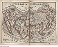
 Sebastian Münster, Typus orbis universalis (FL13736746 2718537).jpg 6,469 × 5,082; 46.58 MB
-

-
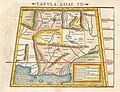
 Tabula Asiae II - Sarmatia Asiatica.jpg 2,203 × 1,700; 1.76 MB
-
 Toda la tierra de las Indias.jpg 2,409 × 1,550; 804 KB
-
 UBBasel Map 1552 Kartenslg Schw A 61 Helvetia.tiff 8,945 × 5,476, 2 pages; 140.16 MB
-
 UBBasel Map 1552 Kartenslg Schw A 62 Helvetia.tiff 8,312 × 5,639, 2 pages; 134.13 MB
-
 Wolfgang Lazius's great map of the Kingdom of Hungary (1552).jpg 1,200 × 846; 314 KB


.jpg)
.jpg)
.jpg)
.jpg)
.jpg)
.jpg)
.jpg)
.jpg)
.jpg)
.jpg)
.jpg)


.jpg)
.jpg)