Category:1550s maps of the world
Jump to navigation
Jump to search
| 16th-century maps of the world: ← 1500s 1510s 1520s 1530s 1540s 1550s 1560s 1570s 1580s 1590s → |
English: This category is supposed to hold world maps created in the 1550s.
Media in category "1550s maps of the world"
The following 32 files are in this category, out of 32 total.
-
 1535 pedro reinel atlantic nord 02.jpg 750 × 499; 99 KB
-
 1550 Ptolemaic world map by Sebastian Münster.jpg 5,093 × 3,880; 2.85 MB
-
 David Kandel 1569.jpg 3,648 × 2,736; 1.89 MB
-
 Print, book-illustration, map (BM 1850,1014.967).jpg 2,500 × 1,840; 1.62 MB
-
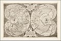
 Altera Generalis Tab Secundum Ptol.jpg 1,554 × 1,200; 703 KB
-
 Typus Orbis Ptol. Descriptus.jpg 9,129 × 7,038; 20.2 MB
-
 1553 map - Charta Cosmographica, Cum Ventorum Propria Natura et Operatione.jpg 7,245 × 5,325; 9.65 MB
-
 1553 map of the world by Peter Apian.jpg 7,217 × 5,254; 10.03 MB
-
 1553 world map - Charta Cosmographica, Cum Ventorum Propria Natura et Operatione.jpg 7,545 × 5,313; 9.57 MB
-
 Charta Cosmographica, Cum Ventorum Propria Natura et Operatione.jpg 7,213 × 5,163; 10.01 MB
-
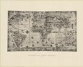
 Map of the world including the New World (1553).jpg 800 × 600; 211 KB
-
 Map of the world including the New World east half(1553).jpg 800 × 1,067; 311 KB
-
 Map of the world including the New World Wst half(1553).jpg 800 × 1,067; 322 KB
-
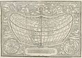
 Die Schiffart aus Hispanien in die newe Welt RMG F1727.tiff 7,440 × 4,818; 102.56 MB
-
 La Figure Du Monde Universel.jpg 9,286 × 7,135; 16.41 MB
-
 1554 lopo homen mapa mundi 03.jpg 2,077 × 1,560; 1.52 MB
-
 Map of the ancient world* (1555) .jpg 1,694 × 800; 307 KB
-
 Altera Generalis Tab Secundum Ptol by Sebastian Münster.jpg 9,195 × 7,014; 14.44 MB
-
 Antonio Salamanca Worldmap 1550.jpg 4,608 × 3,114; 6.1 MB
-
 Ca. 1550 map of the world by Antonio Floriano published in Venice.jpg 20,144 × 11,411; 82.05 MB
-
 Die Weltkarte des Pierre Desceliers von 1553.tif 7,480 × 6,031; 129.09 MB
-
 Dos Libros de Cosmographia by Hieronimo Girava 1556.jpg 3,200 × 2,255; 1.25 MB
-
 Fotothek df tg 0005101 Geographie ^ Karte ^ Erde.jpg 800 × 649; 305 KB
-
 Geographiae Claudii Ptolemaei Alexandrini (Münster, 1552) 04.jpg 10,475 × 6,491; 7.39 MB
-
 Gomara 1552.jpg 984 × 1,317; 321 KB
-
 Ptolemaisch General Tafel, begreiffende die halbe Kugel der Welt.jpg 8,543 × 6,435; 14.74 MB
-

-
 Typo de la carta cosmographica de Gaspar Vopellio Medeburgense (8345827031).jpg 12,246 × 8,656; 23.93 MB
-
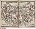
 Typus orbis universalis, Sebastian Munster 1550.jpg 1,778 × 1,278; 2.17 MB
-
 World according to Ptolemy RMG F1749.tiff 7,422 × 4,865; 103.31 MB
-
 World RMG F1750.tiff 7,383 × 4,781; 100.99 MB
-
 Worldmap by Antonio Floriano, 1555.tif 10,313 × 6,984; 274.78 MB


.jpg)


.jpg)
.jpg)
.jpg)


_.jpg)


_04.jpg)


_lector_ca(n)dide_ea(m)_ut_posteriore(m)_ita_%5E_eme(n)datiorem_ijs_que(...)_-_Norman_B._Leventhal_Map_Center_at_the_BPL.jpg)
.jpg)
