Category:1540s maps of the Balkans
Jump to navigation
Jump to search
English: This category is intended to collect maps from the 1540s that show multiple Balkan countries in one map frame.
| 16th-century maps of the Balkans: 1510s 1520s 1540s 1550s 1560s 1570s 1580s 1590s → |
Subcategories
This category has the following 4 subcategories, out of 4 total.
Media in category "1540s maps of the Balkans"
The following 3 files are in this category, out of 3 total.
-
 Johannes Honter-RudimentaCosmographica-Brasov1542.jpg 1,200 × 956; 326 KB
-

-
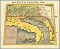 1545 Ptolemy's 5th European Map by Sebastian Munster.jpg 8,969 × 7,272; 14.16 MB

.jpg)
