Category:14th-century maps of the world
Jump to navigation
Jump to search
Subcategories
This category has the following 3 subcategories, out of 3 total.
1
- Medici-Laurentian Atlas (2 F)
Media in category "14th-century maps of the world"
The following 4 files are in this category, out of 4 total.
-
 1311 Portolan map of the world by Pietro Vesconte.jpg 2,875 × 2,780; 1.45 MB
-
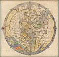
 Greek world map after Ptolemy's 1st projection.jpg 641 × 399; 59 KB
-
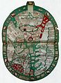
 Atlas Medici-Laurentian.jpg 750 × 559; 130 KB
-
 World map ranulf higden.jpg 1,923 × 2,610; 3.96 MB


