Category:11 Sprzymierzonych Street in Duszniki-Zdrój
Jump to navigation
Jump to search
| Object location | | View all coordinates using: OpenStreetMap |
|---|
 | |||||
| Upload media | |||||
| Instance of | |||||
|---|---|---|---|---|---|
| Location | Duszniki-Zdrój, Kłodzko County, Lower Silesian Voivodeship, Poland | ||||
| Street address |
| ||||
| Heritage designation |
| ||||
| Inception |
| ||||
 | |||||
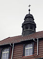
Polski: budynek wybudowany jako przytułek zakonu św. Elżbiety w 1891 r, w okresie powojennym mieścił się tu szpital miejski - Duszniki-Zdrój, ul. Sprzymierzonych 11
Media in category "11 Sprzymierzonych Street in Duszniki-Zdrój"
The following 12 files are in this category, out of 12 total.
-
 2018 Dom seniora Magdalenka w Dusznikach-Zdroju 1.jpg 4,922 × 2,821; 8.4 MB
-
 2018 Dom seniora Magdalenka w Dusznikach-Zdroju 2.jpg 4,624 × 2,623; 7.77 MB
-
 Duszniki Zdrój, szpital, 01.JPG 3,367 × 2,438; 3.81 MB
-
 Duszniki Zdrój, szpital, 02.JPG 3,220 × 2,240; 3.45 MB
-
 Duszniki Zdrój, szpital, 03.JPG 2,520 × 3,222; 3.79 MB
-
 Duszniki Zdrój, szpital, 04.JPG 3,209 × 2,421; 3.11 MB
-
 Duszniki Zdrój, szpital, 05.JPG 3,648 × 2,736; 4.64 MB
-
 Duszniki Zdrój, szpital, 06.JPG 3,648 × 2,736; 5.24 MB
-
 Duszniki Zdrój, szpital, 07.JPG 3,300 × 2,540; 4.37 MB
-
 Duszniki Zdrój, szpital, 08.JPG 3,252 × 2,736; 4.45 MB
-
 Duszniki Zdrój, szpital, 09.JPG 3,296 × 2,280; 3.37 MB
-
 Duszniki Zdrój, szpital, 10.JPG 2,586 × 3,498; 3.72 MB


