Category:Řepy
Jump to navigation
Jump to search
English: Řepy is a part of Prague; it is situated in the west part of Prague
municipal part and cadastral area of Prague  Slánská silnice přecházející osu sídliště Řepy – ulici Makovského.  | |||||
| Upload media | |||||
| Instance of | |||||
|---|---|---|---|---|---|
| Location | Prague 17, Prague 5, Prague, Czechia | ||||
| Population |
| ||||
| Area |
| ||||
 | |||||
Subcategories
This category has the following 11 subcategories, out of 11 total.
Pages in category "Řepy"
The following 2 pages are in this category, out of 2 total.
Media in category "Řepy"
The following 15 files are in this category, out of 15 total.
-
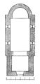 Kostel sv. Martina-Řepy-F. J. Lehner.jpg 1,341 × 2,789; 701 KB
-

-
 Location map municipal district Prague - Praha 17 Řepy.PNG 544 × 399; 14 KB
-
 LogoRepy2018.png 200 × 290; 32 KB
-
 Paint Peeling Off (233950053).jpeg 2,048 × 1,536; 486 KB
-
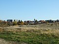
 Pohled na Řepy z slánské ulice, Praha 2.jpg 4,608 × 3,456; 4.81 MB
-
 Pohled na Řepy z slánské ulice, Praha.jpg 4,608 × 3,456; 4.5 MB
-
 Praha Řepy Pěší cesta k městskému úřadu s duhou.jpg 8,000 × 6,000; 12.2 MB
-
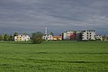
 Praha, Řepy, celkový pohled od severu.JPG 2,848 × 2,136; 1.47 MB
-
 Praha, Řepy, chatová osada II.jpg 4,160 × 3,120; 4.35 MB
-
 Praha, Řepy, Na Fialce a sídliště v pozadí.JPG 2,848 × 2,136; 1.49 MB
-
 Praha, Řepy, pohled na novou zástavbu.jpg 4,722 × 3,142; 2.89 MB
-
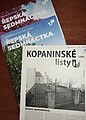 Radniční periodika, Hl. město Praha, obvod 25.jpg 2,876 × 4,018; 3.82 MB
-
 Řepy CoA CZ.gif 189 × 241; 18 KB
-
 Řepy, Praha 17- Řepy, Hlavní město Praha.jpg 1,200 × 804; 664 KB


.jpeg)


