Category:Ördög-orom Quarry Conservation Area (Budapest)
Jump to navigation
Jump to search
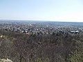
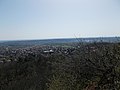
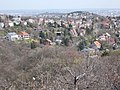
English: Ördög-orom Quarry Conservation Area. This whetsone quarry abandoned in 1950s. The Ördög-orom (Devil's Peak) exposses upper Triassic (cca. 200 mio. years old) dolomite with flint. The conglomerate formed during the Eocene marine transgression (over 30 mio. years ago). The most valued protected plantspecies are the Pigmy Iris (Iris pumila) the yellow adonis (Adonis vernalis) the small pasque flower (Pulsatilla grandis) and black pulsatilla (Pulsatilla nigricans) the lady orchid (Orchis purpurea). Along the walking paths, the area can easily be explored. Varied level protected parts consist the area (district, capital and national). Get in: take bus no. 5 from 'Március 15 tér' and get off at the 'Edvi Illés utca' stop, about 200m walk on left start the path to the Peak. Source: Budapest's Protected Natural Heritage. Edited by Municipality of Budapest in 1996. Supported by Phare (EU project), ISBN 9630471523. - Budapest District XII., Hungary.
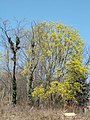
Magyar: Ördög-orom kőfejtő természetvédelmi terület. Ez része a Budai Tájvédelmi Körzetnek, és a Duna–Ipoly Nemzeti Parknak. Növényzete (többek között): Apró nőszirom, Tavaszi hérics, Leánykökörcsin, Fekete kökörcsin, Bíboros kosbor. Edvi Illés út északi és déli oldala mentén található. Területe: 175 416 m2. Részei: Ördögorom, az Edvi Illés úti mészkedvelő tölgyes és a Farkas-völgyi karsztbokorerdő. Forrás: Hegyvidék Településképi arculati kézikönyv - Magyarország, Budapest XII. kerület, Magasút, Farkas-völgy, Edvi Illés utca, Nőszirom utca, Zöld háromszög turistaút
| Object location | | View all coordinates using: OpenStreetMap |
|---|
Media in category "Ördög-orom Quarry Conservation Area (Budapest)"
The following 58 files are in this category, out of 58 total.
-
A Sas-hegy az Ördög-oromról.ogv 29 s, 1,920 × 1,080; 5.61 MB
-
 Kilátás az Ördög-oromról (10).jpg 3,648 × 2,736; 4.36 MB
-
 Kilátás az Ördög-oromról (11).jpg 3,648 × 2,736; 4.41 MB
-
 Kilátás az Ördög-oromról (12).jpg 3,648 × 2,736; 4.21 MB
-
 Kilátás az Ördög-oromról (13).jpg 3,648 × 2,736; 3.98 MB
-
 Kilátás az Ördög-oromról (14).jpg 3,648 × 2,736; 3.24 MB
-
 Kilátás az Ördög-oromról (15).jpg 3,648 × 2,736; 3.77 MB
-
 Kilátás az Ördög-oromról (16).jpg 3,648 × 2,736; 3.52 MB
-
 Kilátás az Ördög-oromról (17).jpg 3,648 × 2,736; 4.08 MB
-
 Kilátás az Ördög-oromról (18).jpg 3,648 × 2,736; 3.96 MB
-
 Kilátás az Ördög-oromról (19).jpg 3,648 × 2,736; 3.92 MB
-
 Kilátás az Ördög-oromról (2).jpg 3,648 × 2,736; 3.48 MB
-
 Kilátás az Ördög-oromról (20).jpg 3,648 × 2,736; 4.1 MB
-
 Kilátás az Ördög-oromról (21).jpg 3,648 × 2,736; 4.16 MB
-
 Kilátás az Ördög-oromról (22).jpg 3,648 × 2,736; 4.01 MB
-
 Kilátás az Ördög-oromról (23).jpg 2,736 × 3,648; 3.35 MB
-
 Kilátás az Ördög-oromról (24).jpg 3,648 × 2,736; 5.7 MB
-
 Kilátás az Ördög-oromról (25).jpg 3,648 × 2,736; 5.5 MB
-
 Kilátás az Ördög-oromról (3).jpg 3,648 × 2,736; 3.83 MB
-
 Kilátás az Ördög-oromról (4).jpg 3,648 × 2,736; 3.93 MB
-
 Kilátás az Ördög-oromról (5).jpg 3,648 × 2,736; 3.61 MB
-
 Kilátás az Ördög-oromról (6).jpg 3,648 × 2,736; 3.51 MB
-
 Kilátás az Ördög-oromról (7).jpg 3,648 × 2,736; 3.86 MB
-
 Kilátás az Ördög-oromról (8).jpg 3,648 × 2,736; 3.97 MB
-
 Kilátás az Ördög-oromról (9).jpg 3,648 × 2,736; 4.58 MB
-
 Kilátás az Ördög-oromról.jpg 3,648 × 2,736; 3.95 MB
-
 Picnic place in Ördög-orom Quarry Conservation Area. - Budapest.JPG 2,272 × 1,704; 1,010 KB
-

-
 Ördög-orom Quarry Conservation Area. Bushlike flora on the south slope. - Budapest.JPG 2,272 × 1,704; 986 KB
-
 Ördög-orom Quarry Conservation Area. Canyonlike cliff. - Edvi Illés utca, Budapest.JPG 1,704 × 2,272; 989 KB
-
 Ördög-orom Quarry Conservation Area. Cave. - Edvi Illés utca, Budapest.JPG 2,272 × 1,704; 1,010 KB
-
 Ördög-orom Quarry Conservation Area. Cliff and trail. - Budapest.JPG 1,704 × 2,272; 961 KB
-
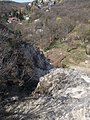
 Ördög-orom Quarry Conservation Area. Cliff. - Budapest.JPG 1,704 × 2,272; 982 KB
-
 Ördög-orom Quarry Conservation Area. Difficult part. - Budapest.JPG 1,704 × 2,272; 1,019 KB
-
 Ördög-orom Quarry Conservation Area. East entry. - Budapest.JPG 1,659 × 1,244; 570 KB
-
 Ördög-orom Quarry Conservation Area. Inclined trees. - Edvi Illés utca, Budapest.JPG 2,272 × 1,704; 964 KB
-

-

-
 Ördög-orom Quarry Conservation Area. North slope and Farkas Valley. - Budapest.JPG 2,272 × 1,704; 1,016 KB
-
 Ördög-orom Quarry Conservation Area. Offroad. - Budapest.JPG 2,272 × 1,704; 990 KB
-
 Ördög-orom Quarry Conservation Area. On the north edge. - Budapest.JPG 2,272 × 1,704; 1,017 KB
-
 Ördög-orom Quarry Conservation Area. Outcrops. - Budapest.JPG 1,704 × 2,272; 970 KB
-
 Ördög-orom Quarry Conservation Area. Road in the depths. - Budapest.JPG 1,704 × 2,272; 999 KB
-
 Ördög-orom Quarry Conservation Area. Rock ledge. - Edvi Illés utca, Budapest.JPG 1,704 × 2,272; 988 KB
-
 Ördög-orom Quarry Conservation Area. Rock. - Budapest.JPG 2,272 × 1,704; 965 KB
-
 Ördög-orom Quarry Conservation Area. Spring. - Edvi Illés utca, Budapest.JPG 1,704 × 2,272; 972 KB
-
 Ördög-orom Quarry Conservation Area. Trail on the panoramic ridge. - Budapest.JPG 2,272 × 1,704; 991 KB
-
 Ördög-orom Quarry Conservation Area. View to East Farkasvölgy. - Budapest.JPG 2,272 × 1,704; 1.03 MB
-
 Ördög-orom Quarry Conservation Area. View to Farkasvölgy nature protected part. - Budapest.JPG 2,272 × 1,704; 1,016 KB
-
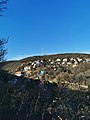
 Ördög-orom Quarry Conservation Area. View to Magasút and Gazdagrét. - Budapest.JPG 2,272 × 1,704; 1,010 KB
-
 Ördög-orom Quarry Conservation Area. View to Pösingermajor. - Budapest.JPG 2,272 × 1,704; 1.01 MB
-
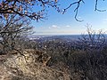
 Ördög-orom Quarry Conservation Area. View to Sasad and Gazdagrét. - Budapest.JPG 2,272 × 1,704; 981 KB
-

-
 Ördög-orom Quarry Conservation Area. View to West Gazdagrét. - Budapest.JPG 2,272 × 1,704; 956 KB
-
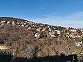
 Ördög-orom Quarry Conservation Area. View toward Sas Hill. - Budapest.JPG 2,272 × 1,704; 1,005 KB
-
 Ördög-orom Quarry Conservation Area. Water washed trail. - Budapest.JPG 1,704 × 2,272; 976 KB
-
 Ördög-orom Quarry wall, 2016 Budapest.jpg 3,264 × 2,448; 1.8 MB
-
 Ördög-szószék.jpg 2,736 × 3,648; 4.9 MB
.jpg)
.jpg)
.jpg)
.jpg)
.jpg)
.jpg)
.jpg)
.jpg)
.jpg)
.jpg)
.jpg)
.jpg)
.jpg)
.jpg)
.jpg)
.jpg)
.jpg)
.jpg)
.jpg)
.jpg)
.jpg)
.jpg)
.jpg)
.jpg)


