Category:'t Oude Hof, Bergen
Jump to navigation
Jump to search
| Object location | | View all coordinates using: OpenStreetMap |
|---|
 | |||||
| Upload media | |||||
| Instance of | |||||
|---|---|---|---|---|---|
| Part of | |||||
| Location | Bergen, North Holland, Netherlands | ||||
| Street address |
| ||||
| Heritage designation |
| ||||
 | |||||
Nederlands: 't Hof te Bergen
|
This is a category about rijksmonumentcomplex number 512268
|
Landhuis
|
This is a category about rijksmonument number 512267
|
Historische aanleg
|
This is a category about rijksmonument number 512269
|
Brug
|
This is a category about rijksmonument number 512274
|
| Address |
|
Media in category "'t Oude Hof, Bergen"
The following 22 files are in this category, out of 22 total.
-
 't Hof te Bergen, exterieur aanzicht - Bergen - 20031458 - RCE.jpg 1,200 × 1,190; 449 KB
-
 't Hof te Bergen, exterieur aanzicht - Bergen - 20031459 - RCE.jpg 1,183 × 1,200; 366 KB
-
 't Hof te Bergen, exterieur aanzicht - Bergen - 20031460 - RCE.jpg 1,200 × 1,200; 324 KB
-
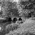 't- Hof te Bergen, brug. - Bergen - 20031463 - RCE.jpg 1,197 × 1,200; 576 KB
-
 't- Hof te Bergen, hofboerderij aanzicht - Bergen - 20031461 - RCE.jpg 1,200 × 1,197; 424 KB
-
 't- Hof te Bergen, hofboerderij aanzicht - Bergen - 20031462 - RCE.jpg 1,200 × 1,197; 494 KB
-
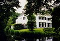
 Bergen-voor.jpg 2,121 × 1,397; 536 KB
-

-
 Het Oude Hof (19231333784).jpg 3,652 × 5,098; 3.14 MB
-
 Het Oude Hof (19665940358).jpg 5,091 × 3,618; 2.11 MB
-
 Oude Hof tuin.jpg 2,143 × 1,459; 441 KB
-
 T Oude Hof, Bergen - boerderij-koetshuis.jpg 3,888 × 2,592; 5.72 MB
-
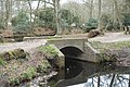 T Oude Hof, Bergen - boogbruggetje.jpg 5,472 × 3,648; 9.03 MB
-
 T Oude Hof, Bergen - brug met sluisje.jpg 3,888 × 2,592; 5.61 MB
-
 T Oude Hof, Bergen - het melkbruggetje.jpg 3,888 × 2,592; 6.31 MB
-
 T Oude Hof, Bergen - hoofdgebouw.jpg 3,888 × 2,592; 3.58 MB
-
 T Oude Hof, Bergen - inrijpoort.jpg 3,888 × 2,592; 5.5 MB
-
 T Oude Hof, Bergen - moestuin 01.jpg 5,472 × 3,648; 8.91 MB
-
 T Oude Hof, Bergen - moestuin 02.jpg 5,472 × 3,648; 9.15 MB
-
 T Oude Hof, Bergen - parkaanleg.jpg 3,888 × 2,592; 6.43 MB
-
 T Oude Hof, Bergen - toegangsbrug met hek.jpg 3,888 × 2,592; 6.06 MB
-
 T Oude Hof, Bergen - zwarte schuur met teerpaal.jpg 3,888 × 2,592; 5.33 MB


.jpg)
.jpg)


