Würzburg Residence with the Court Gardens and Residence Square
Jump to navigation
Jump to search
World Heritage site in Germany | |||||
| Upload media | |||||
| Instance of | |||||
|---|---|---|---|---|---|
| Location | Würzburg, Lower Franconia, Bavaria, Germany | ||||
| Has part(s) |
| ||||
| Heritage designation |
| ||||
| Significant event |
| ||||
| Area |
| ||||
 | |||||
Deutsch: Würzburger Residenz mit Hofgarten und Residenzplatz
English: Würzburg Residence with the Court Gardens and Residence Square
Overview
[edit]-
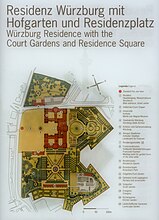
Map
-
Aerial view (incomplete)
Castle (building)
[edit]Main category: Würzburg Residence
Outside (except park)
[edit]-
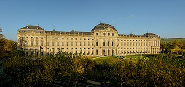
East facade.
Interior
[edit]Main category: Interior of Residence Würzburg
-
Weißer Saal
-
Grosses Treppenhaus: Fresko von Tiepolo (zum Bewegen anklicken)
Museums
[edit]Staatsgalerie Würzburg (Teil der Bayerischen Staatsgemäldesammlungen)
[edit]| Staatsgalerie Würzburg
|
|||
|---|---|---|---|
| Parent institution | Bavarian State Painting Collections | ||
| Location | |||
| Coordinates | | ||
| Website | www.pinakothek.de/besuch/staatsgalerien#3e73e401-76a9-48e9-9f60-9655311ed502 | ||
| Authority file | |||
Main category: Staatsgalerie, Würzburg
-
Susanna und die beiden Alten
-
Die Großmut des Scipio
-
Giovanni Battista Tiepolo - Rinaldo and Armida
-
Luca Carlevarijs, Einzug der venezianischen Gesandten in London, 1707
Martin von Wagner Museum der Universität Würzburg
[edit]| Martin von Wagner Museum
|
|||
|---|---|---|---|
 |
|||
| Native name | Martin von Wagner Museum | ||
| Parent institution | Q123678571 | ||
| Location | |||
| Coordinates | | ||
| Established | 1832 | ||
| Website | martinvonwagner-museum.com | ||
| Authority file | |||
Main category: Martin von Wagner Museum
-
Signage
-
Room D
-
Ancient Egypt exhibits
-
Cornelis Norbertus Gijsbrechts - Vanitas still life with flowers, skull, documents and miniature portrait of the artist
-
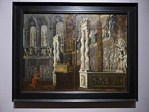
Francois Nomé, Salomo im Tempel.
-
Peter Paul Rubens
-
Self-portrait of Giovanni Battista Paggi
-
Nicolas Régnier, Die reuige Maria Magdalena.
Court garden / Park
[edit]Main category: Court gardens of Würzburg Residence
-
Map
-
um 1770
-
Skulptur unter einem Eibenbaum
Misc.
[edit]-
Rennweg nach Nordwesten gesehen (nördl. Tor)
-
Staatlicher Hofkeller Würzburg
-
Obelisk
Category tree
[edit]
|
This place is a UNESCO World Heritage Site, listed as
Würzburg Residence with the Court Gardens and Residence Square.
|
| Object location | | View all coordinates using: OpenStreetMap |
|---|


