Valley of Fire State Park
Jump to navigation
Jump to search
Valley of Fire State Park is a public recreation and nature preservation area covering nearly 46,000 acres (19,000 ha) located 16 miles (26 km) south of Overton, Nevada and 50 miles (80 km) northeast of Las Vegas.
Aerial
[edit]-
Aerial view with Valley of Fire at left and the Overton Arm of Lake Mead at right
-
Aerial view with Valley of Fire at top, center
-
Closer aerial view
-
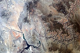
Orbital view, Valley of Fire is the reddish area at left; Grand Canyon is at right
Rock formations
[edit]-
View north into White Domes area from Rainbow Vista
-
Road leading to the White Domes
-
Elephant Rock
-
Windstone Arch
-
Fire Canyon Arch
-
Moon under Arch Rock
-
Piano Rock, Scenic Loop Road
-
White Domes area
-
White Domes trail
-
Slot canyon in the White Domes area
-
A beehive formation
-
Tafoni in sandstone
-
Liesegang rings in sandstone
-
Field of loose rocks
-
Sandstone formation closeup.
-
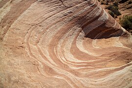
Looking down into the Fire Wave
-
Area near the Fire Wave
-
A view of the Fire Wave area
Animals
[edit]-
Juvenile chuckwalla
Petroglyphs
[edit]-
Stairs to Valley of Fire petroglyphs
-
Petroglyphs panel
-
Petroglyphs detail
-
Buffington Pockets petroglyphs
Miscellaneous
[edit]-
Entrance sign
-
Civilian Conservation Corps cabins
-
John J. Clark memorial
-
Arrowhead Trail marker
-
White Domes trail movie site
-
Curvy park road
-
Colorful trash cans


