User:Thisisbossi/gallery/22JUN2008
< User:Thisisbossi | gallery
Mon Jun 23 00:19:53 EDT 2008
[edit]-
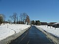
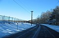
 Beaver Dam Road in the Beltsville Agricultural Research Center, Beltsville, Maryland
Camera location 

View all coordinates using: OpenStreetMap 
-
 Beaver Dam Road in the Beltsville Agricultural Research Center, Beltsville, Maryland
Camera location 
View all coordinates using: OpenStreetMap -
 Beaver Dam Road in the Beltsville Agricultural Research Center, Beltsville, Maryland
Camera location View all coordinates using: OpenStreetMap -
 Beaver Dam Road in the Beltsville Agricultural Research Center, Beltsville, Maryland
Camera location 
View all coordinates using: OpenStreetMap -
 Beaver Dam Road in the Beltsville Agricultural Research Center, Beltsville, Maryland
Camera location 
View all coordinates using: OpenStreetMap -
 Beaver Dam Road in the Beltsville Agricultural Research Center, Beltsville, Maryland
Camera location 
View all coordinates using: OpenStreetMap -
 Beaver Dam Road in the Beltsville Agricultural Research Center, Beltsville, Maryland
Camera location View all coordinates using: OpenStreetMap -
 Beaver Dam Road in the Beltsville Agricultural Research Center, Beltsville, Maryland
Camera location 
View all coordinates using: OpenStreetMap -
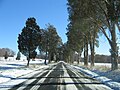
 Beaver Dam Road in the Beltsville Agricultural Research Center, Greenbelt-Beltsville-Laurel-Bowie, Maryland
Camera location View all coordinates using: OpenStreetMap -
 Beaver Dam Road in the Beltsville Agricultural Research Center, Greenbelt-Beltsville-Laurel-Bowie, Maryland
Camera location View all coordinates using: OpenStreetMap -
 Beaver Dam Road in the Beltsville Agricultural Research Center, Greenbelt-Beltsville-Laurel-Bowie, Maryland
Camera location View all coordinates using: OpenStreetMap -
 Beaver Dam Road in the Beltsville Agricultural Research Center, Greenbelt-Beltsville-Laurel-Bowie, Maryland
Camera location View all coordinates using: OpenStreetMap -
 Beaver Dam Road in the Beltsville Agricultural Research Center, Greenbelt-Beltsville-Laurel-Bowie, Maryland
Camera location View all coordinates using: OpenStreetMap -
 Beaver Dam Road in the Beltsville Agricultural Research Center, Greenbelt-Beltsville-Laurel-Bowie, Maryland
Camera location View all coordinates using: OpenStreetMap -
 Beaver Dam Road in the Beltsville Agricultural Research Center, Greenbelt-Beltsville-Laurel-Bowie, Maryland
Camera location View all coordinates using: OpenStreetMap -
 Beaver Dam Road in the Beltsville Agricultural Research Center, Greenbelt-Beltsville-Laurel-Bowie, Maryland
Camera location View all coordinates using: OpenStreetMap -
 Beaver Dam Road in the Beltsville Agricultural Research Center, Greenbelt-Beltsville-Laurel-Bowie, Maryland
Camera location View all coordinates using: OpenStreetMap -
 Beaver Dam Road in the Beltsville Agricultural Research Center, Greenbelt-Beltsville-Laurel-Bowie, Maryland
Camera location View all coordinates using: OpenStreetMap -
 Beaver Dam Road in the Beltsville Agricultural Research Center, Greenbelt-Beltsville-Laurel-Bowie, Maryland
Camera location View all coordinates using: OpenStreetMap -
 Beaver Dam Road in the Beltsville Agricultural Research Center, Greenbelt-Beltsville-Laurel-Bowie, Maryland
Camera location View all coordinates using: OpenStreetMap -
 Beaver Dam Road in the Beltsville Agricultural Research Center, Greenbelt-Beltsville-Laurel-Bowie, Maryland
Camera location View all coordinates using: OpenStreetMap -
 Beaver Dam Road in the Beltsville Agricultural Research Center, Greenbelt-Beltsville-Laurel-Bowie, Maryland
Camera location View all coordinates using: OpenStreetMap -
 Beaver Dam Road in the Beltsville Agricultural Research Center, Greenbelt-Beltsville-Laurel-Bowie, Maryland
Camera location View all coordinates using: OpenStreetMap -
 Beaver Dam Road in the Beltsville Agricultural Research Center, Greenbelt-Beltsville-Laurel-Bowie, Maryland
Camera location View all coordinates using: OpenStreetMap -
 Beaver Dam Road in the Beltsville Agricultural Research Center, Greenbelt-Beltsville-Laurel-Bowie, Maryland
Camera location View all coordinates using: OpenStreetMap -
 Beaver Dam Road in the Beltsville Agricultural Research Center, Greenbelt-Beltsville-Laurel-Bowie, Maryland
Camera location View all coordinates using: OpenStreetMap -
 Beaver Dam Road in the Beltsville Agricultural Research Center, Greenbelt-Beltsville-Laurel-Bowie, Maryland
Camera location View all coordinates using: OpenStreetMap -
 Beaver Dam Road as it crosses beneath the Baltimore-Washington Parkway in the Beltsville Agricultural Research Center, Beltsville, Maryland
Camera location View all coordinates using: OpenStreetMap -
 View of a roadway in the Beltsville Agricultural Research Center as seen from Beaver Dam Road, Beltsville, Maryland
Camera location 
View all coordinates using: OpenStreetMap -
 View of the Beltsville Agricultural Research Center from Powder Mill Road, Beltsville, Maryland
Camera location 
View all coordinates using: OpenStreetMap -
 View of the Beltsville Agricultural Research Center from Powder Mill Road, Beltsville, Maryland
Camera location View all coordinates using: OpenStreetMap -
 View of a snowy swamp area in the Beltsville Agricultural Research Center from Research Road, Beltsville, Maryland
Camera location 
View all coordinates using: OpenStreetMap -
 View of a snowy swamp area in the Beltsville Agricultural Research Center from Research Road, Beltsville, Maryland
Camera location View all coordinates using: OpenStreetMap This panoramic image was created with Autostitch (stitched images may differ from reality). -
 Springfield Road between the Beltsville Agricultural Research Center and Patuxent Wildlife Research Refuge, Greenbelt-Beltsville-Laurel-Bowie, Maryland
Camera location 
View all coordinates using: OpenStreetMap -
 Springfield Road between the Beltsville Agricultural Research Center and Patuxent Wildlife Research Refuge, Greenbelt-Beltsville-Laurel-Bowie, Maryland
Camera location 
View all coordinates using: OpenStreetMap -
 Springfield Road between the Beltsville Agricultural Research Center and Patuxent Wildlife Research Refuge, Greenbelt-Beltsville-Laurel-Bowie, Maryland
Camera location View all coordinates using: OpenStreetMap -
 Springfield Road between the Beltsville Agricultural Research Center and Patuxent Wildlife Research Refuge, Greenbelt-Beltsville-Laurel-Bowie, Maryland
Camera location View all coordinates using: OpenStreetMap -
 Springfield Road between the Beltsville Agricultural Research Center and Patuxent Wildlife Research Refuge, Greenbelt-Beltsville-Laurel-Bowie, Maryland
Camera location 
View all coordinates using: OpenStreetMap -
 Springfield Road between the Beltsville Agricultural Research Center and Patuxent Wildlife Research Refuge, Greenbelt-Beltsville-Laurel-Bowie, Maryland
Camera location View all coordinates using: OpenStreetMap -
![Bowie]], Maryland Camera location 39° 01′ 32.5″ N, 76° 50′ 00.4″ W View all coordinates using: OpenStreetMap](https://upload.wikimedia.org/wikipedia/commons/thumb/4/49/2007_12_06_-_BARC-PWRC_-_Springfield_Rd_07.JPG/120px-2007_12_06_-_BARC-PWRC_-_Springfield_Rd_07.JPG) Bowie]], Maryland
Bowie]], MarylandCamera location View all coordinates using: OpenStreetMap -
![Bowie]], Maryland Camera location 39° 01′ 36.1″ N, 76° 50′ 05.8″ W View all coordinates using: OpenStreetMap](https://upload.wikimedia.org/wikipedia/commons/thumb/c/cd/2007_12_06_-_BARC-PWRC_-_Springfield_Rd_08.JPG/120px-2007_12_06_-_BARC-PWRC_-_Springfield_Rd_08.JPG) Bowie]], Maryland
Bowie]], MarylandCamera location View all coordinates using: OpenStreetMap -
![Bowie]], Maryland Camera location 39° 01′ 42.5″ N, 76° 50′ 12.5″ W View all coordinates using: OpenStreetMap](https://upload.wikimedia.org/wikipedia/commons/thumb/d/df/2007_12_06_-_BARC-PWRC_-_Springfield_Rd_09.JPG/120px-2007_12_06_-_BARC-PWRC_-_Springfield_Rd_09.JPG) Bowie]], Maryland
Bowie]], MarylandCamera location View all coordinates using: OpenStreetMap -
![Bowie]], Maryland Camera location 39° 00′ 46.2″ N, 76° 49′ 13.9″ W View all coordinates using: OpenStreetMap](https://upload.wikimedia.org/wikipedia/commons/thumb/7/73/2007_12_06_-_BARC-PWRC_-_Watertowers_near_Beaver_Dam_Rd_and_Springfield_Rd.JPG/120px-2007_12_06_-_BARC-PWRC_-_Watertowers_near_Beaver_Dam_Rd_and_Springfield_Rd.JPG) Bowie]], Maryland
Bowie]], MarylandCamera location View all coordinates using: OpenStreetMap -
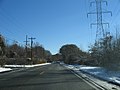
 Powder Mill Road at the Baltimore-Washington Parkway, Beltsville, Maryland
Camera location View all coordinates using: OpenStreetMap -
 American Holly Drive in the Patuxent Wildlife Research Refuge, Laurel-Bowie, Maryland
Camera location View all coordinates using: OpenStreetMap -
 American Holly Drive in the Patuxent Wildlife Research Refuge, Laurel-Bowie, Maryland
Camera location View all coordinates using: OpenStreetMap -
 American Holly Drive in the Patuxent Wildlife Research Refuge, Laurel-Bowie, Maryland
Camera location View all coordinates using: OpenStreetMap -
 American Holly Drive in the Patuxent Wildlife Research Refuge, Laurel-Bowie, Maryland
Camera location View all coordinates using: OpenStreetMap -
 Loblolly Pine Drive in the Patuxent Wildlife Research Refuge, Laurel-Bowie, Maryland
Camera location 
View all coordinates using: OpenStreetMap -
 Loblolly Pine Drive in the Patuxent Wildlife Research Refuge, Laurel-Bowie, Maryland
Camera location 
View all coordinates using: OpenStreetMap -
 Loblolly Pine Drive in the Patuxent Wildlife Research Refuge, Laurel-Bowie, Maryland
Camera location 
View all coordinates using: OpenStreetMap -
 Loblolly Pine Drive in the Patuxent Wildlife Research Refuge, Laurel-Bowie, Maryland
Camera location 
View all coordinates using: OpenStreetMap -
 Loblolly Pine Drive in the Patuxent Wildlife Research Refuge, Laurel-Bowie, Maryland
Camera location View all coordinates using: OpenStreetMap -
 Loblolly Pine Drive approaching MD 197 in the Patuxent Wildlife Research Refuge, Laurel-Bowie, Maryland
Camera location 
View all coordinates using: OpenStreetMap -
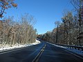
 MD 197 in the Patuxent Wildlife Research Refuge, Laurel-Bowie, Maryland
Camera location View all coordinates using: OpenStreetMap -
 MD 197 in the Patuxent Wildlife Research Refuge, Laurel-Bowie, Maryland
Camera location View all coordinates using: OpenStreetMap -
 MD 197 in the Patuxent Wildlife Research Refuge, Laurel-Bowie, Maryland
Camera location View all coordinates using: OpenStreetMap -
 MD 197 in the Patuxent Wildlife Research Refuge, Laurel-Bowie, Maryland
Camera location View all coordinates using: OpenStreetMap -
 MD 197 in the Patuxent Wildlife Research Refuge, Laurel-Bowie, Maryland
Camera location View all coordinates using: OpenStreetMap -
 MD 197 in the Patuxent Wildlife Research Refuge, Laurel-Bowie, Maryland
Camera location View all coordinates using: OpenStreetMap -
 Powder Mill Road in the Patuxent Wildlife Research Refuge, Laurel-Bowie, Maryland
Camera location 
View all coordinates using: OpenStreetMap -
 Powder Mill Road in the Patuxent Wildlife Research Refuge, Laurel-Bowie, Maryland
Camera location 
View all coordinates using: OpenStreetMap -
 Powder Mill Road in the Patuxent Wildlife Research Refuge, Laurel-Bowie, Maryland
Camera location View all coordinates using: OpenStreetMap -
 Powder Mill Road in the Patuxent Wildlife Research Refuge, Laurel-Bowie, Maryland
Camera location View all coordinates using: OpenStreetMap -
 Powder Mill Road in the Patuxent Wildlife Research Refuge, Laurel-Bowie, Maryland
Camera location View all coordinates using: OpenStreetMap -
 Powder Mill Road in the Patuxent Wildlife Research Refuge, Laurel-Bowie, Maryland
Camera location View all coordinates using: OpenStreetMap -
 Powder Mill Road in the Patuxent Wildlife Research Refuge, Laurel-Bowie, Maryland
Camera location View all coordinates using: OpenStreetMap -
 Powder Mill Road in the Patuxent Wildlife Research Refuge, Laurel-Bowie, Maryland
Camera location 
View all coordinates using: OpenStreetMap -
 Powder Mill Road in the Patuxent Wildlife Research Refuge, Laurel-Bowie, Maryland
Camera location 
View all coordinates using: OpenStreetMap -
 Powder Mill Road at MD 197 in the Patuxent Wildlife Research Refuge, Laurel-Bowie, Maryland
Camera location 
View all coordinates using: OpenStreetMap -
 Powder Mill Road at MD 197 in the Patuxent Wildlife Research Refuge, Laurel-Bowie, Maryland
Camera location View all coordinates using: OpenStreetMap


![Bowie]], Maryland Camera location 39° 01′ 32.5″ N, 76° 50′ 00.4″ W View all coordinates using: OpenStreetMap](/wiki/File:2007_12_06_-_BARC-PWRC_-_Springfield_Rd_07.JPG)
![Bowie]], Maryland Camera location 39° 01′ 36.1″ N, 76° 50′ 05.8″ W View all coordinates using: OpenStreetMap](/wiki/File:2007_12_06_-_BARC-PWRC_-_Springfield_Rd_08.JPG)
![Bowie]], Maryland Camera location 39° 01′ 42.5″ N, 76° 50′ 12.5″ W View all coordinates using: OpenStreetMap](/wiki/File:2007_12_06_-_BARC-PWRC_-_Springfield_Rd_09.JPG)
![Bowie]], Maryland Camera location 39° 00′ 46.2″ N, 76° 49′ 13.9″ W View all coordinates using: OpenStreetMap](/wiki/File:2007_12_06_-_BARC-PWRC_-_Watertowers_near_Beaver_Dam_Rd_and_Springfield_Rd.JPG)


Sun Jun 22 15:02:03 EDT 2008
[edit]-
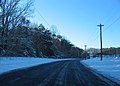
 Powder Mill Road in the Beltsville Agricultural Research Center, Beltsville, Maryland
Camera location View all coordinates using: OpenStreetMap -
 Powder Mill Road in the Beltsville Agricultural Research Center, Beltsville, Maryland
Camera location View all coordinates using: OpenStreetMap -
 Powder Mill Road in the Beltsville Agricultural Research Center, Beltsville, Maryland
Camera location View all coordinates using: OpenStreetMap -
 Powder Mill Road at the Baltimore-Washington Parkway, Beltsville, Maryland
Camera location View all coordinates using: OpenStreetMap -
 Powder Mill Road at Center Road in the Beltsville Agricultural Research Center, Beltsville, Maryland
Camera location View all coordinates using: OpenStreetMap -
 Research Road in the Beltsville Agricultural Research Center, Beltsville, Maryland
Camera location View all coordinates using: OpenStreetMap -
 Research Road in the Beltsville Agricultural Research Center, Beltsville, Maryland
Camera location View all coordinates using: OpenStreetMap -
 Research Road in the Beltsville Agricultural Research Center, Beltsville, Maryland
Camera location View all coordinates using: OpenStreetMap -
 Research Road in the Beltsville Agricultural Research Center, Beltsville, Maryland
Camera location View all coordinates using: OpenStreetMap -
 A building on the Patuxent Wildlife Research Refuge, Laurel, Maryland
Camera location View all coordinates using: OpenStreetMap -
 American Holly Drive in the Patuxent Wildlife Research Refuge, Beltsville, Maryland
Camera location 
View all coordinates using: OpenStreetMap -
 American Holly Drive in the Patuxent Wildlife Research Refuge, Beltsville, Maryland
Camera location 
View all coordinates using: OpenStreetMap -
 American Holly Drive in the Patuxent Wildlife Research Refuge, Beltsville, Maryland
Camera location View all coordinates using: OpenStreetMap -
 American Holly Drive in the Patuxent Wildlife Research Refuge, Beltsville, Maryland
Camera location View all coordinates using: OpenStreetMap -
 American Holly Drive in the Patuxent Wildlife Research Refuge, Beltsville, Maryland
Camera location View all coordinates using: OpenStreetMap -
 Powder Mill Road in the Patuxent Wildlife Research Refuge, Beltsville, Maryland
Camera location View all coordinates using: OpenStreetMap -
 Powder Mill Road in the Patuxent Wildlife Research Refuge, Beltsville, Maryland
Camera location View all coordinates using: OpenStreetMap -
 Powder Mill Road in the Patuxent Wildlife Research Refuge, Beltsville, Maryland
Camera location View all coordinates using: OpenStreetMap -
 Powder Mill Road in the Patuxent Wildlife Research Refuge, Beltsville, Maryland
Camera location 
View all coordinates using: OpenStreetMap -
 Powder Mill Road in the Patuxent Wildlife Research Refuge, Beltsville, Maryland
Camera location View all coordinates using: OpenStreetMap -
 Powder Mill Road in the Patuxent Wildlife Research Refuge, Beltsville, Maryland
Camera location View all coordinates using: OpenStreetMap -
 Powder Mill Road in the Patuxent Wildlife Research Refuge, Beltsville, Maryland
Camera location View all coordinates using: OpenStreetMap -
 Powder Mill Road in the Patuxent Wildlife Research Refuge, Beltsville, Maryland
Camera location View all coordinates using: OpenStreetMap -
 Powder Mill Road at Springfield Road in the Patuxent Wildlife Research Refuge, Beltsville, Maryland
Camera location View all coordinates using: OpenStreetMap


.JPG)
Sun Jun 22 13:36:56 EDT 2008
[edit]-
 Research Road in the Beltsville Agricultural Research Center, Beltsville, Maryland
Camera location View all coordinates using: OpenStreetMap -
 Research Road in the Beltsville Agricultural Research Center, Beltsville, Maryland
Camera location View all coordinates using: OpenStreetMap -

-

-

-

-

-
 Odell Road approaching Springfield Road, Beltsville, Maryland
Camera location View all coordinates using: OpenStreetMap -
 Odell Road approaching Springfield Road, Beltsville, Maryland
Camera location View all coordinates using: OpenStreetMap


