User:Thisisbossi/gallery/18NOV2007
< User:Thisisbossi | gallery
Sun Nov 18 16:36:43 EST 2007
[edit]-
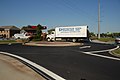
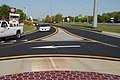
 English: A roundabout formed by pavement markings within hours, located at the intersection of Thompson Creek Road with the service road and ramps for eastbound US 50.
Camera location 

View all coordinates using: OpenStreetMap 
-
 English: A roundabout formed by pavement markings within hours, located at the intersection of Thompson Creek Road with the service road and ramps for eastbound US 50.
Camera location 
View all coordinates using: OpenStreetMap -
 English: A roundabout formed by pavement markings within hours, located at the intersection of Thompson Creek Road with the service road and ramps for eastbound US 50.
Camera location 
View all coordinates using: OpenStreetMap -
 English: A roundabout formed by pavement markings within hours, located at the intersection of Thompson Creek Road with the service road and ramps for eastbound US 50.
Camera location 
View all coordinates using: OpenStreetMap -
 English: A roundabout formed by pavement markings within hours, located at the intersection of Thompson Creek Road with the service road and ramps for eastbound US 50.
Camera location View all coordinates using: OpenStreetMap


Sun Nov 18 16:17:50 EST 2007
[edit]-
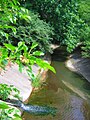
 English: Creek beside MD 355 (Rockville Pike) at Cedar Lane, Bethesda, MD, USA
Camera location 
View all coordinates using: OpenStreetMap -
 English: Creek beside MD 355 (Rockville Pike) at Cedar Lane, Bethesda, MD, USA
Camera location View all coordinates using: OpenStreetMap -
 English: Creek beside MD 355 (Rockville Pike) at Cedar Lane, Bethesda, MD, USA
Camera location View all coordinates using: OpenStreetMap -
 English: Creek beside Cedar Lane, Bethesda, MD, USA
Camera location 
View all coordinates using: OpenStreetMap -
 English: Creek beside Cedar Lane, Bethesda, MD, USA
Camera location View all coordinates using: OpenStreetMap -
 English: Creek beside Cedar Lane, Bethesda, MD, USA
Camera location View all coordinates using: OpenStreetMap


Sun Nov 18 16:15:50 EST 2007
[edit]-
 English: US 29A (Old Columbia Pike) at Dustin Road, Burtonsville, MD, USA
Camera location View all coordinates using: OpenStreetMap -
 English: US 29A (Old Columbia Pike) at Dustin Road, Burtonsville, MD, USA
Camera location View all coordinates using: OpenStreetMap -
 English: US 29A (Old Columbia Pike) at Dustin Road, Burtonsville, MD, USA
Camera location View all coordinates using: OpenStreetMap


Sun Nov 18 15:31:20 EST 2007
[edit]-
 English: MD 118 (Germantown Road) at Wisteria Drive, Germantown, MD, USA
Camera location 
View all coordinates using: OpenStreetMap -
 English: MD 118 (Germantown Road) at Wisteria Drive, Germantown, MD, USA
Camera location View all coordinates using: OpenStreetMap


Sun Nov 18 15:25:56 EST 2007
[edit]-
 English: Sunrise, viewed from Research Road as it travels through the USDA Beltsville Agricultural Research Center, Greenbelt, MD, USA
Camera location 
View all coordinates using: OpenStreetMap
Sun Nov 18 15:25:10 EST 2007
[edit]-
 English: MD 118 (Germantown Road) at Wisteria Drive, Germantown, MD, USA
Camera location View all coordinates using: OpenStreetMap

Sun Nov 18 15:24:24 EST 2007
[edit]-
 English: MD 117 (Clarksburg Road) at the MARC bridge (MD 121 terminates at the camera location), Boyds, MD, USA
Camera location 
View all coordinates using: OpenStreetMap -
 English: MD 117 (Clarksburg Road) at the MARC bridge (MD 121 terminates at the camera location), Boyds, MD, USA
Camera location View all coordinates using: OpenStreetMap -
 English: MD 117 (Clarksburg Road) at the MARC bridge (MD 121 terminates at the camera location), Boyds, MD, USA
Camera location View all coordinates using: OpenStreetMap -
 English: MD 117 (Clarksburg Road) at the MARC bridge (MD 121 terminates at the camera location), Boyds, MD, USA
Camera location View all coordinates using: OpenStreetMap -
 English: MD 117 (Clarksburg Road) at the MARC bridge (MD 121 terminates at the camera location), Boyds, MD, USA
Camera location View all coordinates using: OpenStreetMap


Sun Nov 18 15:22:01 EST 2007
[edit]-
 English: MD 650 (New Hampshire Avenue) at Denit Estates Drive, Brookville, MD, USA
Camera location 
View all coordinates using: OpenStreetMap

Sun Nov 18 15:20:23 EST 2007
[edit]-
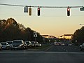
 English: US 29 (Columbia Pike) viewed from Dustin Road, Burtonsville, MD, USA
Camera location 
View all coordinates using: OpenStreetMap -
 English: US 29 (Columbia Pike) viewed from Dustin Road, Burtonsville, MD, USA
Camera location View all coordinates using: OpenStreetMap


Sun Nov 18 15:19:21 EST 2007
[edit]-
 English: View from MD 121 (Clarksburg Road) at West Old Baltimore Road, Clarksburg/Boyds, MD, USA
Camera location 
View all coordinates using: OpenStreetMap
Sun Nov 18 15:18:27 EST 2007
[edit]-
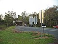
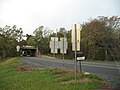
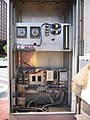
 English: Signal testing along Traffic Drive at the Maryland State Highway Administration's Office of Traffic and Safety, Hanover, MD, USA
Camera location View all coordinates using: OpenStreetMap -
 English: Signal testing along Traffic Drive at the Maryland State Highway Administration's Office of Traffic and Safety, Hanover, MD, USA
Camera location View all coordinates using: OpenStreetMap


Sun Nov 18 13:45:22 EST 2007
[edit]-

Camera location View all coordinates using: OpenStreetMap -

Camera location View all coordinates using: OpenStreetMap


Sun Nov 18 13:36:13 EST 2007
[edit]


Sun Nov 18 13:06:57 EST 2007
[edit]


Sun Nov 18 13:03:02 EST 2007
[edit]


Sun Nov 18 12:59:45 EST 2007
[edit]

Sun Nov 18 12:56:21 EST 2007
[edit]-

Camera location 
View all coordinates using: OpenStreetMap -

Camera location 
View all coordinates using: OpenStreetMap
.JPG)
.JPG)
Sun Nov 18 12:45:26 EST 2007
[edit]


.JPG)
Sun Nov 18 12:41:20 EST 2007
[edit]


Sun Nov 18 12:34:28 EST 2007
[edit]
Sun Nov 18 12:27:10 EST 2007
[edit]


Sun Nov 18 12:23:21 EST 2007
[edit]-
Camera location View all coordinates using: OpenStreetMap -

Camera location View all coordinates using: OpenStreetMap


