User:Sir Iain/gallery
Jump to navigation
Jump to search
Thu Dec 23 20:27:42 CET 2010
[edit]-
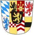
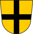
Shield of Arms of the Palatinate-Neuburg line after the inheritance of Jülich-Cleves-Berg.
Thu May 13 13:25:16 CEST 2010
[edit]-
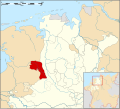
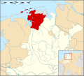
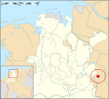
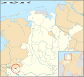
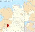
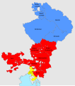
Locator map of the Abbey of Corvey
-
Locator map of the Abbey of Herford
-
Locator mpa of the County of Bentheim
-
Locator mpa of the County of Delmenhorst
-
Locator mpa of the County of East Frisia
-
Locator mpa of the County of Hoya
-
Locator of the County of Lingen
-
Locator of the County of Lippe
-
Locator map of the Counties of Oldenburg & Delmenhorst
-
Locator map of the County of Oldenburg
-
Locator map of the County of Pyrmont
-
Locator map of the County of Ravensberg
-
Locator map of the County of Rietberg
-
Locator map of the County of Schaumburg
-
Locator map of the County of Spiegelberg
-
Locator map of the County of Steinfurt
-
Locator map of the Harlingerland
-
Locator map of the Land Hadeln
-
Locator map of the Lordship of Anholt
-
Locator map of the Lordship of Borculo
-
Locator mpa of the Lordship of Jever
-
Locator map of the Lordship of Kniphausen
-
Locator map of the Prince-Bishopric of Minden
-
Locator map of the Prince-Bishopric of Münster
-
Locator map of the Prince-Bishopric of Osnabrück
-
Locator map of the Prince-Bishopric of Verden
Sun Mar 28 18:20:00 CEST 2010
[edit]-
Locator Map of the Austrian Circle of Holy Roman Empire.
-
Locator Map of the Bavarian Circle of Holy Roman Empire.
-
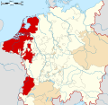
Locator Map of the Burgundian Circle of Holy Roman Empire.
-
Locator Map of the Electoral Rhenish Circle of Holy Roman Empire.
-
Locator Map of the Franconian Circle of Holy Roman Empire.
-
Locator Map of the Lower Saxon Circle of Holy Roman Empire.
-
Locator Map of the Swabian Circle of Holy Roman Empire.
-
Locator Map of the Upper Saxon Circle of Holy Roman Empire.
-
Locator Map of the Upper Rhenish Circle of Holy Roman Empire.
-
Locator Map of the Westphalian Circle of Holy Roman Empire.
Fri Mar 12 23:45:10 CET 2010
[edit]-
Ducal Banner of Saxony since the 14th-century Royal Standard of the Kingdom of Saxony (1806-1918)
-
Infantry flag used by Saxe-Weimar during the Thirty Years' War with 3 stripes
-
Infantry flag used by Saxe-Weimar during the Thirty Years' War with 6 stripes
Sat Feb 27 22:43:11 CET 2010
[edit]-
Map of the Prince-bishopric of Meissen
-
Map of the Prince-bishopric of Merseburg
-
Map of the Prince-bishopric of Naumburg
Sun Feb 07 21:16:07 CET 2010
[edit]-
Banner of the Prince-Bishopric of Strassbourg, in 1:1 proportion.
-
Banner of the Prince-Bishopric of Strassbourg, in 3:2 proportion.
Fri Feb 05 19:04:42 CET 2010
[edit]Tue Feb 02 23:44:33 CET 2010
[edit]Wed Jan 20 16:14:20 CET 2010
[edit]Mon Dec 21 19:37:25 CET 2009
[edit]-
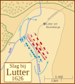
The battle of Lutter (1626)
-
De Slag bij Lutter (1626)
Wed Jul 08 22:04:12 CEST 2009
[edit]-
Banner of Bavaria-Landshut
-
Banner of Bavaria-Munich
Tue Sep 16 12:30:15 CEST 2008
[edit]Tue Sep 16 12:29:14 CEST 2008
[edit]Wed Aug 06 15:58:27 CEST 2008
[edit]-
Flag of Hungary from 1301 untill 1382, rectangular version.
-
15th century flag of Hungary. Rectangular version.
Tue Aug 05 22:36:15 CEST 2008
[edit]-
Flag of Hungary from 1301 untill 1382.
-
Flagof Hungary in the 15th century
-
Flag of Hungary under the Arpád dynasty.
Thu Jul 31 16:01:11 CEST 2008
[edit]-
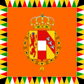
Standard of an Archduke or an Archduchess of Austria-Hungary. From 1915 untill 1918.
