User:Grueslayer/Southern Trinidad Aerial Photo Project
Jump to navigation
Jump to search

The Southern Trinidad Aerial Photo Project is a small project sponsored by WMDE. On Dec 23, 2016 I took a tour to southern Trinidad to shoot photos of populated places and landmarks with a drone. Visiting 7 places, 40 gb or 95 minutes of video footage was shot. The project page can be found here (German language only).
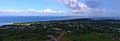
Station 1 - San Fernando
[edit]-
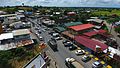
 001: Irving Park
 -
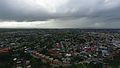
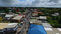
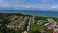
 002: City panorama
 -
 003: City panorama with Naparima college
 -
 004: Naparima College
 -
 005: Naparima College
 -
 006: Naparima Bowl
 -
 007: San Fernando General Hospital
 -
 008: Independence Avenue
 -
 009: Police headquarter
 -
 010: San Fernando General Hospital
 -
 011: Old police station
 -
 012: St. Paul's Church
 -
 013: Harris Promenade
 -
 014: City hall
 -
 015: Pro-Cathedral Our Lady of Perpetual Help
 -
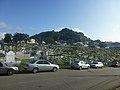
 016: San Fernando Hill
 -
 017: City panorama with Carnegie Free Library
 -
 018: Carnegie Free Library
 -
 019: Naparima Girls' High School
 -
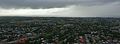
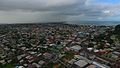
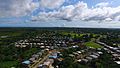
 020: City panorama
 -
 021: Presentation College
 -
 022: San Fernando Hill
 -
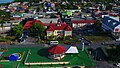
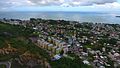
 023: Olera Heights
 -
 024: Cocoyea
 -
 025: Pleasantville
 -
 026: Mon Repos
 -
 027: OWTU headquarter
 -
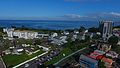
 028: San Fernando
 -
 029: Olera Heights
 -
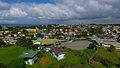
 030: Marabella
 -
 031: Vistabella + Sumadh Gardens
 -
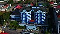
 032: Southern Elegance
 -
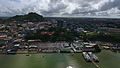
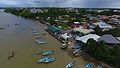
 033: King's Wharf
 -
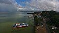
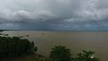
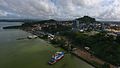 034: Harbour
 -
 035: San Fernando
 -
 036: San Fernando
 -
 037:Harbour
 -
 038: Bus terminal
 -
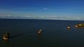
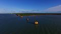
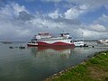
 039: Water taxis
 -
 040: Brown pelicans
 -
 041: Brown pelicans
 -
 042: Brown pelicans
 -
 043: Skinner Park
 -
 044: Coney Island
 -
 045: Skinner Park Velodrome
 -
 046: Skinner Park Velodrome
 -
 047: Les Efforts East
 -
 048: Coney Island
 -
 049: ASJA Colleges
 -
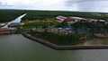
 050: UTT campus & SAPA building
 -
 051: San Fernando Central Secondary
 -
 052: ASJA Girls' College
 -
 053: Green Acres
 -
 054: Les Efforts West
 -
 055: Roodal Cemetery
 -
 056: Roodal Cemetery
 -
 057: Rienzi Kirton Highway
 -
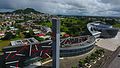
 058: Gulf City Mall
 -
 059: UTT campus + SAPA building


.jpg)
.jpg)

.jpg)
.jpg)
.jpg)
.jpg)
.jpg)

.jpg)
.jpg)


.jpg)


.jpg)


.jpg)


.jpg)
.jpg)

.jpg)


.jpg)

.jpg)


.jpg)

Station 2 - Debe
[edit]-
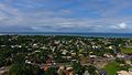
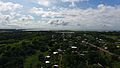
 060: Debe
 -
 061: Parvati Girls' Hindu College
 -
 062: Debe Market
 -
 063: Debe
 -
 064: S.S. Erin Road
 -
 065: Debe
 -
 066: Street food stalls
 -
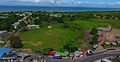
 067: Francis Seupaul Recreation Ground
 -
 068: Fun Splash Water Park & Debe Secondary School
 -
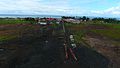
 069: Sir Solomon Hochoy Highway
 -
 070: Sir Solomon Hochoy Highway
 -
 071: Sir Solomon Hochoy Highway
 -
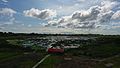
 072: Debe Market
 -
 073: Debe Market


.jpg)
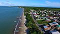
Station 3 - South Oropouche
[edit]-
 074: Godineau River
 -
 075: Godineau River
 -
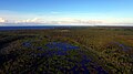
 076: Oropouche Swamp
 -
 077: Godineau River
 -
 078: Freemans Bay
 -
 079: Mosquito Creek Cremation Ground
 -
 080: Mosquito Creek Cremation Ground
 -
 081: Southern Main Road
 -
 082: Otaheite Bay
 -
 083: Dow
 -
 084: Dow
 -
 085: Otaheite Bay Fish Market
 -
 086: Southern Main Road
 -
 087: South Oropouche
 -
 088: Dow
 -
 089: South Oropouche


Station 4 - La Brea
[edit]-
 090: La Brea
 -
 091: La Brea
 -
 092: La Brea
 -
 093: La Brea
 -
 094: Point D'or
 -
 095: La Brea Brighton Sports Ground
 -
 096: La Brea Brighton Sports Ground
 -
 097: La Brea
 -
 098: Point D'or
 -
 099: La Brea Beach
 -
 100: Otaheite Bay
 -
 101: Point D'or
 -
 102: Pitch Lake
 -
 103: Pitch Lake
 -
 104: Pitch Lake
 -
 105: La Brea
 -
 106: Pitch Lake
 -
 107: Vessigny
 -
 108: CGCL Plant
 -
 109: Sobo Village
 -
 110: Lake Asphalt of Trinidad and Tobago (1978)
 -
 111: Lake Asphalt of Trinidad and Tobago (1978)
 -
 112: LABIDCO
 -
 113: La Brea
 -
 114: Pitch Lake


.jpg)
.jpg)


.jpg)
.jpg)
.jpg)


Station 5 - Point Fortin
[edit]No fly zone, hence the lack of pictures.
-
 115: Point Fortin
 -
116: Salazar Village

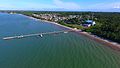
Station 6 - Cedros
[edit]-
 117: Beach
 -
 118: Beach
 -
 119: Cedros
 -
 120: Cedros
 -
 121: Cedros
 -
 122: Cedros
 -
 123: Cedros
 -
 124: Port
 -
 125: Beach
 -
 126: Beach
 -
 127: Ship wreck
 -
 128: Port
 -
 129: Port
 -
 130: Pier
 -
 131: Cedros
 -
 132: Cedros Secondaty School
 -
 133: Cedros
 -
 134: Cedros Bay
 -
 135: Cedros
 -
 136: Cedros


.jpg)


.jpg)


.jpg)


Station 7 - Icacos
[edit]-
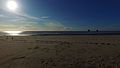 137: Columbus Beach
 -
 138: Three Sisters
 -
 139: Three Sisters
 -
 140: Three Sisters
 -
 141: Three Sisters
 -
 142: Three Sisters
 -
 143: Three Sisters
 -
 144: Los Gallos
 -
 145: Los Gallos
 -
 146: Los Gallos
 -
 147: Three Sisters
 -
 148: Columbus Bay
 -
 149: Three Sisters
 -
 150: Three Sisters
 -
 151: Three Sisters
 -
 152: Three Sisters
 -
 153: Three Sisters
 -
 154: Three Sisters
 -
 155: Three Sisters
 -
 156: Columbus Bay
 -
 157: Three Sisters
 -
 158: Three Sisters
 -
 159: Three Sisters
 -
 160: Los Gallos
 -
 161: Los Gallos
 -
 162: Columbus Bay
 -
 163: Columbus Bay
 -
 164: Columbus Bay
 -
 165: Columbus Bay
 -
 166: Columbus Beach
 -
 167: Columbus Beach
 -
 168: Columbus Bay
 -
 169: Columbus Beach
 -
 170: Coral Point
 -
 171: Icacos Wetlands
 -
 172: Icacos Wetlands
 -
 173: Icacos Wetlands
 -
 174: Icacos Wetlands
 -
 175: Three Sisters


Ground Shots
[edit]Over the course of the day I've also done a few ground shots with my smartphones and digicams, hoping someone can make use of them one day.
-
 Cedros: Beach
 -
 Cedros: Beach and wharf
 -
 Cedros: Beach and wharf
 -
 Cedros: Beach and wharf and coast guard/customs building
 -
 Cedros: Southern Main Road
 -
 Corbeau
 -
 Corbeau
 -
 Debe: Francis Seupaul Recreation Ground
 -
 Debe: Royal Castle sign
 -
 Fyzabad: Charlie King Junction
 -
 Fyzabad: Uriah Butler statue
 -
 Icacos: Columbus beach
 -
 Icacos: Columbus beach
 -
 Icacos: Coral Point
 -
 Icacos: Coral Point
 -
 Icacos: Icacos Wetlands
 -
 Icacos: Icacos Wetlands
 -
 Icacos: Three Sisters
 -
 Icacos: Three Sisters
 -
 Icacos: Three Sisters
 -
 Icacos: Three Sisters
 -
 Icacos: Village beach
 -
 Icacos: Village beach
 -
 La Brea: Brighton Sports Ground
 -
 San Fernando: ASJA Boys' College
 -
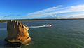
 San Fernando: Farallon Rock
 -
 San Fernando: Farallon Rock
 -
 San Fernando: Irving Park
 -
 San Fernando: Naparima Girls' High School
 -
 San Fernando: Paradise Cemetary
 -
 San Fernando: Paradise Cemetary
 -
 San Fernando: PS Carnival Runner
 -
 San Fernando: Skinner Park
 -
 San Fernando: Southern Elegance
 -
 South Oropouche: Freemans Bay
 -
 South Oropouche: Mosquito Creek Cremation Grounds


_2.jpg)
_3.jpg)


