User:Giftzwerg 88/Fotoprojekt Weissach
Jump to navigation
Jump to search
| This is a gallery of files created by Giftzwerg 88. |
Bahnhof Weissach
[edit]| Object location | | View all coordinates using: OpenStreetMap |
|---|
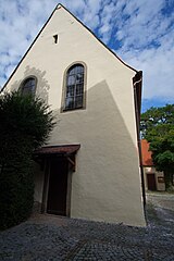
St. Ulrich Kirche in Weissach
[edit]| Object location | | View all coordinates using: OpenStreetMap |
|---|
Ansichten
[edit]St. Clemens
[edit]| Object location | | View all coordinates using: OpenStreetMap |
|---|
Neuapostolische Kirche
[edit]| Object location | | View all coordinates using: OpenStreetMap |
|---|
Methodistische Kirche
[edit]| Object location | | View all coordinates using: OpenStreetMap |
|---|
Evangelisches Gemeindehaus Weissach
[edit]| Object location | | View all coordinates using: OpenStreetMap |
|---|
Adventistische Kirche
[edit]| Object location | | View all coordinates using: OpenStreetMap |
|---|


