User:Giftzwerg 88/Fotoprojekt Döffingen Teil 3
Jump to navigation
Jump to search
| This is a gallery of files created by Giftzwerg 88. |
Gemeinschaftsschule
[edit]| Object location | | View all coordinates using: OpenStreetMap |
|---|
Graf-Ulrich-Bau
[edit]| Object location | | View all coordinates using: OpenStreetMap |
|---|
Süddeutsche Gemeinschaft
[edit]| Object location | | View all coordinates using: OpenStreetMap |
|---|
Kindergarten Arche Noah
[edit]| Object location | | View all coordinates using: OpenStreetMap |
|---|
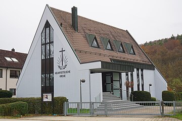
Neuapostolische Kirche
[edit]| Object location | | View all coordinates using: OpenStreetMap |
|---|
Kita Regenbogen
[edit]| Object location | | View all coordinates using: OpenStreetMap |
|---|
St. Johannes der Täufer
[edit]| Object location | | View all coordinates using: OpenStreetMap |
|---|


