User:Ebyabe/northeast
Jump to navigation
Jump to search

Bunnell
[edit]-

-
-

-

-

-

-
-

-
-

-
-
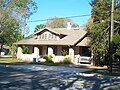
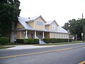
 Deen house
 -

-

-

-

-
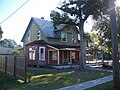
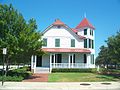
 Hendricks house
 -

-


Fernandina Beach
[edit]


Fort George Island
[edit]-
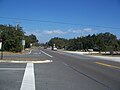 A1A
A1A -
 A1A
A1A -
 Signs for historic sites
 -
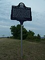
 Historical marker
 -
 Historical marker
 -
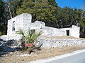 Tabby ruins


Green Cove Springs
[edit]-
 Bartram Plantation plaque
 -
 Fort San Francisco de Pupo plaque


Jacksonville
[edit]-
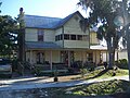
 Merrill House
 -
 Merrill House
 -
 Merrill House
 -
 Churchwell and Company Building
 -
 Endurance Run historical marker
 -
 Greenleaf and Crosby Building
 -
 Greenleaf and Crosby Building
 -
 Greenleaf and Crosby Building
 -
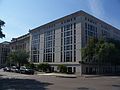
 Main downtown library
 -
 Main downtown library
 -
 Main downtown library
 -
 Main downtown library
 -
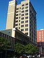
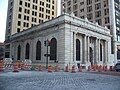
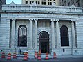
 Old Federal Reserve Bank of Atlanta
 -
 Old YMCA Building
 -
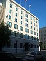 Old YMCA Building
 -
 Old YMCA Building
 -
 San Marco gazebo
 -
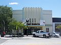 San Marco Theatre
 -
 Yates Building
 -
 Yates Building
 -
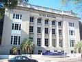 Yates Building


Laura Street Trio
-
 Bisbee Building
 -
 Bisbee Building
 -
 Bisbee Building
 -

-

-
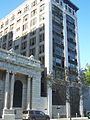
 Marble Bank and Bisbee Building
 -
 Marble Bank, with "Laura Trio"
 -
 Marble Bank
 -
 Marble Bank
 -
 Marble Bank


Macclenny
[edit]Old railroad depot


Mandarin
[edit]-
 Harriet Beecher Stowe house marker

Mayport (ferry)
[edit]


Olustee
[edit]Old railroad depot
[edit]


Orange Park
[edit]Club Continental
[edit]


.jpg)


Grace Episcopal Church
[edit]


St. Augustine
[edit]Clapp Octagon House
[edit]


Florida School for the Deaf and the Blind
[edit]


Fort Matanzas (near)
[edit]

Fountain of Youth Park
[edit]-

-
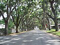 Magnolia Avenue, outside the park


Fullerwood Park Historic District
[edit]


Nelmar Terrace Historic District
[edit]


San Sebastian Winery
[edit]
View from top of St. Augustine Lighthouse
[edit]-
 Anastasia Island: Panorama view from the top of the St. Augustine Lighthouse, looking north towards St. Augustine
 -
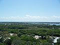
 Anastasia Island: Panorama view from the top of the St. Augustine Lighthouse, looking west. The land in the distance is Conch Island, part of Anastasia State Park. Beyond it is the Atlantic Ocean
 -
 Looking south towards the St. Augustine Amphitheatre. The annual Taste of St. Augustine was being held at the Amphitheatre. The smoke is from the restaurants cooking their food there.
 -
 Looking south towards the St. Augustine Amphitheatre. The annual Taste of St. Augustine was being held at the Amphitheatre. The smoke is from the restaurants cooking their food there.
 -
 Looking west. The SR 312 bridge across the Matanzas River can be seen in the distance
 -
 Looking west across the Matanzas River towards downtown St. Augustine. Mostly the area around King Street.


Talbot Islands
[edit]-
 A1A on Big Talbot Island
 -
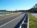 A1A on Big Talbot Island
 -
 A1A on Little Talbot Island
 -
 A1A on Little Talbot Island
 -
 Fort George Island Cultural Park


