Transport in the United States
Jump to navigation
Jump to search

-
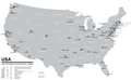 Map of places with urban/ metro transport

Air
[edit]-
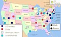 Airport hubs of the USA
 -
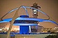 LAX
LAX -
 SFO
SFO


Cycling
[edit]Main category: Cycling in the United States
-
 Segways on Santa Monica beach
 -
 Roller skating, Santa Monica beach
 -
 Bay Trail at the Golden Gate Bridge
.jpg)
.jpg)

Rail
[edit]Main category: Rail transport in the United States
-
 Amtrak system map
 -
 Proposed high speed rail
 -
 Amtrak California map
 -
 Los Angeles County Metro Rail and Metro Liner map
 -
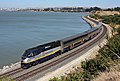 Amtrak, California
 -
 Cable car, San Francisco
 -
 Light rail, San Francisco
 -
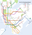 NYC Subway diagram


Road
[edit]Main category: Road transport in the United States
-
 Interstate highways map in the contiguous United States
 -
 Intrastate interstates highways map in the contiguous United States
 -
 Seven Mile Bridge, Florida
 -
 U.S. Route 66, Amboy, California
 -
 Park Police Horse Mounted Unit, San Francisco
 -
 LA Metro 20 bus with bicycles


,_Hist._Route_66_--_2012_--_1.jpg)


Walking
[edit]Main category: Pedestrian transport in the United States
-
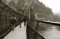 Appalachian Trail, Maryland
 -
 Atlantic City boardwalk, New Jersey
 -
 Broad Street, Philadelphia
 -
 Benjamin Franklin Parkway, Philadelphia
 -
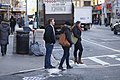 Broadway, Manhattan, New York
 -
 Fifth Avenue, New York
 -
 Franklin Avenue, Minneapolis, Minnesota
 -

-
 Hollywood Boulevard, Los Angeles, California
 -
-
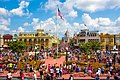
 Pennsylvania Avenue, Washington D.C.
 -
 Pier 39, Fisherman's Wharf, San Francisco, California


.jpg)
.jpg)
.jpg)

.jpg)
.jpg)
.jpg)


Water
[edit]Main category: Water transport in the United States
-
 Canals
 -
 LA Port, Long Beach

