Maps of Helsingborg
Jump to navigation
Jump to search
English: Maps of Helsingborg
Deutsch: Karten von Helsingborg
Svenska: Kartor över Helsingborg
-
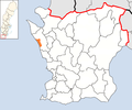
Location of Helsingborg (municipality) in Scania
-
Location of Helsingborg (town) in Scania
Location of Helsingborg city districts / Karten zur Lage der Stadtbezirke / B-områden i Helsingborgs kommuns innerområde
[edit]-
All city districts
-
Adolfsberg
-
Ättekulla
-
Berga
-
Centrum
-
Dalhem
-
Drottningshög
-
Elineberg
-
Eneborg
-
Eskilsminne
-
Fältabacken
-
Fredriksdal
-
Gustavslund
-
Högaborg
-
Högasten
-
Husensjö
-
Mariastaden
-
Miatorp
-
Närlunda
-
Norr
-
Olympia
-
Planteringen
-
Råå
-
Ramlösa
-
Ringstorp
-
Rosengården
-
Slottshöjden
-
Söder
-
Sofieberg
-
Stattena
-
Tågaborg S, Tågaborg N
-
Wilson Park
Other maps / Andere Karten / Övriga kartor
[edit]-
Unemployment rate
-
Population with foreign background
-
Educational level
-
Average income


