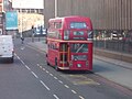
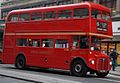
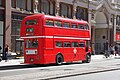
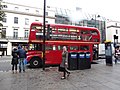
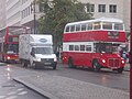
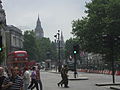
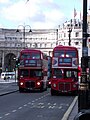
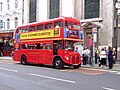
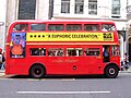
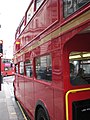
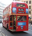
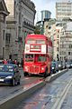
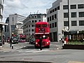
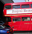
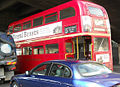
London Buses heritage route 15
Eastbound: Strand (Stop F, Trafalgar Square / Charing Cross Station, 51°30′30″N 0°07′34″W / 51.508317°N 0.126106°W) - Aldwych - Strand - Fleet Street - Ludgate Hill - St. Paul's Church Yard - Cannon Street - Eastcheap - Great Tower Street - Byward Street - Tower Hill (Stop TB, Tower of London, 51°30′35″N 0°04′35″W / 51.509602°N 0.076405°W)
Westbound: Tower Hill (Stop TA, Tower of London, 51°30′35″N 0°04′32″W / 51.509618°N 0.075515°W) - Byward Street - Great Tower Street - Eastcheap - Cannon Street - St. Paul's Church Yard - Ludgate Hill - Fleet Street - Strand (Stop H, Charing Cross Station, 51°30′31″N 0°07′32″W / 51.508493°N 0.125487°W)
The route uses the same roads in both directions, with the exception of the street named Aldwych, which is a one-way westbound diversion off the Strand.
Eastern end, first/last stops & out of service
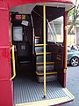
[edit]Stops TA/TB are staggered, on opposite sides of Tower Hill, with the Tower of London to the south and Tower Hill tube station to the north. To get from last stop TB to first stop TA, buses turn around using the square shaped one-way gyratory just to the west, formed by Minories (the west side), Goodman's Yard (north), Mansell Street (east) & Shorter Street (south, in line with Tower Hill). Buses can lay over on the bus stand on the south side of Goodman's Yard, outside the Travelodge.
Goodman's Yard bus stand
[edit]-
 RM2071
11 November 2010
51°30′40″N 0°04′26″W / 51.511147°N 0.073932°W
Parked up, minus a driver and with blinds still set to Tower Hill -
 RM324
RM324
10 December 2012
Parked up at the front of the stand, with blinds still set to Tower Hill

,_10_December_2012.jpg)
Shorter Street (departures)
[edit]-
 RM324
RM324
7 October 2012
51°30′36″N 0°04′27″W / 51.510015°N 0.074085°W
Waiting at the lights at the end of Shorter Street, about to enter Tower Hill
Blinds set for a short working to Aldwych

Stop TA (departures)
[edit]-
 ?
?
13 November 2011
At Stop TA

Westbound
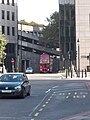
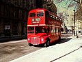
[edit]Tower Hill
[edit]Westbound route 15 buses on Tower Hill (ie ordinarily terminating at Trafalgar Square)
.jpg)
Byward Street
[edit]Westbound route 15 buses on Byward Street (ie ordinarily terminating at Trafalgar Square)
-
 RM1933
13 April 2007
51°30′34″N 0°04′48″W / 51.509542°N 0.080037°W
Waiting at the lights in the bus only lane for the right turn into Great Tower Street -
 RM2071
3 November 2013
51°30′34″N 0°04′48″W / 51.509542°N 0.080037°W
Waiting at the lights in the bus only lane for the right turn into Great Tower Street
_heritage_route_15_Byward_Street_13_April_2007.jpg)
,_3_November_2013.jpg)
Great Tower Street
[edit]Westbound route 15 buses on Great Tower Street (ie ordinarily terminating at Trafalgar Square)
-
 RM652
RM652
25 July 2007
geograph
Entering Great Tower Street from Byward Street, through the bus only gate -
 RM1968
23 March 2011
51°30′36″N 0°04′53″W / 51.509959°N 0.081476°W
Loading at the stop also named Great Tower Street, near the eastern end of the street


Eastcheap
[edit]Westbound route 15 buses on Eastcheap (ie ordinarily terminating at Trafalgar Square)
-
 RM324
RM324
16 September 2012
51°30′39″N 0°05′06″W / 51.510701°N 0.084984°W
Between Botolph Lane and Pudding Lane -
 RM1933
11 May 2012
geograph
Between Pudding Lane and Fish Street Hill -
 ?
?
28 August 2012
51°30′38″N 0°05′08″W / 51.510688°N 0.08555°W
Between Pudding Lane and Fish Street Hill (just passed Stop J, Monument) -
-

-
 RM1941
25 August 2012
51°30′39″N 0°05′11″W / 51.510838°N 0.086441°W
At the end of Eastcheap outside Monument tube station, about to cross King William Street to enter Cannon Street


,_heritage_route_15,_Eastcheap,_13_July_2008_uncropped.jpg)
.jpg)
,_25_August_2012.jpg)
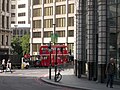
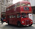
Cannon Street
[edit]Westbound route 15 buses on Cannon Street (ie ordinarily terminating at Trafalgar Square)
-

-

-
 RM1933
12 July 2008
geograph
About to cross (pedestrianised) Queen Street -
 ?
?
16 November 2008
51°30′47″N 0°05′50″W / 51.512966°N 0.097099°W
Loading at Stop SJ (St Paul's Church Yard) -
 ?
?
16 November 2008
51°30′47″N 0°05′50″W / 51.512966°N 0.097099°W
Loading at Stop SJ (St Paul's Church Yard)
,_24_January_2013_(2).jpg)
,_24_January_2013_(1).jpg)

.jpg)
.jpg)
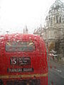
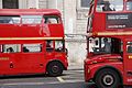
St Paul's Church Yard
[edit]Westbound route 15 buses on St Paul's Church Yard (ie ordinarily terminating at Trafalgar Square)
-

-
 RM324 (right)
18 September 2010
51°30′48″N 0°05′54″W / 51.513236°N 0.098204°W
Passing the Cathedral's south door, with London Bus Company's RML class Routemaster RML902 coming the other way -
 ?
?
20 December 2007
51°30′48″N 0°05′56″W / 51.513255°N 0.098917°W
Just passed the south door of the cathedral -
 ?
?
11 May 2012
approaching the western end of the cathedral -
 RM2050
5 December 2005
51°30′48″N 0°05′58″W / 51.513283°N 0.099379°W
Approaching Stop SJ (St Paul's Cathedral) -
 RM652
RM652
4 August 2007
51°30′47.73″N 0°5′57.05″W / 51.5132583°N 0.0991806°W
Approaching Stop SJ (St Paul's Cathedral) -
 RM324
RM324
28 December 2007
51°30′48″N 0°05′59″W / 51.51333°N 0.099625°W
Loading at Stop SJ (St Paul's Cathedral) -
 RM871
RM871
17 June 2008
51°30′48″N 0°05′59″W / 51.51333°N 0.099625°W
Loading at Stop SJ (St Paul's Cathedral)

_%26_RM324_(WLT_324),_18_September_2010.jpg)


_heritage_route_15_St_Pauls_5_December_2005.jpg)
_heritage_route_15_St_Pauls_4_August_2007.jpg)
.jpg)

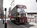
Ludgate Hill
[edit]Westbound route 15 buses on Ludgate Hill (ie ordinarily terminating at Trafalgar Square)
,_Ludgate_Hill,_heritage_route_15,_5_May_2011.jpg)
Ludgate Circus
[edit]Westbound route 15 buses crossing Ludgate Circus (ie ordinarily terminating at Trafalgar Square)
-
 ?
?
13 April 2008
geograph
Crossing Ludgate Circus, about to enter Fleet Street
Blinds possibly set for Aldwych, meaning this could either be a short westbound working, or more likely given the bus is empty, a not in service positioning run

Fleet Street
[edit]Westbound route 15 buses on Fleet Street (ie ordinarily terminating at Trafalgar Square)
-
 RM1968
28 October 2009
51°30′51″N 0°06′28″W / 51.514203°N 0.107667°W
Paused at the pedestrian crossing between Whitefriars Street and Bouverie Street -

-

.jpg)
.JPG)
.jpg)
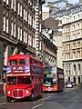
Strand
[edit]Westbound route 15 buses on Strand (ie ordinarily terminating at Trafalgar Square)
-
 ?
?
15 January 2009
51°30′47″N 0°06′49″W / 51.51295°N 0.113559°W
At Stop P (The Royal courts of Justice), St Clement Danes church on the left -
 RM324
RM324
9 February 2013
51°30′45″N 0°06′55″W / 51.512592°N 0.115217°W
Between Arundel Street and Surrey Street, passing a VH class on route 13, parked up on the Aldywch (Strand) bus stand with blinds set for a new journey to Golders Green -
 RM652
RM652
3 January 2009
51°30′45″N 0°06′56″W / 51.512479°N 0.115485°W
Between Arundel Street and Surrey Street, on the Aldywch (Strand) bus stand with blinds set for Aldwych, so probably at the end of a short working -

-
 RM1933
26 October 2013
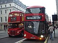
Loading at Stop U (Savoy Street), behind an LT class (New Routemaster) on standard route 9 to Hammersmith, also loading at the stop -
 RM2050
26 October 2013
Over-taking an LT class (New Routemaster) on standard route 9 to Hammersmith, loading at Stop U (Savoy Street) -

-
-
-

-

-
 RM324
RM324
27 October 2012
51°30′32″N 0°07′30″W / 51.508813°N 0.124928°W
At the lights before Charing Cross station forecourt -
 RM324
RM324
23 December 2012
51°30′32″N 0°07′30″W / 51.508813°N 0.124928°W
At the lights before Charing Cross station forecourt -
 RM1933
30 August 2012
Passing the road entrance Charing Cross station forecourt, about to reach Stop H -
 RM1933
30 August 2012
Passing the road entrance Charing Cross station forecourt, about to reach Stop H
_-_geograph.org.uk_-_1132671.jpg)
_%26_London_Sovereign_bus_VH3_(BD13_OHW),_9_February_2013.jpg)

.jpg)
,_route_9,_26_October_2013_(3).jpg)
_%26_New_Routemaster_LT72_(LTZ_1072),_route_9,_26_October_2013.jpg)
.jpg)
.jpg)
,_8_June_2013.jpg)
,_20_April_2014.jpg)
.jpg)
,_27_October_2012.jpg)
,_23_December_2012.jpg)
,_30_August_2012_(1).jpg)
,_30_August_2012_(2).jpg)
Western end, first/last stops & out of service
[edit]The central London terminus of route 15 is on the east side of Trafalgar Square, with the first/last stops on opposite sides of the west end of Strand, which has Charing Cross station on its south side. That last stop, H, is directly outside the Eleanor cross in the station forecourt, while first stop F is slightly to the west of the station forecourt. As with route 9, to get from its own first & last stops, route 15 buses can either turn right around Charing Cross roundabout and layover on the first stop, or use Whitehall/Northumberland Avenue and other streets to the south, to turn around and if necessary, layover in nearby stands. Before it was shifted west, route 9 buses heading west to terminate in Aldwych used Stop E 51°30′29″N 0°07′35″W / 51.50813°N 0.12643°W in Strand, which is behind stop F.
Strand -> Charing Cross roundabout (arrivals)
[edit]-
 RM2050
15 May 2011
Unloading at Stop H -
 RM871
RM871
8 February 2014
17:17
Unloading at Stop H -
 RM871
RM871
8 February 2014
17:17 -
 RM652
RM652
8 February 2014
51°30′29″N 0°07′35″W / 51.508191°N 0.126329°W
At Stop H, interior lights off, blinds already reset to Tower Hill -
 ?
?
4 September 2010
51°30′30″N 0°07′33″W / 51.508374°N 0.125741°W
Departing Stop H with blinds still set to Trafalgar Square, with a route 9 heritage Routemaster behind -
 RM1968
11 May 2012
51°30′28″N 0°07′36″W / 51.50789°N 0.126706°W
End of Strand, waiting to enter Trafalgar Square (right hand lane suggesting an immediate run around the Charing Cross roundabout)
Blinds still set for Trafalgar Square -
 RM871
RM871
25 August 2012
End of Strand, waiting to enter Trafalgar Square (right hand lane suggesting an immediate run around the Charing Cross roundabout)
Blinds set to Not in Service -
 RM324
RM324
10 August 2013
End of Strand, entering Trafalgar Square (left hand lane suggesting a layover in the southern streets)
Blinds still set for Trafalgar Square

,_8_February_2014.jpg)

,_8_February_2014.jpg)

,_11_May_2012.jpg)
,_25_August_2012_(1).jpg)
,_10_August_2013.jpg)
Whitehall, southbound (arrivals)
[edit]-
 RM652
RM652
5 August 2007
11:51
51°30′23″N 0°07′38″W / 51.506424°N 0.127096°W
Approaching Great Scotland Yard, with blinds still set to Trafalgar Square -
 RM652
RM652
5 August 2007
11:51
51°30′22″N 0°07′37″W / 51.506063°N 0.126937°W
Passing Great Scotland Yard, with blinds still set to Trafalgar Square - turning via Whitehall Place, Scotland Place and Great Scotland Yard -
 RM2050
26 June 2009
51°30′21″N 0°07′36″W / 51.505729°N 0.126746°W
Turning left into Whitehall Place, with the rear blind already reset to Tower Hill


Great Scotland Yard bus stands (north side)
[edit]-
 RM2060
5 September 2008
51°30′22″N 0°07′35″W / 51.506248°N 0.126319°W
Parked up minus a driver, with blind already reset to Tower Hill
.jpg)
Great Scotland Yard bus stands (south side)
[edit]-
 RM871
RM871
15 November 2008
51°30′22″N 0°07′35″W / 51.506203°N 0.126297°W
Parked up minus a driver, with blind still set to Trafalgar Square -
 RM2071
2 December 2008
51°30′22″N 0°07′35″W / 51.506203°N 0.126297°W
Parked up minus a driver, with blind already reset to Tower Hill -
 ?
?
16 December 2009
geograph
Parked up, with blind already reset to Tower Hill -
 RM2089
16 December 2009
geograph
Parked up, with blind already reset to Tower Hill -
 RM1941
11 May 2013
51°30′23″N 0°07′34″W / 51.506297°N 0.125983°W
Parked up minus a driver, with blind already reset to Tower Hill

.jpg)


,_11_May_2013.jpg)
Great Scotland Yard, Whitehall lights (departures)
[edit]-
 RM652
RM652
15 May 2006
51°30′22″N 0°07′36″W / 51.506104°N 0.12671°W
Waiting to turn right into Whitehall, with blinds now set for Tower Hill -
 RM652
RM652
5 August 2007
51°30′22″N 0°07′36″W / 51.506104°N 0.12671°W
Waiting to turn right into Whitehall, with blinds now set for Tower Hill


Whitehall Place, northbound
[edit]-
 RM2071
5 September 2010
15:02
51°30′23″N 0°07′25″W / 51.506527°N 0.123502°W
Turning left from Whitehall Place into Northumberland Avenue, with blinds still set for Trafalgar Square - then parked up in the Avenue northbound bus stand -
,_5_September_2010_(4).jpg)
,_5_September_2010_(3).jpg)
Northumberland Avenue bus stand (northbound)
[edit]-
 RM1941
21 February 2009
51°30′25″N 0°07′28″W / 51.506826°N 0.124514°W
Parked up minus a driver, with blind already reset to Tower Hill -

-
 RM2071
5 September 2010
?
Parked up, blind still set for Trafalgar Square -
 RM2071
5 September 2010
15:19
51°30′25″N 0°07′29″W / 51.506856°N 0.124653°W
Parked up, with blind already reset to Tower Hill -
.jpg)
.jpg)
,_5_September_2010.jpg)
,_5_September_2010_(1).jpg)
,_5_September_2010_(2).jpg)
Northumberland Avenue bus stand (southbound)
[edit]-
 RM1941
18 April 2010
51°30′26″N 0°07′35″W / 51.507247°N 0.126431°W
Parked up minus a driver, with blind still set to Trafalgar Square
_on_heritage_route_15.jpg)
Whitehall, northbound (departures)
[edit]-
 RM2050
21 March 2008
51°30′25″N 0°07′39″W / 51.507035°N 0.127543°W
At the top of Whitehall, about to enter Charing Cross roundabout, blinds set for Tower Hill
_heritage_route_15_Whitehall_21_March_2008.jpg)
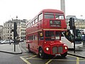
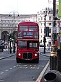
Charing Cross roundabout -> Trafalgar Square -> Strand (departures)
[edit]-
 RM1941
23 February 2013
51°30′27″N 0°07′41″W / 51.507371°N 0.128021°W
West side of the roundabout, blinds set for Tower Hill -
 RM324
RM324
13 June 2011
51°30′27″N 0°07′40″W / 51.507571°N 0.127794°W
North side of the roundabout (Whitehall in the background) -
 RM2050
10 April 2008
51°30′28″N 0°07′39″W / 51.507666°N 0.127413°W
Trafalgar Square, blinds set for Tower Hill -
 ?
?
21 October 2013
51°30′28″N 0°07′39″W / 51.507655°N 0.127542°W
Trafalgar Square (Whitehall in the background) -

-
 RM1933
26 October 2013
51°30′28″N 0°07′38″W / 51.507745°N 0.127239°W
Trafalgar Square, about to enter Strand, blinds set for Tower Hill -
 RM2071
8 March 2007
51°30′28″N 0°07′38″W / 51.507774°N 0.127123°W
Trafalgar Square, about to enter Strand, blinds set for Tower Hill -
 RM2089
15 September 2013
51°30′28″N 0°07′38″W / 51.507762°N 0.127138°W
Trafalgar Square, about to enter Strand, blinds set for Tower Hill -
 RM871
RM871
27 August 2012
Pulling up at Stop E or F; blinds set for Tower Hill -
 RM324
RM324
29 August 2012
Pulling up at Stop E or F; blinds set for Tower Hill -
 RM1941
24 August 2012
Parked up with a driver but with hazard lights on at the back of Stop E; blinds set for Tower Hill -
 RM871
RM871
25 August 2012
Parked up with a driver at the back of Stop E; blinds set for Tower Hill -
 RM871
RM871
25 August 2012
Parked up with a driver at the back of Stop E; blinds set for Tower Hill
A route 9 Routemaster can be seen on the left, running around the roundabout while displaying Not In Service -
 RM324 & RM652
26 August 2012
RM324 is seen passing RM652, which is parked up at the back of Stop E; both with blinds set for Tower Hill -
 RM1933
5 September 2012
Passing Stop E, indicating to stop at the back of Stop F, blinds set to Not In Service -
 RM1941
24 August 2012
Parked up with a driver but with hazard lights on at the back of Stop E; blinds set for Tower Hill -
 RM1941
13 January 2012
51°30′29″N 0°07′36″W / 51.507981°N 0.126772°W
Parked up minus a driver at the rear of Stop E, with blinds set to Not In Service -
 RM2060
6 July 2010
geograph
Parked up minus a driver at the rear of Stop E, with blinds now reset to Tower Hill -
 RM1933
4 June 2011
51°30′29″N 0°07′36″W / 51.508063°N 0.126598°W
Pullung out of Stop E, with blinds set for Tower Hill -
 RM1933
12 June 2010
51°30′30″N 0°07′34″W / 51.508289°N 0.126142°W
Strand
Parked up minus a driver at Stop F -

-
 RM652
RM652
26 October 2013
51°30′29″N 0°07′35″W / 51.508191°N 0.126329°W
Departing Stop F (from the rear of the stop box), being overtaken by an LT class (New Routemaster) on route 9 departing Stop E while en route to Aldwych -
 RM871
RM871
25 July 2014
Parked up with a driver at the back of Stop E; blinds set for Tower Hill
,_23_February_2013.jpg)
,_Trafalgar_Square,_heritage_route_15,_13_June_2011.jpg)
.JPG)
.jpg)

,_26_October_2013.jpg)

,_15_September_2013.jpg)
,_27_August_2012.jpg)
,_29_August_2012.jpg)
,_24_August_2012_(2).jpg)
,_25_August_2012_(2).jpg)
,_25_August_2012_(3).jpg)
_%26_RM652_(WLT_652),_26_August_2012.jpg)
,_5_September_2012.jpg)
,_24_August_2012_(1).jpg)
,_1964_Heritage_Routemaster,_route_15,_13_January_2012_uncropped.jpg)
,_heritage_route_15,_Strand,_4_June_2011_uncropped.jpg)
,_heritage_route_15,_Strand,_12_June_2010_(1).jpg)
,_heritage_route_15,_Strand,_12_June_2010_(2).jpg)
_%26_Heritage_Routemaster_RM652_(WLT_652),_route_9,_26_October_2013.jpg)
.jpg)
Eastbound
[edit]Strand/Aldwych/Strand
[edit]Eastbound route 15 buses on Strand (which in this direction also encompasses Aldwych) (ie ordinarily terminating at Tower Hill)
-
 RM2071
9 August 2011
51°30′33″N 0°07′28″W / 51.509181°N 0.124433°W
Approaching Agar Street (Charing Cross station behind the bus) -
 RM1941
24 August 2012
51°30′37″N 0°07′20″W / 51.510181°N 0.12226°W
About to pass Stop A (Southampton Street)
(view from the lower deck front window) -

-
 RM324
RM324
4 August 2008
51°30′48″N 0°06′51″W / 51.513277°N 0.114029°W
Departing Stop L (The Royal courts of Justice)
(view from the lower deck, through the driver's cab) -
 RM2089
1 February 2013
51°30′48″N 0°06′48″W / 51.513374°N 0.113417°W
Passing the Royal Courts of Justice
.jpg)
,_24_August_2012_(3).jpg)
,_23_October_2013.jpg)

,_1_February_2013.jpg)
Fleet Street
[edit]Eastbound route 15 buses on Fleet Street (ie ordinarily terminating at Tower Hill)
-
 RM1941
16 September 2007
51°30′51″N 0°06′19″W / 51.514202°N 0.105216°W
Departing Stop E (Ludgate Circus), approaching the Circus -
 RM1941
16 September 2007
51°30′51″N 0°06′17″W / 51.514199°N 0.104818°W
Waiting at the lights to cross Ludgate Circus
.jpg)
.jpg)
Ludgate Hill
[edit]Eastbound route 15 buses on Ludgate Hill (ie ordinarily terminating at Tower Hill)
-
 RM324
RM324
25 February 2007
51°30′51″N 0°06′14″W / 51.514179°N 0.10392°W
Just crossed Ludgate Circus, now passing City Thameslink station -
 RM1933
14 January 2009
geograph
Passing Old Bailey (the street) -

-

-
-
-
 RM652
RM652
27 September 2012
51°30′50″N 0°06′02″W / 51.513787°N 0.100594°W
Waiting to enter St Paul's Church Yard
.jpg)

_30_June_2008_heritage_route_15_Ludgate_Hill.jpg)
_heritage_route_15_Ludgate_Hill_25_June_2008.jpg)
_7_August_2006_heritage_route_15_Ludgate_Hill.jpg)

,_27_September_2012.jpg)
St Paul's Church Yard
[edit]Eastbound route 15 buses on St Paul's Church Yard (ie ordinarily terminating at Tower Hill)
-
 RM652
RM652
15 February 2007
51°30′48″N 0°05′55″W / 51.513317°N 0.09863°W
Waiting for the pedestrian crossing outside the south door of the cathedral -
 RM2060
18 September 2010
51°30′48″N 0°05′55″W / 51.513322°N 0.098625°W
Waiting for the pedestrian crossing outside the south door of the cathedral -
 ?
?
16 September 2007
51°30′48″N 0°05′53″W / 51.513296°N 0.098161°W
Passing the south door of the Cathedral -
 RM1941
30 April 2014
Loading at Stop SK (St Paul's Cathedral) -
 ?
?
30 October 2013
51°30′48″N 0°05′52″W / 51.513201°N 0.097673°W
Departing Stop SK (St Paul's Cathedral)

,_18_September_2010.jpg)

,_30_April_2014.jpg)

Cannon Street
[edit]Eastbound route 15 buses on Cannon Street (ie ordinarily terminating at Tower Hill)
-
 RM652
RM652
30 October 2013
51°30′47″N 0°05′49″W / 51.513042°N 0.096973°W
In the queue to cross Distaff Lane / New Change
Closest the camera is an LT class (New Routemaster) on route 11 to Fulham Broadway, loading at Stop SH (New Change) -
 ?
?
8 August 2007
51°30′47″N 0°05′48″W / 51.51301°N 0.096785°W
Waiting at the lights before Distaff Lane / New Change, St Paul's in the background -
 ?
?
19 August 2012
About to cross Queen Victoria Street -
 RM871
RM871
11 August 2006
51°30′47″N 0°05′48″W / 51.512994°N 0.096778°W
About to cross Distaff Lane / New Change -
 RM2050
26 June 2012
51°30′41″N 0°05′23″W / 51.511509°N 0.089653°W
About to cross Salters Hall Court (Cannon Street station behind the bus) -

-
 RM2089
7 March 2009
51°30′40″N 0°05′15″W / 51.511075°N 0.087432°W
Approaching the King William Street lights -

-
,_route_11,_30_October_2013.jpg)


.jpg)
,_26_June_2012_(1).jpg)
,_26_June_2012_(2).jpg)
.jpg)
.jpg)
.jpg)
Eastcheap
[edit]Eastbound route 15 buses on Eastcheap (ie ordinarily terminating at Tower Hill)
-
 RM871
RM871
16 September 2012
51°30′39″N 0°05′09″W / 51.510862°N 0.08589°W
Entering Eastcheap, at the southern end of Gracechurch Street

Great Tower Street
[edit]Eastbound route 15 buses on Great Tower Street (ie ordinarily terminating at Tower Hill)

Route 15 buses off route
[edit]-
-

-
 RM652
RM652
8 November 2008
51°30′36″N 0°05′37″W / 51.509866°N 0.093488°W
Queen Street Place (Southwark Bridge), southbound -
 RM1941
15 May 2009
geograph
Westbound, Queen Victoria Street (diversion)
_heritage_route_15_Monument_15_March_2006.jpg)
.jpg)
.jpg)

Route 15 buses in unknown locations
[edit]-
 RM1933
27 July 2012 -
 RM1933
? -
 RM324
RM324
? -
 RM324
RM324
?
,_27_July_2012.jpg)
_nearside.jpg)
_(1).jpg)
_(2).jpg)