Kerlingarfjöll
Jump to navigation
Jump to search
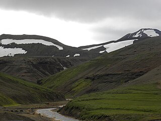
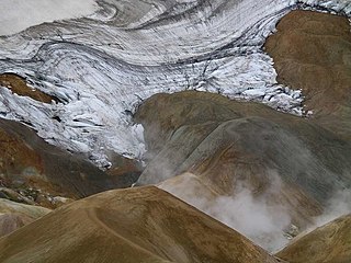
Deutsch: Kerlingarfjöll ist ein Gebirge und Vulkansystem im Hochland von Island in der Nähe des Hofsjökull.
English: w:Kerlingarfjöll is a mountain range and volcanic system in the highland of w:Iceland near w:Hofsjökull.
Français : Kerlingarfjöll est une chaîne de montagnes et en même temps un système volcanique dans l'intérieur de l'Islande tout près de Hofsjökull.
Íslenska: Kerlingarfjöll er fjallgarður á hálendi Íslands nálægt Kili. Jarðvegur er sums staðar rauður á svæðinu vegna eldvirkni þar. Jarðefni úr hverum á svæðinu eru gul, rauð og græn. Vinsælt skíðasvæði var í Kerlingarfjöllum en það var aflagt árið 2000.
Satellite images and maps of Kerlingarfjöll
[edit]-
Map of the volcanic zones of Iceland; Kerlingarfjöll are part of the MIB (Mid-Iceland Belt)
-
The glacier volcano Hofsjökull occupies the center of Iceland, Kerlingarfjöll just to the southeast.
Kerlingarfjöll and Kjölur highland road
[edit]The mountain range is situated not far from Kjölur highland road.
-
Kjölur highland road in the wintertime
-
Kjölur highland road
-
The mountain range seen from direction of Kjölur highland road
-
Two peaks of Kerlingarfjöll: Loðmundur to the left, Snækollur to the right
-
The ravine of Innri-Ásgarðsá
-
Snow lies here even in the summer time
-
Hyaloclastite tuff of Kerlingarfjöll
-
Tuff rock formations of Kerlingarfjöll
High temperature area of Kerlingarfjöll: the hot springs of Hveradalir
[edit]-
Rhyolite of Kerlingarfjöll


