Goudswaard
Jump to navigation
Jump to search
town and former municipality in South Holland, Netherlands     | |||||
| Upload media | |||||
| Instance of | |||||
|---|---|---|---|---|---|
| Location |
| ||||
| Population |
| ||||
| Area |
| ||||
 | |||||
-
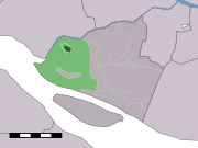 Goudswaard (Hoeksche Waard)
 -
 Vlag
Vlag -
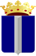 Wapen
Wapen -
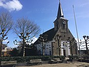 Dorpskerk
 -
 Kerkorgel
 -
 Dorpsstraat
 -
 Haven
Haven -
 Molen aan de Molendijk
 -
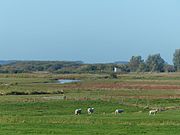 Korendijkse slikken


