Floridsdorf
Jump to navigation
Jump to search
| Floridsdorf on sister projects: | |||||||||
|---|---|---|---|---|---|---|---|---|---|
de: en: da: fr: it: lb: nl: pl: sr: tr: | |||||||||
Deutsch: Floridsdorf ist der 21. Wiener Gemeindebezirk.
English: Floridsdorf is the 21st district of Vienna, Austria.
21st district of Vienna | |||||
| Upload media | |||||
| Pronunciation audio | |||||
|---|---|---|---|---|---|
| Instance of |
| ||||
| Named after | |||||
| Location | Vienna, Austria | ||||
| Head of government |
| ||||
| Has part(s) |
| ||||
| Population |
| ||||
| Area |
| ||||
| Elevation above sea level |
| ||||
| Different from | |||||
| official website | |||||
 | |||||
-
Coat of arms
-
Old coat of arms of Floridsdorf
-
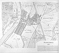
Plan of the Floridsdorf region and the danube
-
Plan der Donauregulierung 1870-1875
-
Moschee in Floridsdorf
-
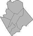
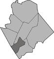
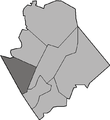
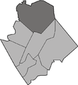
Bezirksteile von Floridsdorf
-
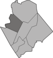
Bezirksteile von Floridsdorf
-
Hauptstraße and market place about 1895
-
Pragerstraße about 1899
-
St Jakobs church
-
Amtshaus
-
Schlingerhof
-
Deutsch: Blick vom LeopoldsbergEnglish: View from Leopoldsberg
-
Map of Donaufeld 1887
-
Donaufelder Pfarrkirche
-
Map of Groß-Jedlersdorf 1821
-
Map of Jedlesee 1821
-
Heereslager Karls V. von Lothringen bei Jedlesee
-
Map of Leopoldau 19. century
-
Leopoldau about 1890
-
Map of Stammersdorf 1822
-
Cyrill und Method church in Neu-Stammersdorf
-
Old cemetry of Stammersdorf
-
Parish church of Stammersdorf
-
Stammersdorfer Kellergasse
-
Stammersdorfer Kellergasse
-
Army hospital, Van-Swieten Kaserne
-
Freiheitsplatz in Stammersdorf
-
Former community guesthouse
-
Map of Strebersdorf 1821
-
Parish church of Strebersdorf


