Fischerstraße (Ruhland)
Jump to navigation
Jump to search
| Object location | | View all coordinates using: OpenStreetMap |
|---|
vom Markt nach Westen
[edit]-
 Fischerstraße, Ostansicht
 -
 vom Schwarzwasser westwärts
vorn rechts Stadtmühle nordwärts -
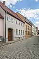
 rechts Hausnr. 12, Baudenkmal, saniert
 -
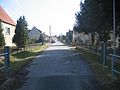
 vom Haingraben westwärts
links Feldweg zur Ortrander Straße


von Nordwesten zum Markt
[edit]-
 vom Haingraben ostwärts
 -
 bei Hausnr. 3
vorher rechts in die Gartenstraße -
 Fischerstraße 1-2 dahinter Markt 8b-6
geradeaus zum Marktplatz


