File:World location map (W3) (ante 1992-03+04+05).svg
Jump to navigation
Jump to search

Size of this PNG preview of this SVG file: 800 × 489 pixels. Other resolutions: 320 × 196 pixels | 640 × 391 pixels | 1,024 × 626 pixels | 1,280 × 782 pixels | 2,560 × 1,564 pixels | 3,188 × 1,948 pixels.
Original file (SVG file, nominally 3,188 × 1,948 pixels, file size: 2.47 MB)
Captions
Captions
Add a one-line explanation of what this file represents
Summary
[edit]| Description |
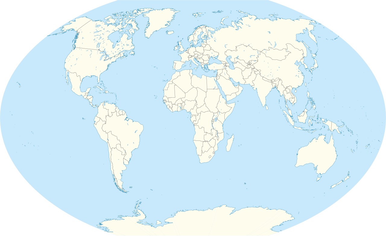
Deutsch: Positionskarte der Welt. Winkel III Projektion mit Zentralmeridian 11°30' Ost und Standardparallele bei 50°28'. Die Karte zeigt historische Ländergrenzen, siehe unten!
English: Location map of the world. Winkel III proection centered 11°30' East and standard parallels at 50°28'. International borders shown are expired, see below |
| Date | |
| Source |
Own work This W3C-unspecified vector image was created with Adobe Illustrator. This SVG file was uploaded with Commonist. This vector image includes elements that have been taken or adapted from this file: |
| Author |
TUBS |
| Other versions |
English: Historic world maps series → This map series shows the map of the world with all relevant widely accepted international borders dating back to around 1950. A nice overview of how international borders in the last decades evolved is provided by “The List of World Map Changes”. All descriptions in italics indicate non-visible changes that effected only the file's internal data (i.e. primarily objects' id and group). For derived locator maps of historic territories, please check out this category.
Deutsch: Historische Weltkartenserie → Die Kartenserie zeigt alle gemeinhin anerkannten internationeln Grenzen der Welt für den Zeitraum ab etwa 1950. Für eine erklärende Übersicht, siehe List of world map changes (englisch). Alle Karten mit einer kursiven Bildumschrift resultieren in keiner sichtbaren Änderung, sondern beeinflussen nur die internen Daten der Datei (im Wesentlichen Bennennunng einzelner Objekte und deren Gruppierung). Für abgeleitete Lagekarten historischer Staaten, siehe hier
Timeline[edit]
|
.svg)
_(ante_2011-07-11).svg)
_(ante_2010-10-10).svg)
_(ante_2008-08-25).svg)
_(ante_2008-02-17).svg)
_(ante_2006-06-03).svg)
_(ante_2003-02-04).svg)
_(ante_2002-05-20).svg)
_(ante_1999-12-31).svg)
_(ante_1999-12-20).svg)
_(ante_1997-07-01).svg)
_(ante_1997-05-17).svg)
_(ante_1994-02-28).svg)
_(ante_1993-01-01).svg)
_(ante_1992-03%2B04%2B05).svg)
_(ante_1992-03%2B04%2B05).svg&action=edit§ion=1)
Licensing
[edit]_(ante_1992-03%2B04%2B05).svg&action=edit§ion=2)
I, the copyright holder of this work, hereby publish it under the following licenses:
This file is licensed under the Creative Commons Attribution-Share Alike 3.0 Unported license.
- You are free:
- to share – to copy, distribute and transmit the work
- to remix – to adapt the work
- Under the following conditions:
- attribution – You must give appropriate credit, provide a link to the license, and indicate if changes were made. You may do so in any reasonable manner, but not in any way that suggests the licensor endorses you or your use.
- share alike – If you remix, transform, or build upon the material, you must distribute your contributions under the same or compatible license as the original.

|
Permission is granted to copy, distribute and/or modify this document under the terms of the GNU Free Documentation License, Version 1.2 or any later version published by the Free Software Foundation; with no Invariant Sections, no Front-Cover Texts, and no Back-Cover Texts. A copy of the license is included in the section entitled GNU Free Documentation License. |
You may select the license of your choice.

|
I'd greatly appreciate, that you attribute this media file to Wikimedia Commons, if used outside Wikipedia or Commons. For use in publications such as books, newspapers, blogs, websites, please insert here the following line:
|
_(ante_1992-03%2B04%2B05).svg&action=edit&redlink=1)
File history
Click on a date/time to view the file as it appeared at that time.
| Date/Time | Thumbnail | Dimensions | User | Comment | |
|---|---|---|---|---|---|
| current | 16:03, 17 April 2012 | | 3,188 × 1,948 (2.47 MB) | TUBS (talk | contribs) | {{Information |Description={{de|Positionskarte der Welt. Winkel III Projektion mit Zentralmeridian 11°30' Ost und Standardparallele bei 50°28'. Die Karte zeigt historische Ländergrenzen, siehe unten!}} {... |
You cannot overwrite this file.
File usage on Commons
The following 18 pages use this file:
- File:World location map (W3) (ante 1992-03+04+05).svg
- File:World location map (W3) (ante 1993-01-01).svg
- File:World location map (W3) (ante 1994-02-28).svg
- File:World location map (W3) (ante 1997-05-17).svg
- File:World location map (W3) (ante 1997-07-01).svg
- File:World location map (W3) (ante 1999-10-25).svg
- File:World location map (W3) (ante 1999-12-20).svg
- File:World location map (W3) (ante 1999-12-31).svg
- File:World location map (W3) (ante 2000-06-12).svg
- File:World location map (W3) (ante 2002-05-20).svg
- File:World location map (W3) (ante 2003-02-04).svg
- File:World location map (W3) (ante 2006-06-03).svg
- File:World location map (W3) (ante 2007-02-21).svg
- File:World location map (W3) (ante 2008-02-17).svg
- File:World location map (W3) (ante 2008-08-25).svg
- File:World location map (W3) (ante 2010-10-10).svg
- File:World location map (W3) (ante 2011-07-11).svg
- Template:Historic world map series
_(ante_1999-10-25).svg)
_(ante_2000-06-12).svg)
_(ante_2007-02-21).svg)
_(ante_1992-03%2B04%2B05).svg&oldid=519108587)