File:Wismarbucht1850.jpg
Original file (3,364 × 1,719 pixels, file size: 650 KB, MIME type: image/jpeg)
Captions
Captions
Summary
[edit]
| Description |
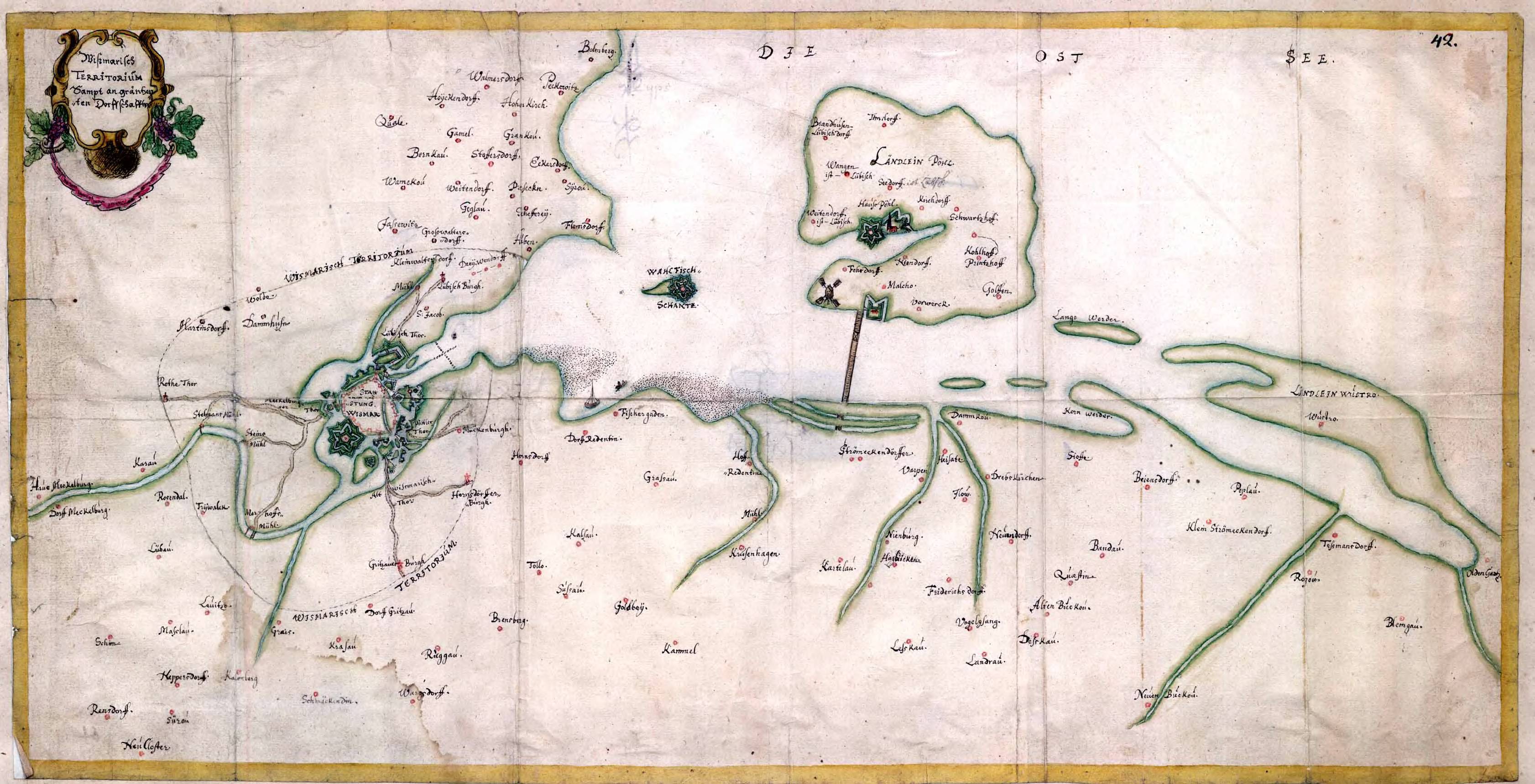
Deutsch: Karte der Wismarer Bucht mit den Inseln Walfisch und Poel aus dem schwedischen Kriegsarchiv, dort auf 1850 datiert. |
| Date | circa 1850 |
| Source | Riksarkivet (Krigsarkivet), https://sok.riksarkivet.se/arkiv/VJJN1lpXIKw7dgeQycZx32 |
| Author | unbekannter Kartograph |
Licensing
[edit]
|
This work is in the public domain in its country of origin and other countries and areas where the copyright term is the author's life plus 70 years or fewer.
| |
| This file has been identified as being free of known restrictions under copyright law, including all related and neighboring rights. | |
File history
Click on a date/time to view the file as it appeared at that time.
| Date/Time | Thumbnail | Dimensions | User | Comment | |
|---|---|---|---|---|---|
| current | 06:32, 15 June 2022 | | 3,364 × 1,719 (650 KB) | DivadH (talk | contribs) | Radically increased resolution compared to previous file |
| 09:15, 29 January 2009 |  | 981 × 501 (54 KB) | Kresspahl (talk | contribs) | {{Information |Description={{de|1=Karte der Wismar Bucht mit den Inseln Walfisch und Poel aus dem schwedischen Kriegsarchiv, dort auf 1850 datiert.}} |Source=Krigsarkivet bei www.statensarkiv.se |Author=unbekannter Kartograph |Date=ca. 1850 |Permission= | |
You cannot overwrite this file.
File usage on Commons
The following 3 pages use this file:
- Poel
- User:Symposiarch/Mainz/2022 June 11-20
- File:Wismarbugt1850.jpg (file redirect)
File usage on other wikis
The following other wikis use this file:
- Usage on de.wikipedia.org