File:West Sister Island Karte.png
Jump to navigation
Jump to search

Size of this preview: 670 × 599 pixels. Other resolutions: 268 × 240 pixels | 537 × 480 pixels | 859 × 768 pixels | 1,145 × 1,024 pixels | 2,000 × 1,789 pixels.
Original file (2,000 × 1,789 pixels, file size: 157 KB, MIME type: image/png)
Captions
Captions
Add a one-line explanation of what this file represents
Summary
[edit]
| Description |
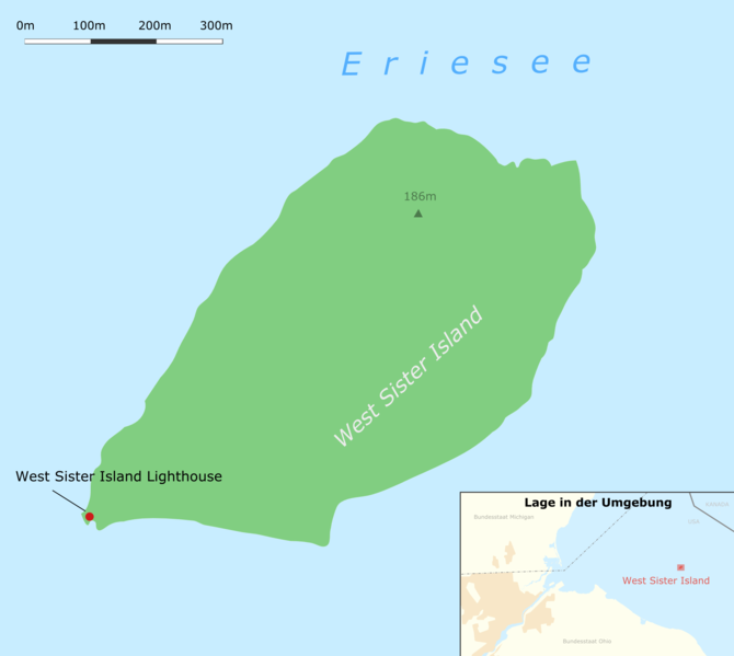
Deutsch: Karte der Insel West Sister Island im Eriesee, Ohio
English: Map of West Sister Island located in Lake Erie, Ohio |
| Date | |
| Source | Own work, using OpenStreetMap data for the orientation map |
| Author |
Graphic made by Carport |
Licensing
[edit]
This file is licensed under the Creative Commons Attribution-Share Alike 2.0 Generic license.
- You are free:
- to share – to copy, distribute and transmit the work
- to remix – to adapt the work
- Under the following conditions:
- attribution – You must give appropriate credit, provide a link to the license, and indicate if changes were made. You may do so in any reasonable manner, but not in any way that suggests the licensor endorses you or your use.
- share alike – If you remix, transform, or build upon the material, you must distribute your contributions under the same or compatible license as the original.
File history
Click on a date/time to view the file as it appeared at that time.
| Date/Time | Thumbnail | Dimensions | User | Comment | |
|---|---|---|---|---|---|
| current | 17:26, 4 January 2010 | | 2,000 × 1,789 (157 KB) | Carport (talk | contribs) | k |
| 17:24, 4 January 2010 |  | 2,000 × 1,789 (158 KB) | Carport (talk | contribs) | {{Information |Description={{de|1=Karte der Insel {{w|West Sister Island|3=de}} im Eriesee, Ohio}} {{en|1=Map of {{w|West Sister Island}} located in Lake Erie, Ohio}} |Source={{own}}, using OpenStreetMap data for the orientation map |Author={{user:car |
You cannot overwrite this file.
File usage on Commons
There are no pages that use this file.
File usage on other wikis
The following other wikis use this file:
- Usage on de.wikipedia.org