File:Watukumpul kecamatan Pemalang Regency location map.jpg
Jump to navigation
Jump to search
Size of this preview: 600 × 600 pixels. Other resolutions: 240 × 240 pixels | 480 × 480 pixels | 768 × 768 pixels | 1,250 × 1,250 pixels.
Original file (1,250 × 1,250 pixels, file size: 238 KB, MIME type: image/jpeg)
Captions
Captions
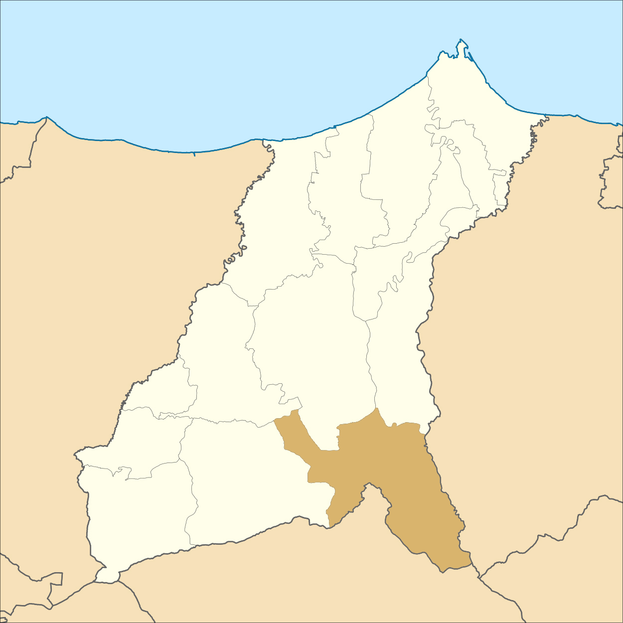
Kecamatan Watukumpul, Pemalang Regency, Central Java, Indonesia
Summary
[edit]
| Description |
English: Kecamatan Watukumpul, Pemalang Regency, Central Java, Indonesia English: Location map of Pemalang Regency, Indonesia
Geographic Coordinate System WGS 1984 (EPSG: 4326) Geographic limits of the map:
Bahasa Indonesia: Peta lokasi Kabupaten Pemalang Indonesia |
| Date | |
| Source | File:Indonesia_Pemalang_Regency_location_map.svg |
| Author | Mandamaruta. In gekleurd door Lidewij C J. |
Licensing
[edit]
This file is licensed under the Creative Commons Attribution-Share Alike 4.0 International license.
- You are free:
- to share – to copy, distribute and transmit the work
- to remix – to adapt the work
- Under the following conditions:
- attribution – You must give appropriate credit, provide a link to the license, and indicate if changes were made. You may do so in any reasonable manner, but not in any way that suggests the licensor endorses you or your use.
- share alike – If you remix, transform, or build upon the material, you must distribute your contributions under the same or compatible license as the original.
File history
Click on a date/time to view the file as it appeared at that time.
| Date/Time | Thumbnail | Dimensions | User | Comment | |
|---|---|---|---|---|---|
| current | 09:13, 16 July 2021 | | 1,250 × 1,250 (238 KB) | Lidewij C J. (talk | contribs) | Uploaded a work by Mandamaruta. In gekleurd door Lidewij C J. from File:Indonesia_Pemalang_Regency_location_map.svg with UploadWizard |
You cannot overwrite this file.
File usage on Commons
There are no pages that use this file.
File usage on other wikis
The following other wikis use this file:
- Usage on id.wikipedia.org
- Usage on nl.wikipedia.org
- Tlagasana
- Bongas (Watukumpul)
- Cawet
- Medayu (Watukumpul)
- Bodas (Watukumpul)
- Jojogan (Watukumpul)
- Majalangu
- Tambi (Watukumpul)
- Watukumpul (Watukumpul)
- Gapura (Watukumpul)
- Majakerta (Watukumpul)
- Wisnu
- Watukumpul (onderdistrict)
- Sjabloon:Positiekaart Pemalang Watukumpul
- Cikadu (Watukumpul)
- Tundagan (Watukumpul)
- Pagelaran (Watukumpul)