Category:Maps of Pemalang Regency
Jump to navigation
Jump to search
Subcategories
This category has the following 2 subcategories, out of 2 total.
B
- Maps of Belik (14 F)
P
- Maps of Petarukan (22 F)
Media in category "Maps of Pemalang Regency"
The following 18 files are in this category, out of 18 total.
-
 33.27.00 JawaTengah Pemalang.svg 187 × 65; 863 KB
-
 Ampelgading kecamatan Pemalang Regency location map.jpg 1,250 × 1,250; 239 KB
-
 Bantarbolang kecamatan Pemalang Regency location map.jpg 1,250 × 1,250; 240 KB
-
 Belik kecamatan Pemalang Regency location map.jpg 1,250 × 1,250; 237 KB
-
 Bodeh kecamatan Pemalang Regency location map.jpg 1,250 × 1,250; 238 KB
-
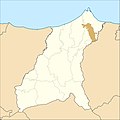 Comal kecamatan Pemalang Regency location map.jpg 1,250 × 1,250; 236 KB
-
 Indonesia Pemalang Regency location map.svg 1,250 × 1,250; 978 KB
-
 Locator kabupaten pemalang.png 232 × 149; 4 KB
-
 Moga kecamatan Pemalang Regency location map.jpg 1,250 × 1,250; 235 KB
-
 Pemalang kecamatan Pemalang Regency location map.jpg 1,250 × 1,250; 237 KB
-
 Peta Google Desa Majalangu.jpg 1,032 × 555; 44 KB
-
 Petarukan kecamatan Pemalang Regency location map.jpg 1,250 × 1,250; 237 KB
-
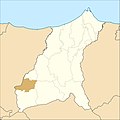
 Pulosari kecamatan Pemalang Regency location map.jpg 1,250 × 1,250; 235 KB
-
 Randudongkal kecamatan Pemalang Regency location map.jpg 1,250 × 1,250; 238 KB
-
 Taman kecamatan Pemalang Regency location map.jpg 1,250 × 1,250; 237 KB
-
 Ulujami kecamatan Pemalang Regency location map.jpg 1,250 × 1,250; 235 KB
-
 Warungpring kecamatan Pemalang Regency location map.jpg 1,250 × 1,250; 234 KB
-
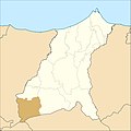
 Watukumpul kecamatan Pemalang Regency location map.jpg 1,250 × 1,250; 238 KB


