File:Varanasi locator.png
Jump to navigation
Jump to search

Size of this preview: 562 × 599 pixels. Other resolutions: 225 × 240 pixels | 450 × 480 pixels | 721 × 768 pixels | 961 × 1,024 pixels | 1,793 × 1,911 pixels.
Original file (1,793 × 1,911 pixels, file size: 336 KB, MIME type: image/png)
Captions
Captions
Add a one-line explanation of what this file represents
Summary
[edit]
| Description |
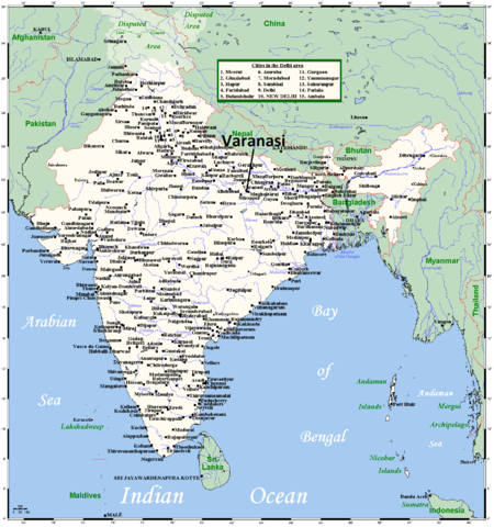
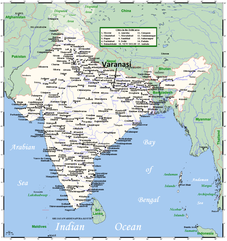
English: A map showing India's cities and main towns.
I have endeavoured to include every city in India whose population is 100,000 or more. If you spot an oversight, leave a message on my talk page and I'll see if I can do anything about it. |
| Date | 7 August 2008 (original upload date) |
| Source | This map's source is here, with the uploader's modifications, and the GMT homepage says that the tools are released under the GNU General Public License. |
| Author | Kelisi at English Wikipedia, Varanasi locator added by Dr. Blofeld |
Licensing
[edit]
Kelisi at the English-language Wikipedia, the copyright holder of this work, hereby publishes it under the following license:
| This file is licensed under the Creative Commons Attribution-Share Alike 3.0 Unported license. Subject to disclaimers. | ||
| Attribution: Kelisi at the English-language Wikipedia | ||
| ||
| This licensing tag was added to this file as part of the GFDL licensing update. |

|
Permission is granted to copy, distribute and/or modify this document under the terms of the GNU Free Documentation License, Version 1.2 or any later version published by the Free Software Foundation; with no Invariant Sections, no Front-Cover Texts, and no Back-Cover Texts. A copy of the license is included in the section entitled GNU Free Documentation License. Subject to disclaimers. |
Original upload log
[edit]
Transferred from en.wikipedia to Commons by Dharmadhyaksha using CommonsHelper.
The original description page was here. All following user names refer to en.wikipedia.
- 2009-05-20 12:15 ESkog 1793×1911× (214652 bytes) Reverted to version as of 23:55, 7 August 2008 (vandalism)
- 2009-05-20 11:52 Shalabhmaheshwary 1793×1911× (277217 bytes)
- 2008-08-07 23:55 Kelisi 1793×1911× (214652 bytes) A map showing India's cities and main towns. This map's source is [http://www.aquarius.ifm-geomar.de/ here], with the uploader's modifications, and the [http://gmt.soest.hawaii.edu/ GMT homepage] says that the tools are released under the GN
File history
Click on a date/time to view the file as it appeared at that time.
| Date/Time | Thumbnail | Dimensions | User | Comment | |
|---|---|---|---|---|---|
| current | 19:48, 30 October 2012 | | 1,793 × 1,911 (336 KB) | Blofeld Dr. (talk | contribs) | {{Information |Description ={{en|1=g}} |Source =g |Author =g |Date =g |Permission = |other_versions = }} |
You cannot overwrite this file.
File usage on Commons
There are no pages that use this file.
File usage on other wikis
The following other wikis use this file: