Category:Locator maps of cities in India
Jump to navigation
Jump to search
Subcategories
This category has the following 5 subcategories, out of 5 total.
Media in category "Locator maps of cities in India"
The following 67 files are in this category, out of 67 total.
-
 Bhopal in India.png 748 × 796; 40 KB
-
 Bhubaneswar in India.png 747 × 798; 37 KB
-
 BombayKaart.PNG 1,165 × 1,415; 320 KB
-
 Chennai in India.png 740 × 789; 37 KB
-
 Cochin in India.png 744 × 790; 36 KB
-
 Map darjiling.png 400 × 447; 25 KB
-
 Dhanbad2.png 200 × 231; 20 KB
-
 India Calcutta-Kolkata 2001.png 653 × 350; 41 KB
-
 India central universities edited.png 514 × 600; 62 KB
-
 India map mod.png 324 × 351; 17 KB
-
 India Map.gif 327 × 351; 17 KB
-
 India mapa.png 330 × 355; 15 KB
-
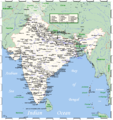
 India Top 10 Biggest Cities.png 803 × 933; 192 KB
-
 India-CIA WFB Map (2004).png 327 × 351; 16 KB
-
 India-CIA WFB Map.png 329 × 353; 24 KB
-
 India-Kolkata-locator-map.PNG 514 × 600; 74 KB
-
 India-locator-raulibandha.png 514 × 600; 60 KB
-
 IndiaCndgh.png 300 × 347; 30 KB
-
 IndiaEveryCityOMC.png 1,793 × 1,911; 286 KB
-
 IndiaEveryCityOMCdefinitive.png 1,793 × 1,911; 286 KB
-
 IndiaMap (renamed cities).png 474 × 547; 210 KB
-
 Indiamap-mo.JPG 322 × 346; 29 KB
-
 Indiamap.gif 329 × 353; 25 KB
-
 IndiaMap.png 474 × 547; 182 KB
-
 IndiaSurat.PNG 180 × 219; 23 KB
-
 Jaynagar Locator Map.jpg 3,000 × 4,000; 506 KB
-
 Kozhikode locator.png 239 × 290; 32 KB
-
 Loc-sarnath.png 99 × 102; 1 KB
-
 Location map of Surat India.jpg 269 × 282; 54 KB
-
 Location of Kochi Kerala.png 251 × 420; 9 KB
-
 Location of Kollam Kerala.png 251 × 420; 9 KB
-
 Location of Kottayam Kerala.png 251 × 420; 9 KB
-
 Location of Kozhikode Kerala.png 251 × 420; 9 KB
-
 Location of Palakkad Kerala.png 251 × 420; 9 KB
-
 Location of Pathanamthitta Kerala.png 251 × 420; 9 KB
-
 Location of Thrissur Kerala.png 251 × 420; 9 KB
-
 LocationChennai.png 300 × 346; 20 KB
-
 LocationDharamsala.png 626 × 706; 68 KB
-
 Locationgangtok.png 300 × 365; 23 KB
-
 LocationSrinagar.png 474 × 547; 175 KB
-
 Locationsuntemple.JPG 556 × 543; 22 KB
-
 Malappuram map1.GIF 580 × 705; 84 KB
-
 Map India Ahmedabad.png 330 × 355; 21 KB
-
 Map India Bhopal.png 330 × 355; 20 KB
-
 Map India Mathura.jpg 330 × 355; 52 KB
-
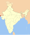
 Map of india position of Agartala highlighted.png 327 × 351; 45 KB
-
 Map of india position of Allahabad highlighted.png 327 × 351; 53 KB
-
 Map of india with mubai.jpg 330 × 355; 126 KB
-
 Mapa de la India.png 557 × 542; 128 KB
-
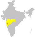
 Maru Pradesh.jpg 3,464 × 3,464; 825 KB
-
 Mumbai in India.png 743 × 786; 38 KB
-
 Mumbai locator map.png 239 × 280; 23 KB
-
 Overzichtskaart Chandigarh.PNG 1,165 × 1,415; 318 KB
-
 Overzichtskaart Lucknow.PNG 1,165 × 1,415; 319 KB
-
 Political Map of India with terrain.png 2,000 × 2,063; 3.22 MB
-
 Port Blair in India.png 745 × 786; 35 KB
-
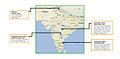 Project RISHI Locations.jpg 1,920 × 950; 726 KB
-
 Pune in India.png 748 × 786; 38 KB
-
 Sir-Creek-locator.svg 1,486 × 1,734; 421 KB
-
 Tf in india.png 1,299 × 1,443; 437 KB
-
 Thanjavur in India.png 400 × 447; 31 KB
-
 The mints of the Republic of India.png 624 × 704; 49 KB
-
 Twelve-jyotirlingas-map.jpg 1,710 × 1,733; 132 KB
-
 Uttar Pradesh Binauli locator map.jpg 572 × 599; 50 KB
-
 Varanasi locator.png 1,793 × 1,911; 336 KB
-
 WikiprojectIndiacities agra.gif 400 × 447; 29 KB
-
 WikiprojectIndiacities puri.png 400 × 447; 31 KB


.png)


.png)


