File:Upper Canada. From "Tanner's Universal Atlas". (IA bp 3759).pdf
Jump to navigation
Jump to search

Size of this JPG preview of this PDF file: 752 × 600 pixels. Other resolutions: 301 × 240 pixels | 602 × 480 pixels | 963 × 768 pixels | 1,280 × 1,021 pixels | 2,310 × 1,843 pixels.
Original file (2,310 × 1,843 pixels, file size: 1.57 MB, MIME type: application/pdf)
Captions
Captions
Add a one-line explanation of what this file represents
Summary
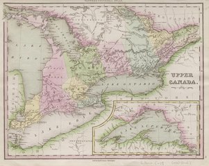
[edit]| Upper Canada. From "Tanner's Universal Atlas".
( |
|
|---|---|
| Title |
Upper Canada. From "Tanner's Universal Atlas". |
| Description |
Inset of Lake Superior. Subjects: Ontario--Physical sciences |
| Language | English |
| Publication date | [1836] |
| Current location |
IA Collections: wcw_gale; wcw; university_of_alberta_libraries; toronto |
| Accession number |
bp_3759 |
| Notes | Scale: Ca. 1:2,000,000. |
| Source | |
Licensing
[edit]|
This work is in the public domain in its country of origin and other countries and areas where the copyright term is the author's life plus 70 years or fewer. | |
| This file has been identified as being free of known restrictions under copyright law, including all related and neighboring rights. | |
File history
Click on a date/time to view the file as it appeared at that time.
| Date/Time | Thumbnail | Dimensions | User | Comment | |
|---|---|---|---|---|---|
| current | 13:15, 27 August 2021 |  | 2,310 × 1,843 (1.57 MB) | Fæ (talk | contribs) | IA Query "collection:(wcw) date:[1000 TO 1899]" bp_3759 Category:William C. Wonders Map Collection (COM:IA books#query) (1836 #343) |
You cannot overwrite this file.
File usage on Commons
The following page uses this file: