File:United States Virgin Islands in its region (zoom).svg
Jump to navigation
Jump to search

Size of this PNG preview of this SVG file: 351 × 197 pixels. Other resolutions: 320 × 180 pixels | 640 × 359 pixels | 1,024 × 575 pixels | 1,280 × 718 pixels | 2,560 × 1,437 pixels.
Original file (SVG file, nominally 351 × 197 pixels, file size: 4.37 MB)
Captions
Captions
Add a one-line explanation of what this file represents
Summary
[edit].svg&action=edit§ion=1)
| Description |
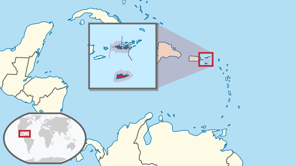
English: Location of XY (see filename) in the region. |
| Date | |
| Source |
This file was derived from: |
| Author |
Licensing
[edit].svg&action=edit§ion=2)
This file is licensed under the Creative Commons Attribution-Share Alike 3.0 Unported license.
- You are free:
- to share – to copy, distribute and transmit the work
- to remix – to adapt the work
- Under the following conditions:
- attribution – You must give appropriate credit, provide a link to the license, and indicate if changes were made. You may do so in any reasonable manner, but not in any way that suggests the licensor endorses you or your use.
- share alike – If you remix, transform, or build upon the material, you must distribute your contributions under the same or compatible license as the original.
File history
Click on a date/time to view the file as it appeared at that time.
| Date/Time | Thumbnail | Dimensions | User | Comment | |
|---|---|---|---|---|---|
| current | 22:16, 26 August 2019 | | 351 × 197 (4.37 MB) | Aplaice (talk | contribs) | User created page with UploadWizard |
You cannot overwrite this file.
File usage on Commons
There are no pages that use this file.
File usage on other wikis
The following other wikis use this file:
- Usage on en.wikipedia.org
- Hassel Island, U.S. Virgin Islands
- Cruz Bay, U.S. Virgin Islands
- Salt River Bay National Historical Park and Ecological Preserve
- Christiansted National Historic Site
- Coral Bay, U.S. Virgin Islands
- Blackbeard's Castle
- Sandy Point National Wildlife Refuge
- Fort Christian
- Hams Bluff Light
- St. Thomas Synagogue
- Fort Frederik
- Frederiksted Historic District
- Catherineberg Sugar Mill Ruins
- Cinnamon Bay Plantation
- Annaberg Historic District
- Mary Point Estate
- Reef Bay Sugar Factory Historic District
- Green Kay, U.S. Virgin Islands
- Sion Hill, U.S. Virgin Islands
- Friedensfeld Midlands Moravian Church and Manse
- New Herrnhut Moravian Church
- Estate Little Princess
- Reef Bay Trail petroglyphs
- Danish West India and Guinea Company Warehouse
- Diamond School
- Charlotte Amalie Historic District
- Bordeaux (St. Thomas, U.S. Virgin Islands)
- Hamburg-America Shipping Line Administrative Offices
- Friedensthal Mission
- Christiansted Historic District
- Fortsberg
- Bethlehem Middle Works Historic District
- Coakley Bay Estate
- Estate Judith's Fancy
- Estate Saint George Historic District
- Estate Carolina Sugar Plantation
- Lind Point Fort
- Estate Hafensight
- Estate Grove Place
- Whim (United States Virgin Islands)
- St. John's Episcopal Church (Christiansted, U.S. Virgin Islands)
- Tutu Plantation House
- Mafolie Great House
- Estate Brewers Bay
- Estate Hogansborg
- Brown Bay, U.S. Virgin Islands
- Liever Marches Bay
- Richmond Prison Detention and Workhouse
- L'Esperance Historic District
- Dennis Bay Historic District
View more global usage of this file.
.svg)
.svg&oldid=678968772)