File:United States Congressional Districts in Michigan, 1993 – 2002.tif
Jump to navigation
Jump to search

Size of this PNG preview of this TIF file: 800 × 504 pixels. Other resolutions: 320 × 202 pixels | 640 × 404 pixels | 1,024 × 646 pixels | 1,280 × 807 pixels | 2,560 × 1,614 pixels.
Original file (2,560 × 1,614 pixels, file size: 4.43 MB, MIME type: image/tiff)
Captions
Captions
Add a one-line explanation of what this file represents
Summary
[edit]| Description |
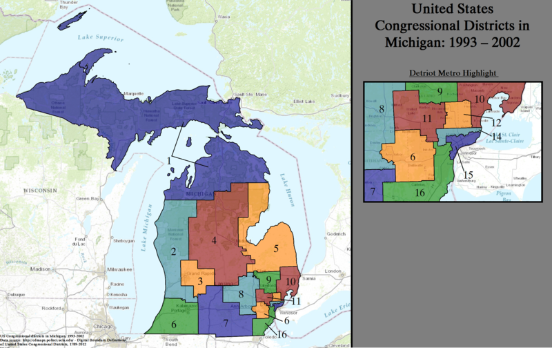
English: Statewide boundaries map for United States congressional districts in Michigan, 1993 – 2002. |
| Date | |
| Source | US Department of the Interior, public data retrieved and rendered from archive at: http://cdmaps.polisci.ucla.edu on October 18, 2014. |
| Author | Authors: 1) All GIS data presented in this project was originally collected and published by the United States Department of the Interior. 2) US district GIS shapefile data created in association with the UCLA by Jeffrey B. Lewis, Brandon DeVine, Lincoln Pitcher, and Kenneth C. Martis. (2013) Digital Boundary Definitions of United States Congressional Districts, 1789-2012. 3) Data was rendered using ArcGIS® software by Esri. 4) File developed for use on Wikipedia and elsewhere by 7partparadigm. |
Licensing
[edit]| This image or media file contains material based on a work of a United States Department of the Interior employee, created as part of that person's official duties. As a work of the U.S. federal government, such work is in the public domain in the United States. See the Department of the Interior copyright policy for more information. |  |
File history
Click on a date/time to view the file as it appeared at that time.
| Date/Time | Thumbnail | Dimensions | User | Comment | |
|---|---|---|---|---|---|
| current | 02:36, 4 June 2015 |  | 2,560 × 1,614 (4.43 MB) | 7partparadigm (talk | contribs) | User created page with UploadWizard |
You cannot overwrite this file.
File usage on Commons
The following page uses this file:
File usage on other wikis
The following other wikis use this file:
- Usage on en.wikipedia.org
- Usage on it.wikipedia.org