File:US 50 (NV) map.svg
Jump to navigation
Jump to search

Size of this PNG preview of this SVG file: 558 × 600 pixels. Other resolutions: 223 × 240 pixels | 446 × 480 pixels | 714 × 768 pixels | 953 × 1,024 pixels | 1,905 × 2,048 pixels.
Original file (SVG file, nominally 800 × 860 pixels, file size: 350 KB)
Captions
Captions
Add a one-line explanation of what this file represents
Summary
[edit]_map.svg&action=edit§ion=1)
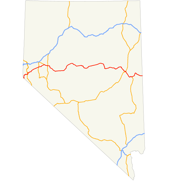
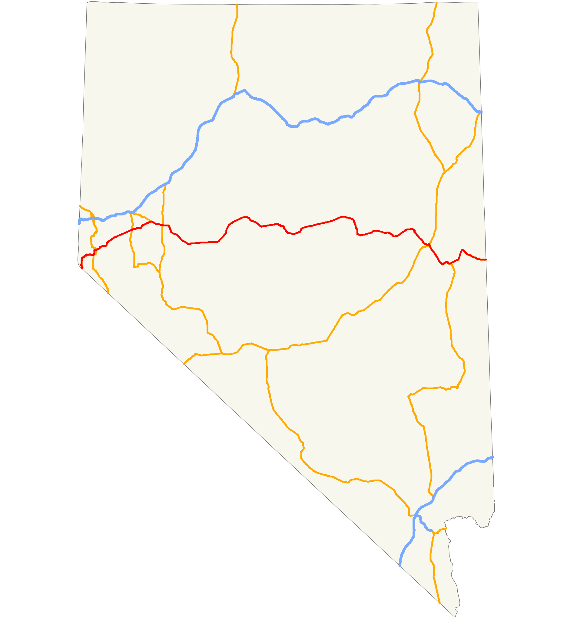
| Description | Map of US Route 50 in Nevada— from California on west, across Nevada to Utah on the east. |
| Date | |
| Source | Self made from GIS data available at [1][dead link] |
| Author | 25or6to4 |
Licensing
[edit]_map.svg&action=edit§ion=2)
I, the copyright holder of this work, hereby publish it under the following licenses:
This file is licensed under the Creative Commons Attribution-Share Alike 4.0 International, 3.0 Unported, 2.5 Generic, 2.0 Generic and 1.0 Generic license.
- You are free:
- to share – to copy, distribute and transmit the work
- to remix – to adapt the work
- Under the following conditions:
- attribution – You must give appropriate credit, provide a link to the license, and indicate if changes were made. You may do so in any reasonable manner, but not in any way that suggests the licensor endorses you or your use.
- share alike – If you remix, transform, or build upon the material, you must distribute your contributions under the same or compatible license as the original.

|
Permission is granted to copy, distribute and/or modify this document under the terms of the GNU Free Documentation License, Version 1.2 or any later version published by the Free Software Foundation; with no Invariant Sections, no Front-Cover Texts, and no Back-Cover Texts. A copy of the license is included in the section entitled GNU Free Documentation License. |
You may select the license of your choice.
File history
Click on a date/time to view the file as it appeared at that time.
| Date/Time | Thumbnail | Dimensions | User | Comment | |
|---|---|---|---|---|---|
| current | 04:45, 27 March 2008 | | 800 × 860 (350 KB) | Moabdave (talk | contribs) | == Summary == {{Information |Description={{en|Map of w:U.S. Route 50 in Nevada}} |Source=self-made |Date= |Author= 25or6to4 |Permission= |other_versions= }} |
| 12:49, 26 March 2008 |  | 1,475 × 860 (337 KB) | 25or6to4 (talk | contribs) | rotated | |
| 19:13, 22 March 2008 |  | 537 × 817 (306 KB) | Scott5114 (talk | contribs) | Crop and remove some artifacts | |
| 11:53, 20 March 2008 |  | 1,475 × 860 (308 KB) | 25or6to4 (talk | contribs) | {{Information |Description=Map of US Route 50 in Nevada |Source=self-made |Date= |Author= 25or6to4 |Permission= |other_versions= }} |
You cannot overwrite this file.
File usage on Commons
The following page uses this file:
File usage on other wikis
The following other wikis use this file:
- Usage on en.wikipedia.org
- Usage on es.wikipedia.org
- Usage on uk.wikipedia.org
- Usage on www.wikidata.org
_map.svg&oldid=447298410)