File:USGS deep wells 1997.png
Jump to navigation
Jump to search
Size of this preview: 800 × 480 pixels. Other resolutions: 320 × 192 pixels | 1,108 × 665 pixels.
Original file (1,108 × 665 pixels, file size: 276 KB, MIME type: image/png)
Captions
Captions
Add a one-line explanation of what this file represents
Summary
[edit]
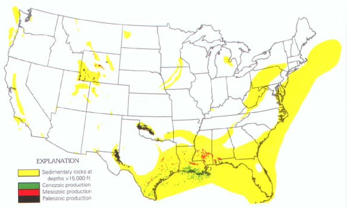
| Description | Map of the United States showing wells that have produced hydrocarbons from depths greater than 15,000 feet (4,572 m), grouped by geologic age of the producing formation. |
| Date | |
| Source | USGS bulletin 2146: Geologic Controls of Deep Natural Gas Resources in the United States http://pubs.usgs.gov/bul/b2146/b2146.html |
| Author | United States Geological Survey |
Licensing
[edit]
This image is in the public domain in the United States because it only contains materials that originally came from the United States Geological Survey, an agency of the United States Department of the Interior. For more information, see the official USGS copyright policy.
|
File history
Click on a date/time to view the file as it appeared at that time.
| Date/Time | Thumbnail | Dimensions | User | Comment | |
|---|---|---|---|---|---|
| current | 05:49, 5 October 2006 | | 1,108 × 665 (276 KB) | SEWilco (talk | contribs) | {{Information |Description=Map of the United States showing wells that have produced hydrocarbons from depths greater than 15,000 feet (4,572 m), grouped by geologic age of the producing formation. |Source=USGS bulletin 2146: ''Geologic Controls of Deep N |
You cannot overwrite this file.
File usage on Commons
There are no pages that use this file.