File:TyroneShape.gif
Jump to navigation
Jump to search
No higher resolution available.
TyroneShape.gif (532 × 405 pixels, file size: 10 KB, MIME type: image/gif)
Captions
Captions
Add a one-line explanation of what this file represents
Summary
[edit]
| Description |
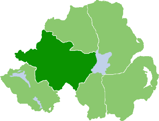
English: Outline map of County Tyrone, Northern Ireland |
| Date | |
| Source | Own work (Original text: own work, based on :Image:NIShape.gif) |
| Author | User:Grutness, based on work of User:Setanta747 / Grutness at English Wikipedia |
Licensing
[edit]
| This work has been released into the public domain by its author, Grutness at English Wikipedia. This applies worldwide. In some countries this may not be legally possible; if so: Grutness grants anyone the right to use this work for any purpose, without any conditions, unless such conditions are required by law. |
Original upload log
[edit]
Transferred from en.wikipedia to Commons by Quadell using CommonsHelper.
The original description page was here. All following user names refer to en.wikipedia.
- 2008-07-07 07:59 Grutness 532×405× (10626 bytes) {{Information |Description=Outline map of County Tyrone, Northern Ireland |Source=own work, based on [[:Image:NIShape.gif]] |Date=7/7/08 |Author=[[User:Grutness]], based on work of [[User:Setanta747]] |Permission={{PD-self}} |other_versions= }}
File history
Click on a date/time to view the file as it appeared at that time.
| Date/Time | Thumbnail | Dimensions | User | Comment | |
|---|---|---|---|---|---|
| current | 13:30, 25 July 2013 | | 532 × 405 (10 KB) | File Upload Bot (Magnus Manske) (talk | contribs) | Transfered from en.wikipedia by User:Quadell using CommonsHelper |
You cannot overwrite this file.
File usage on Commons
There are no pages that use this file.
File usage on other wikis
The following other wikis use this file:
- Usage on en.wikipedia.org
- Drum Manor Forest Park
- Sperrins
- Tullyhogue
- Landahaussy
- Loughmacrory
- Mountfield, County Tyrone
- Tullywiggan
- Blackwatertown
- Eglish
- Moylagh, County Tyrone
- Clanabogan
- Dooish
- Drumnakilly
- Edenderry, County Tyrone
- Gillygooly
- Gortaclare
- Rousky
- Cranagh
- Douglas Bridge
- Erganagh
- Garvetagh
- Glenmornan
- Magheramason
- Spamount
- Mountains of Pomeroy
- Brackaville
- Galbally, County Tyrone
- Evish
- Lissan
- Granville, County Tyrone
- Killyman
- Tamnamore
- Liscloon
- Cavanakeeran
- Garvaghey
- River Drumragh
- Template:Tyrone-geo-stub
- Craigballyharky
- Listamlet
- County of Upper Tyrone
- County of Nether Tyrone
- Mullaghcarn
- Killyclogher
- A505 road (Northern Ireland)
- Kildress
- Altishane
- Clonoe
- Elagh Fault
- Laghy Fault
- Omagh Fault
View more global usage of this file.