File:Trimontium viewing tower - geograph.org.uk - 585344.jpg
Jump to navigation
Jump to search
No higher resolution available.
Trimontium_viewing_tower_-_geograph.org.uk_-_585344.jpg (640 × 480 pixels, file size: 121 KB, MIME type: image/jpeg)
Captions
Captions
Add a one-line explanation of what this file represents
Summary
[edit]
| Description |
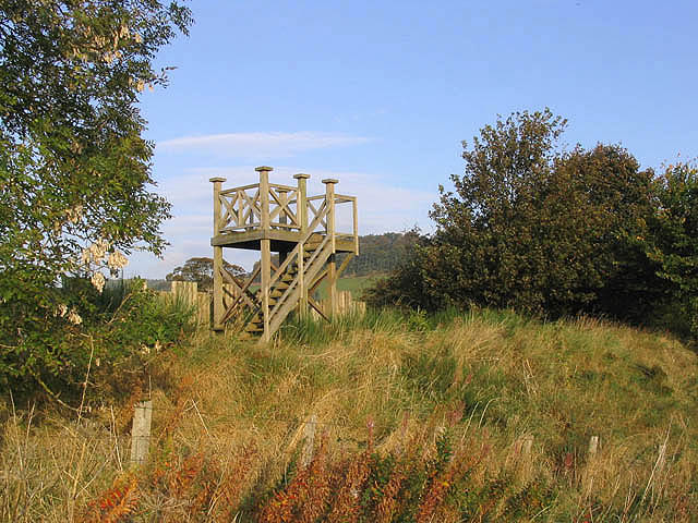
English: Trimontium viewing tower A viewing platform erected by the Trimontium Trust and overlooking farmland on the site of the Roman fort and camps of Trimontium. The platform stands on the route of the former Berwickshire Railway Line. The remains of the Roman buildings are hidden under the soil but there are several information boards around the site to help visitors interpret the area. |
| Date | |
| Source | From geograph.org.uk |
| Author | Walter Baxter |
| Attribution (required by the license) | Walter Baxter / Trimontium viewing tower / |
| Camera location | | View this and other nearby images on: OpenStreetMap |
|---|
_heading:315.00&language=en)
| Object location | | View this and other nearby images on: OpenStreetMap |
|---|
_heading:315.00&language=en)
Licensing
[edit]

|
This image was taken from the Geograph project collection. See this photograph's page on the Geograph website for the photographer's contact details. The copyright on this image is owned by Walter Baxter and is licensed for reuse under the Creative Commons Attribution-ShareAlike 2.0 license.
|
This file is licensed under the Creative Commons Attribution-Share Alike 2.0 Generic license.
Attribution: Walter Baxter
- You are free:
- to share – to copy, distribute and transmit the work
- to remix – to adapt the work
- Under the following conditions:
- attribution – You must give appropriate credit, provide a link to the license, and indicate if changes were made. You may do so in any reasonable manner, but not in any way that suggests the licensor endorses you or your use.
- share alike – If you remix, transform, or build upon the material, you must distribute your contributions under the same or compatible license as the original.
File history
Click on a date/time to view the file as it appeared at that time.
| Date/Time | Thumbnail | Dimensions | User | Comment | |
|---|---|---|---|---|---|
| current | 15:45, 6 February 2011 | | 640 × 480 (121 KB) | GeographBot (talk | contribs) | == {{int:filedesc}} == {{Information |description={{en|1=Trimontium viewing tower A viewing platform erected by the Trimontium Trust and overlooking farmland on the site of the Roman fort and camps of Trimontium. The platform stands on the route of the fo |
You cannot overwrite this file.
File usage on Commons
There are no pages that use this file.