Category:Files with coordinates missing SDC location of creation (55° N, 3° W)
Jump to navigation
Jump to search
Media in category "Files with coordinates missing SDC location of creation (55° N, 3° W)"
The following 200 files are in this category, out of 15,746 total.
(previous page) (next page)-
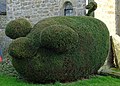 " Green Pig" - geograph.org.uk - 245244.jpg 640 × 457; 113 KB
-
 "Castle" in Ridsdale - geograph.org.uk - 459978.jpg 640 × 480; 85 KB
-
 "Farglow" with Inner Dodd behind - geograph.org.uk - 549406.jpg 640 × 480; 383 KB
-

-
 "Hova bova" - Flickr - S. Rae.jpg 2,624 × 1,568; 1.58 MB
-
 "Larsen" Trap on Weetfoot Bog - geograph.org.uk - 770887.jpg 640 × 480; 67 KB
-
 "Mirage", Kielder Forest - geograph.org.uk - 604993.jpg 480 × 640; 191 KB
-
 "Missing " wood - geograph.org.uk - 1024220.jpg 640 × 359; 77 KB
-
 "None" bridge over Hunter's Burn - geograph.org.uk - 358143.jpg 640 × 480; 126 KB
-
 "Our Vision" - geograph.org.uk - 352886.jpg 640 × 480; 198 KB
-
 "Primsidehill - geograph.org.uk - 91774.jpg 640 × 480; 135 KB
-
 "Scenic lay-by" near Wall - geograph.org.uk - 1018853.jpg 640 × 480; 100 KB
-
 "The Glory of Clovenfords" - geograph.org.uk - 1276810.jpg 640 × 433; 155 KB
-
 "The measured mile" - geograph.org.uk - 146318.jpg 480 × 640; 219 KB
-
 "The path less trodden" - geograph.org.uk - 103071.jpg 640 × 480; 267 KB
-
 "Triumph" No.5 Potato Digger - geograph.org.uk - 1343964.jpg 640 × 480; 155 KB
-
 "Viewpoint" on the north shore - geograph.org.uk - 1362081.jpg 640 × 480; 94 KB
-
 'Aerial archaeology' from West Hill - geograph.org.uk - 1739443.jpg 1,024 × 769; 376 KB
-
 'Back' entrance to Boggs Farm - geograph.org.uk - 1291431.jpg 640 × 400; 86 KB
-
 'Cairn' on Hairny Law - geograph.org.uk - 1007552.jpg 640 × 480; 138 KB
-
 'Cherrytrees' Junction - geograph.org.uk - 91770.jpg 640 × 480; 106 KB
-

-
 'Crookedshaws' Farm - geograph.org.uk - 91784.jpg 640 × 480; 163 KB
-
 'I've got a lovely bunch of coconuts' - geograph.org.uk - 1744409.jpg 1,024 × 768; 106 KB
-
 'Island' on Kielder Water - geograph.org.uk - 576716.jpg 640 × 423; 82 KB
-

-
 'Low tide' at Kielder Reservoir - geograph.org.uk - 597509.jpg 640 × 480; 84 KB
-
 'Per porta ad astra' - geograph.org.uk - 895512.jpg 640 × 480; 96 KB
-

-
 'Ridley Common' Stone Circle - geograph.org.uk - 258861.jpg 640 × 427; 82 KB
-
 'Rose's Bower' - geograph.org.uk - 261114.jpg 640 × 457; 70 KB
-
 'Shoe Tree' near Knowesgate - geograph.org.uk - 596614.jpg 640 × 480; 103 KB
-
 (All that remains of) Milecastle 33 - geograph.org.uk - 592666.jpg 640 × 480; 101 KB
-

-
 (Former Home Farm And Steading), Harestanes Visitors' Centre, Monteviot Estate 01.jpg 4,608 × 3,456; 5.07 MB
-
 (Former Home Farm And Steading), Harestanes Visitors' Centre, Monteviot Estate 02.jpg 4,608 × 3,456; 5.8 MB
-
 (Former Home Farm And Steading), Harestanes Visitors' Centre, Monteviot Estate 03.jpg 4,608 × 3,456; 4.77 MB
-
 (Former Unionist Club), 2024 Reivers Pool Hall, 69 High Street.jpg 6,000 × 8,000; 8.15 MB
-
 (Former Unionist Club), Reivers Pool Hall, 69 High Street.jpg 6,000 × 8,000; 9.47 MB
-
 (Part of) Blue Bog (2) - geograph.org.uk - 1405689.jpg 640 × 480; 63 KB
-
 (Part of) Blue Bog - geograph.org.uk - 1405366.jpg 640 × 480; 60 KB
-

-
-
-

-

-

-
-
-
-

-

-
 (The east end of) Colwell (2) - geograph.org.uk - 1052349.jpg 640 × 359; 64 KB
-
 (The east end of) Colwell (3) - geograph.org.uk - 1052352.jpg 640 × 480; 88 KB
-
 (The east end of) Colwell - geograph.org.uk - 1052339.jpg 640 × 480; 80 KB
-

-

-

-

-
-
-

-

-

-

-

-
-
-

-

-
-

-

-
-

-

-

-
-

-

-

-

-

-

-

-

-
-

-

-

-
 (The site of) Milecastle 25 (Codlawhill) - geograph.org.uk - 1216637.jpg 640 × 480; 128 KB
-

-

-
 (The site of) Milecastle 32 - geograph.org.uk - 592657.jpg 640 × 480; 107 KB
-
 (The site of) Milecastle 34 - geograph.org.uk - 592694.jpg 640 × 427; 98 KB
-
 (The site of) Roman Portgate - geograph.org.uk - 1234715.jpg 640 × 480; 98 KB
-

-
 (The site of) Turret 27a - geograph.org.uk - 1057787.jpg 640 × 480; 127 KB
-

-
-
 (The site of) Turret 29b - geograph.org.uk - 1129255.jpg 640 × 480; 94 KB
-

-

-
-
 (The site of) Turret 33a - geograph.org.uk - 592676.jpg 640 × 480; 100 KB
-
 (Very) minor road near Bellingham - geograph.org.uk - 493754.jpg 640 × 480; 79 KB
-
 02689 Canonbie United Parish Church, Canonbie 001.jpg 5,184 × 3,888; 4.84 MB
-
 02689 Canonbie United Parish Church, Canonbie 002.jpg 4,860 × 6,480; 5.18 MB
-
 02689 Canonbie United Parish Church, Canonbie 003.jpg 4,860 × 6,480; 5.63 MB
-
 02689 Canonbie United Parish Church, Canonbie 004.jpg 4,860 × 6,480; 4.99 MB
-
 02689 Canonbie United Parish Church, Canonbie 005.jpg 4,860 × 6,480; 6.42 MB
-
 02689 Canonbie United Parish Church, Canonbie 006.jpg 4,860 × 6,480; 4.53 MB
-
 02689 Canonbie United Parish Church, Canonbie 007.jpg 4,860 × 6,480; 5.91 MB
-
 02689 Canonbie United Parish Church, Canonbie 008.jpg 4,860 × 6,480; 5.58 MB
-
 02689 Canonbie United Parish Church, Canonbie 009.jpg 4,860 × 6,480; 5.28 MB
-
 02689 Canonbie United Parish Church, Canonbie 010.jpg 4,860 × 6,480; 5.58 MB
-
 02689 Canonbie United Parish Church, Canonbie 011.jpg 4,860 × 6,480; 4.84 MB
-
 02689 Canonbie United Parish Church, Canonbie 012.jpg 5,184 × 3,888; 6.03 MB
-
 02689 Canonbie United Parish Church, Canonbie 013.jpg 4,860 × 6,480; 4.37 MB
-
 02689 Canonbie United Parish Church, Canonbie 014.jpg 5,184 × 3,888; 5.2 MB
-
 02689 Canonbie United Parish Church, Canonbie 015.jpg 5,184 × 3,888; 5.03 MB
-
 02689 Canonbie United Parish Church, Canonbie 016.jpg 5,184 × 3,888; 6.45 MB
-
 02689 Canonbie United Parish Church, Canonbie 017.jpg 5,184 × 3,888; 5.99 MB
-
 02689 Canonbie United Parish Church, Canonbie 018.jpg 2,336 × 1,736; 870 KB
-
 02689 Canonbie United Parish Church, Canonbie 019.jpg 2,336 × 1,736; 953 KB
-
 02689 Canonbie United Parish Church, Canonbie 020.jpg 2,336 × 1,736; 899 KB
-
 02689 Canonbie United Parish Church, Canonbie 021.jpg 2,336 × 1,736; 954 KB
-
 02689 Canonbie United Parish Church, Canonbie 022.jpg 2,336 × 1,736; 971 KB
-
 02836 Ruins Langholm Church of Scotland, Langholm 001.jpg 5,184 × 3,888; 5.47 MB
-
 02836 Ruins Langholm Church of Scotland, Langholm 002.jpg 5,184 × 3,888; 5.5 MB
-
 02836 Ruins Langholm Church of Scotland, Langholm 003.jpg 5,832 × 7,776; 8.28 MB
-
 02836 Ruins Langholm Church of Scotland, Langholm 004.jpg 5,184 × 3,888; 6.19 MB
-
 02836 Ruins Langholm Church of Scotland, Langholm 005.jpg 5,184 × 3,888; 6.91 MB
-
 02836 Ruins Langholm Church of Scotland, Langholm 006.jpg 5,832 × 7,776; 7.59 MB
-
 02836 Ruins Langholm Church of Scotland, Langholm 007.jpg 5,184 × 3,888; 7.83 MB
-
 02836 Ruins Langholm Church of Scotland, Langholm 008.jpg 5,184 × 3,888; 6.4 MB
-
 02836 Ruins Langholm Church of Scotland, Langholm 009.jpg 5,184 × 3,888; 6.45 MB
-
 02836 Ruins Langholm Church of Scotland, Langholm 010.jpg 5,184 × 3,888; 7.32 MB
-
 02836 Ruins Langholm Church of Scotland, Langholm 011.jpg 5,184 × 3,888; 6.93 MB
-
 03379 Former Evangelical Union Church, Langholm 001.jpg 5,184 × 3,888; 4.6 MB
-
 03379 Former Evangelical Union Church, Langholm 002.jpg 5,832 × 7,776; 7.25 MB
-
 03379 Former Evangelical Union Church, Langholm 003.jpg 5,832 × 7,776; 6.94 MB
-
 03379 Former Evangelical Union Church, Langholm 004.jpg 5,832 × 7,776; 5.83 MB
-
 03379 Former Evangelical Union Church, Langholm 005.jpg 5,184 × 3,888; 4.46 MB
-
 03379 Former Evangelical Union Church, Langholm 006.jpg 5,832 × 7,776; 6.55 MB
-
 03379 Former Evangelical Union Church, Langholm 007.jpg 5,832 × 7,776; 7.14 MB
-
 03379 Former Evangelical Union Church, Langholm 008.jpg 5,832 × 7,776; 5.66 MB
-
 03379 Former Evangelical Union Church, Langholm 009.jpg 5,184 × 3,888; 5 MB
-
 03379 Former Evangelical Union Church, Langholm 010.jpg 5,832 × 7,776; 6.57 MB
-
 04730 Ewes Church of Scotland & BG, Ewes 001.jpg 3,840 × 2,160; 5.08 MB
-
 04730 Ewes Church of Scotland & BG, Ewes 002.jpg 3,240 × 5,760; 4.63 MB
-
 04730 Ewes Church of Scotland & BG, Ewes 003.jpg 3,240 × 5,760; 3.5 MB
-
 04730 Ewes Church of Scotland & BG, Ewes 004.jpg 3,840 × 2,160; 5.4 MB
-
 04730 Ewes Church of Scotland & BG, Ewes 005.jpg 3,240 × 5,760; 3.86 MB
-
 04730 Ewes Church of Scotland & BG, Ewes 006.jpg 3,240 × 5,760; 3.92 MB
-
 04730 Ewes Church of Scotland & BG, Ewes 007.jpg 3,240 × 5,760; 4.4 MB
-
 04730 Ewes Church of Scotland & BG, Ewes 008.jpg 3,240 × 5,760; 3.69 MB
-
 04730 Ewes Church of Scotland & BG, Ewes 009.jpg 3,840 × 2,160; 5.17 MB
-
 04730 Ewes Church of Scotland & BG, Ewes 010.jpg 3,240 × 5,760; 4.84 MB
-
 04730 Ewes Church of Scotland & BG, Ewes 011.jpg 3,240 × 5,760; 4.42 MB
-
 04730 Ewes Church of Scotland & BG, Ewes 012.jpg 3,840 × 2,160; 5.13 MB
-
 04730 Ewes Church of Scotland & BG, Ewes 013.jpg 3,240 × 5,760; 4.6 MB
-
 04730 Ewes Church of Scotland & BG, Ewes 014.jpg 3,240 × 5,760; 4.91 MB
-
 04730 Ewes Church of Scotland & BG, Ewes 015.jpg 3,240 × 5,760; 3.03 MB
-
 04730 Ewes Church of Scotland & BG, Ewes 016.jpg 3,840 × 2,160; 5.02 MB
-
 055167 union bridge.jpg 1,600 × 1,200; 378 KB
-
 06941 Former St Francis' Roman Catholic Church, Langholm 001.jpg 5,184 × 3,888; 3.85 MB
-
 06941 Former St Francis' Roman Catholic Church, Langholm 002.jpg 5,832 × 7,776; 6.03 MB
-
 06941 Former St Francis' Roman Catholic Church, Langholm 003.jpg 5,832 × 7,776; 5.5 MB
-
 06941 Former St Francis' Roman Catholic Church, Langholm 004.jpg 5,832 × 7,776; 6.61 MB
-
 06941 Former St Francis' Roman Catholic Church, Langholm 005.jpg 5,832 × 7,776; 4.41 MB
-
 06941 Former St Francis' Roman Catholic Church, Langholm 006.jpg 5,184 × 3,888; 4.47 MB
-
 06941 Former St Francis' Roman Catholic Church, Langholm 007.jpg 5,832 × 7,776; 6.36 MB
-
 06941 Former St Francis' Roman Catholic Church, Langholm 008.jpg 5,832 × 7,776; 6.48 MB
-
 1 - 11 Abbey Bridge End 2023.jpg 8,000 × 6,000; 13.98 MB
-
 1 and 2, West View.jpg 8,000 × 6,000; 11.29 MB
-
 1 Bonjedward Cottages, Bonjedward House.jpg 4,608 × 3,456; 5.02 MB
-
 1 Bonjedward Cottages, Bonjedward.jpg 3,888 × 2,592; 3.18 MB
-
 1 High Street Jedburgh is a listed building.jpg 3,120 × 4,160; 3.92 MB
-
 1 Maxwellheugh Terrace, Kelso.jpg 3,648 × 2,736; 2.93 MB
-
 1 North Bridge Street 2024.jpg 6,000 × 8,000; 11.38 MB
-
 1 North Bridge Street inside.jpg 8,000 × 6,000; 8.83 MB
-
 1 North Street,Belhaven, Dunbar.jpg 1,920 × 1,280; 842 KB
-
 1 Queen Mary's buiildings Jedburgh.jpg 2,736 × 3,648; 2.81 MB
-
 1 Simon Square, Kelso now Empire in 2020 04.jpg 4,608 × 3,456; 4.62 MB
-
 1 Simon Square, Kelso now Empire in 2020.jpg 3,456 × 4,608; 4.15 MB
-
 1 Simon Square, Kelso now Empire shop.jpg 4,608 × 3,456; 4.43 MB
-
 1 Simon Square, Kelso side.jpg 3,456 × 4,608; 4.17 MB
-
 1 Smiths.jpg 2,736 × 4,864; 3.88 MB
-
 1 Upper nags head close.jpg 4,864 × 2,736; 3.75 MB
-
 1, 2 Old Bridge End on Festival day.jpg 8,000 × 6,000; 12.96 MB
-
 1, 2, 3, Duck Row from the A68.jpg 4,608 × 3,456; 4.3 MB
-
 1, Easter Ulston Cottages.jpg 2,592 × 3,888; 4.39 MB
-
 1, The Row, Longformacus - geograph.org.uk - 445568.jpg 480 × 640; 68 KB
-
 1-3 High Street, Hawick in rain showing shopfronts.jpg 3,888 × 2,592; 3.91 MB
-
 1-3 High Street, Hawick.jpg 4,608 × 3,456; 5.01 MB
-
 1-3, High Street cheviot.jpg 8,000 × 6,000; 12 MB
-
 10 East High Street, Lauder.jpg 8,000 × 6,000; 14.86 MB
-
 10 North Street, Belhaven, Dunbar.jpg 1,920 × 1,280; 1.2 MB
-
 10 Sandgate, Berwick-upon-Tweed (geograph 5800463).jpg 4,032 × 3,024; 2.54 MB


_Milecastle_33_-_geograph.org.uk_-_592666.jpg)
_St._Oswald%27s_Church_(from_Hadrian%27s_Wall_Path)_-_geograph.org.uk_-_1267542.jpg)
,_Harestanes_Visitors%27_Centre,_Monteviot_Estate_01.jpg)
,_Harestanes_Visitors%27_Centre,_Monteviot_Estate_02.jpg)
,_Harestanes_Visitors%27_Centre,_Monteviot_Estate_03.jpg)
,_2024_Reivers_Pool_Hall,_69_High_Street.jpg)
,_Reivers_Pool_Hall,_69_High_Street.jpg)
_Blue_Bog_(2)_-_geograph.org.uk_-_1405689.jpg)
_Blue_Bog_-_geograph.org.uk_-_1405366.jpg)
_Roman_Camp_south_of_Limestone_Corner_(10)_-_geograph.org.uk_-_1205991.jpg)
_Roman_Camp_south_of_Limestone_Corner_(2)_-_geograph.org.uk_-_1205947.jpg)
_Roman_Camp_south_of_Limestone_Corner_(3)_-_geograph.org.uk_-_1205969.jpg)
_Roman_Camp_south_of_Limestone_Corner_(4)_-_geograph.org.uk_-_1205974.jpg)
_Roman_Camp_south_of_Limestone_Corner_(5)_-_geograph.org.uk_-_1205975.jpg)
_Roman_Camp_south_of_Limestone_Corner_(6)_-_geograph.org.uk_-_1205978.jpg)
_Roman_Camp_south_of_Limestone_Corner_(7)_-_geograph.org.uk_-_1205983.jpg)
_Roman_Camp_south_of_Limestone_Corner_(8)_-_geograph.org.uk_-_1205986.jpg)
_Roman_Camp_south_of_Limestone_Corner_(9)_-_geograph.org.uk_-_1205989.jpg)
_Roman_Camp_south_of_Limestone_Corner_-_geograph.org.uk_-_1205934.jpg)
_track_south_of_the_minor_road_west_of_Portgate_Farm_-_geograph.org.uk_-_1308680.jpg)
_Colwell_(2)_-_geograph.org.uk_-_1052349.jpg)
_Colwell_(3)_-_geograph.org.uk_-_1052352.jpg)
_Colwell_-_geograph.org.uk_-_1052339.jpg)
_Hadrian%27s_Wall_and_(the_site_of)_Turret_29b_-_geograph.org.uk_-_1145018.jpg)
_Hadrian%27s_Wall_and_the_north_defensive_ditch_below_the_trig_point_at_Limestone_Corner_-_geograph.org.uk_-_1145097.jpg)
_Hadrian%27s_Wall_and_the_north_defensive_ditch_near_Planetrees_(2)_-_geograph.org.uk_-_1267530.jpg)
_Hadrian%27s_Wall_and_the_north_defensive_ditch_near_Planetrees_-_geograph.org.uk_-_1267522.jpg)
_Hadrian%27s_Wall_and_the_trig_point_east_of_Limestone_Corner_-_geograph.org.uk_-_1145052.jpg)
_Hadrian%27s_Wall_east_of_Limestone_Corner_-_geograph.org.uk_-_1145109.jpg)
_Hadrian%27s_Wall_east_of_Milecastle_22_-_geograph.org.uk_-_1305400.jpg)
_Hadrian%27s_Wall_east_of_Milecastle_33_-_geograph.org.uk_-_592802.jpg)
_Hadrian%27s_Wall_east_of_Milecastle_34_-_geograph.org.uk_-_592773.jpg)
_Hadrian%27s_Wall_east_of_Tower_Tye_(2)_-_geograph.org.uk_-_1250181.jpg)
_Hadrian%27s_Wall_east_of_Tower_Tye_-_geograph.org.uk_-_1250161.jpg)
_Hadrian%27s_Wall_near_Planetrees_Farm_-_geograph.org.uk_-_1246709.jpg)
_Hadrian%27s_Wall_near_Shield_on_the_Wall_-_geograph.org.uk_-_592782.jpg)
_Hadrian%27s_Wall_near_St._Oswald%27s_Church_-_geograph.org.uk_-_1267656.jpg)
_Hadrian%27s_Wall_west_of_Milecastle_34_-_geograph.org.uk_-_592767.jpg)
_Hadrian%27s_Wall_west_of_Walwick_(2)_-_geograph.org.uk_-_1252186.jpg)
_Hadrian%27s_Wall_west_of_Walwick_(3)_-_geograph.org.uk_-_1252191.jpg)
_Hadrian%27s_Wall_west_of_Walwick_(4)_-_geograph.org.uk_-_1252219.jpg)
_Hadrian%27s_Wall_west_of_Walwick_-_geograph.org.uk_-_1252185.jpg)
_Milecastle_29_-_Tower_Tye_(2)_-_geograph.org.uk_-_1203840.jpg)
_Milecastle_29_-_Tower_Tye_(3)_-_geograph.org.uk_-_1203850.jpg)
_Milecastle_29_-_Tower_Tye_(4)_-_geograph.org.uk_-_1203853.jpg)
_Milecastle_29_-_Tower_Tye_(5)_-_geograph.org.uk_-_1203856.jpg)
_Milecastle_29_-_Tower_Tye_-_geograph.org.uk_-_1129286.jpg)
_Halton_Chesters_(Onnum)_Roman_Fort_-_north_part_(2)_-_geograph.org.uk_-_1376280.jpg)
_Halton_Chesters_(Onnum)_Roman_Fort_-_north_part_(3)_-_geograph.org.uk_-_1376287.jpg)
_Halton_Chesters_(Onnum)_Roman_Fort_-_north_part_-_geograph.org.uk_-_1376277.jpg)
_Milecastle_23_(Stanley)_(2)_-_geograph.org.uk_-_1305754.jpg)
_Milecastle_23_(Stanley)_(3)_-_geograph.org.uk_-_1305759.jpg)
_Milecastle_23_(Stanley)_-_geograph.org.uk_-_1234732.jpg)
_Milecastle_24_(Wall_Fell)_(2)_-_geograph.org.uk_-_1282690.jpg)
_Milecastle_24_(Wall_Fell)_(3)_-_geograph.org.uk_-_1282694.jpg)
_Milecastle_24_(Wall_Fell)_(4)_-_geograph.org.uk_-_1282750.jpg)
_Milecastle_24_(Wall_Fell)_(5)_-_geograph.org.uk_-_1282756.jpg)
_Milecastle_24_(Wall_Fell)_-_geograph.org.uk_-_1216649.jpg)
_Milecastle_25_(Codlawhill)_-_geograph.org.uk_-_1216637.jpg)
_Milecastle_30_at_Limestone_Corner_-_geograph.org.uk_-_1075144.jpg)
_Milecastle_31_just_east_of_Brocolitia_-_geograph.org.uk_-_1075156.jpg)
_Milecastle_32_-_geograph.org.uk_-_592657.jpg)
_Milecastle_34_-_geograph.org.uk_-_592694.jpg)
_Roman_Portgate_-_geograph.org.uk_-_1234715.jpg)
_Turret_21b_(Fence_Burn)_-_geograph.org.uk_-_1376060.jpg)
_Turret_27a_-_geograph.org.uk_-_1057787.jpg)
_Turret_28b_(near_Rye_Hill)_-_geograph.org.uk_-_1250150.jpg)
_Turret_29a_(west_of_Walwick)_-_geograph.org.uk_-_1129362.jpg)
_Turret_29b_-_geograph.org.uk_-_1129255.jpg)
_Turret_29b_on_Hadrian%27s_Wall_-_geograph.org.uk_-_1145025.jpg)
_Turret_30b_on_Hadrian%27s_Wall_near_Carrawbrough_Farm_-_geograph.org.uk_-_1110724.jpg)
_Turret_31b_on_Hadrian%27s_Wall_near_Carraw_Farm_-_geograph.org.uk_-_1075166.jpg)
_Turret_33a_-_geograph.org.uk_-_592676.jpg)
_minor_road_near_Bellingham_-_geograph.org.uk_-_493754.jpg)


.jpg)
&filefrom=11+0115m+-+Fa%27side+Castle%2C+near+Edinburgh+%286462518979%29.jpg#mw-category-media)