File:Tongwaxiang zhi hai kou xin Huang He he dao di gong xing shi tu LOC gm71002473.tif
Jump to navigation
Jump to search

Size of this JPG preview of this TIF file: 593 × 599 pixels. Other resolutions: 237 × 240 pixels | 475 × 480 pixels | 760 × 768 pixels | 1,013 × 1,024 pixels | 2,026 × 2,048 pixels | 8,198 × 8,286 pixels.
Original file (8,198 × 8,286 pixels, file size: 194.35 MB, MIME type: image/tiff)
Captions
Captions
Add a one-line explanation of what this file represents
Summary
[edit]| Description |
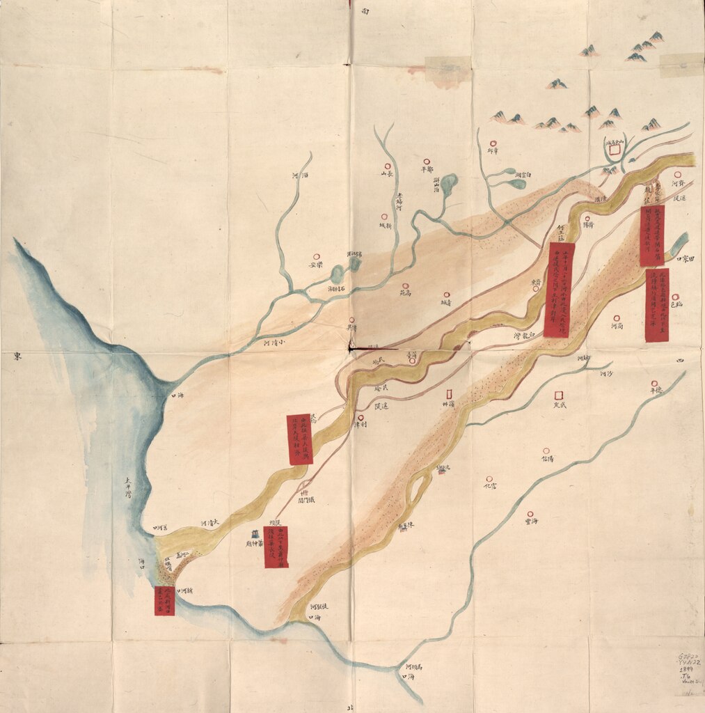
English: Scale ca. 1:450,000. Title supplied. Oriented with north to the bottom. Relief shown pictorially. Pictorial map. Pen-and-ink and watercolor. Labels pasted on to show plans for water regulation of the lower course of the Yellow River from the city of Kaifeng to the sea. Hummel gift 1962, no. 8. Available also through the Library of Congress Web site as a raster image. Includes text. Previous call number: G7822.Y4N22 1899 .T6 Vault Shelf Previous call no.: G7822.H9N2 18-- .H8 Vault Shelf AACR2 |
||
| Title | [Tongwaxiang zhi hai kou xin Huang He he dao di gong xing shi tu] | ||
| Shelf ID | G7822.Y4N22 1876 .T6 | ||
| Date | |||
| Source | https://www.loc.gov/item/gm71002473/ | ||
| Author | Hummel, Arthur W. (Arthur William) | ||
| Permission (Reusing this file) |
|
||
| Other versions |
|
||
| Location | Yellow River · China | ||
| Part of | American Memory · General Maps · Catalog · Geography And Map Division | ||
| Subject | Maps, Manuscript · Maps, Pictorial · Yellow River (China) · Maps · China · Yellow River · Flood Control |


Licensing
[edit]|
This is a faithful photographic reproduction of a two-dimensional, public domain work of art. The work of art itself is in the public domain for the following reason:
The official position taken by the Wikimedia Foundation is that "faithful reproductions of two-dimensional public domain works of art are public domain".
This photographic reproduction is therefore also considered to be in the public domain in the United States. In other jurisdictions, re-use of this content may be restricted; see Reuse of PD-Art photographs for details. | ||||
File history
Click on a date/time to view the file as it appeared at that time.
| Date/Time | Thumbnail | Dimensions | User | Comment | |
|---|---|---|---|---|---|
| current | 02:23, 18 May 2018 |  | 8,198 × 8,286 (194.35 MB) | Fæ (talk | contribs) | LOC Maps https://www.loc.gov/item/gm71002473/ #1531 |
You cannot overwrite this file.
File usage on Commons
The following 3 pages use this file: