File:Thonburi-history-map.svg
Jump to navigation
Jump to search

Size of this PNG preview of this SVG file: 124 × 175 pixels. Other resolutions: 170 × 240 pixels | 340 × 480 pixels | 544 × 768 pixels | 725 × 1,024 pixels | 1,451 × 2,048 pixels.
Original file (SVG file, nominally 124 × 175 pixels, file size: 392 KB)
Captions
Captions
Add a one-line explanation of what this file represents
Summary
[edit]
| Description |
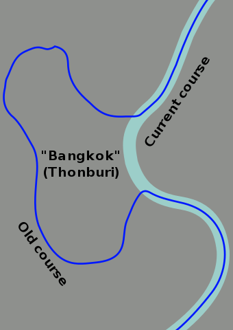
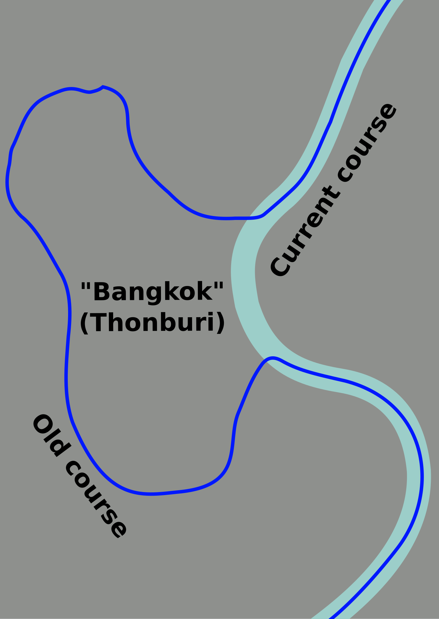
Current and historic course of the Chao Phraya River in Bangkok (SVG). |
| Date | |
| Source | Own work based on OpenStreetMap.org [1]. |
| Author | Globe-trotter |
| Other versions | Thonburi-history-map.png |
Licensing
[edit]
This file is licensed under the Creative Commons Attribution-Share Alike 3.0 Unported license.
- You are free:
- to share – to copy, distribute and transmit the work
- to remix – to adapt the work
- Under the following conditions:
- attribution – You must give appropriate credit, provide a link to the license, and indicate if changes were made. You may do so in any reasonable manner, but not in any way that suggests the licensor endorses you or your use.
- share alike – If you remix, transform, or build upon the material, you must distribute your contributions under the same or compatible license as the original.
Original upload log
[edit]
| This file was imported from Wikivoyage WTS. |
The original description page was here. All following user names refer to wts.wikivoyage-old.
- 2012-10-31 12:20 Globe-trotter[dead link] 124×175 (401022 bytes) {{Imagecredit|credit=Globe-trotter|captureDate=31 October 2012|location=Bangkok|source=Traced over OpenStreetMap contributions [http://www.opensteetmap.org]|caption=Historical course of the Chao Phraya River|description=This map shows the historical co...
File history
Click on a date/time to view the file as it appeared at that time.
| Date/Time | Thumbnail | Dimensions | User | Comment | |
|---|---|---|---|---|---|
| current | 03:03, 18 November 2012 | | 124 × 175 (392 KB) | MGA73bot2 (talk | contribs) | {{BotMoveToCommons|wts.oldwikivoyage|year={{subst:CURRENTYEAR}}|month={{subst:CURRENTMONTHNAME}}|day={{subst:CURRENTDAY}}}} == {{int:filedesc}} == {{Information |description=Current and historic course of the Chao Phraya River in Bangkok (SVG). * Map o... |
You cannot overwrite this file.
File usage on Commons
There are no pages that use this file.
File usage on other wikis
The following other wikis use this file:
- Usage on azb.wikipedia.org
- Usage on en.wikipedia.org
- Usage on es.wikipedia.org
- Usage on fa.wikipedia.org
- Usage on ml.wikipedia.org
- Usage on simple.wikipedia.org
- Usage on tl.wikipedia.org