Category:Files by Wikivoyage user Globe-trotter
Jump to navigation
Jump to search
Media in category "Files by Wikivoyage user Globe-trotter"
The following 198 files are in this category, out of 198 total.
-
Abhisek Dusit Throne Hall in Dusit District, Bangkok, Thailand.jpg 1,600 × 1,200; 557 KB
-
Amsterdam-map.png 1,959 × 1,679; 1.95 MB
-
Amsterdam-map.svg 4,897 × 4,196; 2.25 MB
-
Amsterdam-metro-map.png 1,709 × 2,478; 357 KB
-
Amsterdam-metro-map.svg 736 × 1,067; 286 KB
-
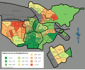
Amsterdam-unsafety-map.png 3,169 × 2,617; 1.23 MB
-
Amsterdam-unsafety-map.svg 822 × 679; 239 KB
-
Anantasamakhom Throne Hall in Dusit District, Bangkok, Thailand.jpg 1,600 × 1,200; 436 KB
-
Arch in Samphanthawong District, Bangkok, Thailand.jpg 2,592 × 1,944; 2.12 MB
-
Austria-regions.png 2,565 × 1,238; 619 KB
-
Austria-regions.svg 1,160 × 560; 735 KB
-
Ayutthaya-map.png 1,490 × 1,544; 322 KB
-
Ayutthaya-map.svg 1,837 × 1,904; 1.6 MB
-
Bangkok 2008 020.JPG 2,048 × 1,536; 556 KB
-
Bangkok 2008 029.JPG 1,536 × 2,048; 396 KB
-
Bangkok 2008 829.JPG 2,048 × 1,536; 517 KB
-
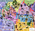
Bangkok-central-map.png 3,418 × 3,008; 2.9 MB
-
Bangkok-central-map.svg 887 × 780; 2.69 MB
-
Bangkok-large.png 3,385 × 2,979; 2.17 MB
-
Bangkok-large.svg 878 × 773; 1.99 MB
-
Bangkok-saensaep-map.png 1,324 × 311; 101 KB
-
Bangkok-saensaep-map.svg 1,295 × 305; 48 KB
-
Bangkok-transit-map.png 3,200 × 2,583; 732 KB
-
Bangkok-transit-map.svg 1,384 × 1,118; 192 KB
-
Banglampoo Market in Phra Nakhon District, Bangkok, Thailand.jpg 1,600 × 1,200; 471 KB
-
Bar along Khao San Road, in Phra Nakhon District, Bangkok, Thailand.jpg 1,200 × 900; 189 KB
-
Barkly-regions-map.png 2,792 × 2,343; 636 KB
-
Barkly-regions-map.svg 867 × 727; 518 KB
-
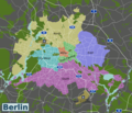
Berlin map new.png 2,915 × 2,498; 2.41 MB
-
Berlin map new.svg 10,092 × 8,647; 1.47 MB
-
Catalonia-regions-map.svg 700 × 596; 404 KB
-
Central plains map.png 2,000 × 2,822; 1.53 MB
-
Central plains map.svg 404 × 570; 607 KB
-
Chatuchak-map.png 3,008 × 1,709; 858 KB
-
Chatuchak-map.svg 780 × 443; 651 KB
-
Christmas-island-map.png 3,000 × 2,513; 1.12 MB
-
Christmas-island-map.svg 840 × 704; 779 KB
-
City Pillar Shrine in Phra Nakhon District, Bangkok, Thailand.jpg 2,592 × 1,944; 2.26 MB
-
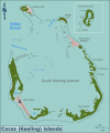
Cocos-keeling-islands-map.png 3,000 × 3,583; 1.56 MB
-
Cocos-keeling-islands-map.svg 792 × 946; 1.46 MB
-
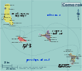
Comoros map.png 1,786 × 1,527; 397 KB
-
Comoros mayotte map.svg 773 × 661; 504 KB
-
Crocodile in a pond in Wat Chakrawat, Samphanthawong District, Bangkok, Thailand.jpg 1,600 × 1,200; 1.43 MB
-
Czech-regions wts.png 1,609 × 1,252; 744 KB
-
Czech-regions.svg 727 × 566; 552 KB
-
Dusit-map.png 3,008 × 1,709; 1.08 MB
-
Dusit-map.svg 780 × 443; 2.24 MB
-
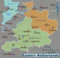
Eastern-netherlands-map.png 2,997 × 2,872; 1.61 MB
-
Eastern-netherlands-map.svg 297 × 285; 1.1 MB
-
Eastern-thailand-map.png 2,000 × 2,511; 882 KB
-
Eastern-thailand-map.svg 1,519 × 1,907; 907 KB
-
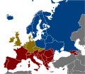
Europe alcohol belts.png 689 × 599; 98 KB
-
Europe alcohol belts.svg 1,500 × 1,307; 792 KB
-
Fabric store in Sampeng Lane, Samphanthawong District, Bangkok, Thailand.jpg 2,592 × 1,944; 2.27 MB
-
Fiji-regions.png 2,062 × 2,549; 702 KB
-
Fiji-regions.svg 589 × 728; 1.09 MB
-
France-regions.png 1,996 × 2,085; 1.51 MB
-
France-regions.svg 619 × 647; 1.08 MB
-
Gibraltar-map.png 2,489 × 3,869; 890 KB
-
Gibraltar-map.svg 1,000 × 1,558; 290 KB
-
Grandpalace-map.png 3,008 × 1,709; 1.25 MB
-
Grandpalace-map.svg 780 × 443; 927 KB
-
Groest in Hilversum, the Netherlands 2.jpg 3,072 × 2,304; 2.51 MB
-
Groest in Hilversum, the Netherlands.jpg 3,072 × 2,304; 2.75 MB
-
Hilversum-center-map.png 2,500 × 1,998; 1.23 MB
-
Hilversum-center-map.svg 1,499 × 1,198; 1.25 MB
-
Hilversum-full-map.png 1,379 × 1,008; 749 KB
-
Hilversum-full-map.svg 1,379 × 1,008; 769 KB
-
Hilvertshof shopping centre in Hilversum, the Netherlands.jpg 3,072 × 2,304; 2.68 MB
-
Hoorneboegse heide in Hilversum, the Netherlands.jpg 3,072 × 2,304; 2.64 MB
-
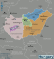
Hungary colour nl.png 1,995 × 2,151; 628 KB
-
Hungary colour se.png 1,995 × 2,151; 614 KB
-
Hungary colour.png 1,995 × 2,151; 616 KB
-
Hungary colour.svg 606 × 654; 792 KB
-
Isaan-regions.png 1,902 × 2,000; 915 KB
-
Israel map wts.png 3,529 × 4,612; 1.58 MB
-
Israel map.svg 1,307 × 1,708; 595 KB
-
Karachi map.png 2,377 × 2,498; 174 KB
-
Karachi map.svg 8,229 × 8,647; 313 KB
-
Khaosanroad-map.png 1,709 × 3,971; 1.8 MB
-
Khaosanroad-map.svg 443 × 1,030; 1.29 MB
-
Lebanon region map.png 521 × 647; 197 KB
-
Lebanon region map.svg 521 × 647; 1.22 MB
-
Liechtenstein-map.png 1,987 × 2,563; 611 KB
-
Liechtenstein-map.svg 1,386 × 1,788; 473 KB
-
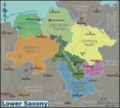
Lower-Saxony-map.png 3,032 × 2,736; 2.57 MB
-
Lower-Saxony-map.svg 704 × 635; 648 KB
-
Macao-map.png 5,500 × 8,728; 6.08 MB
-
Macao-map.svg 2,541 × 4,033; 2.03 MB
-
Maetoranee.jpg 1,200 × 1,600; 893 KB
-
Marshall-islands-map.png 3,006 × 2,846; 808 KB
-
Marshall-islands-map.svg 780 × 738; 1.09 MB
-
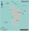
Mayotte map.png 1,537 × 1,652; 222 KB
-
Mayotte map.svg 665 × 715; 444 KB
-
Montenegro-map.png 624 × 670; 156 KB
-
Montenegro-map.svg 624 × 670; 536 KB
-
Mushroom-shaped sign near Hilversum, the Netherlands.jpg 3,072 × 2,304; 2.76 MB
-
National Museum of Royal Barges in Bangkok Noi District, Bangkok, Thailand.jpg 1,600 × 1,200; 636 KB
-
Nederlands Instituut voor Beeld en Geluid in Hilversum, the Netherlands.jpg 3,072 × 2,304; 2.59 MB
-
Nepal-regions-map.png 1,678 × 969; 347 KB
-
Nepal-regions-map.svg 1,119 × 646; 1,021 KB
-
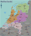
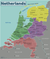
Netherlands-regions-new.png 612 × 703; 287 KB
-
Netherlands-regions-new.svg 599 × 687; 1.32 MB
-
Netherlands-regions.png 1,732 × 2,007; 680 KB
-
Netherlands-regions.svg 1,694 × 1,963; 659 KB
-
Nieuwe Laanstraat (with Sint-Vituskerk in the background) in Hilversum, the Netherlands.jpg 3,072 × 2,304; 2.55 MB
-
Northern-netherlands-map.png 3,000 × 2,145; 1.14 MB
-
Northern-netherlands-map.svg 377 × 269; 1.1 MB
-
Northern-thailand-regions.png 1,241 × 1,523; 1.22 MB
-
Northholland-regions (nl).png 675 × 1,344; 173 KB
-
Northholland-regions.png 675 × 1,344; 171 KB
-
Northholland-regions.svg 428 × 852; 525 KB
-
Northrhinewestphalia-regions.png 1,996 × 2,085; 1.39 MB
-
Northrhinewestphalia-regions.svg 619 × 647; 2.16 MB
-
Oudkatholieke kerk Sint-Vitus in Hilversum, the Netherlands.jpg 3,072 × 2,304; 2.61 MB
-
Pak Khlong Talat in Phra Nakhon District, Bangkok, Thailand.jpg 1,600 × 1,200; 567 KB
-
Pal territories map.png 1,990 × 2,600; 926 KB
-
Pal territories map.svg 1,307 × 1,708; 557 KB
-
Phahonyothin-map.png 1,709 × 6,016; 1.8 MB
-
Phahonyothin-map.svg 443 × 1,560; 484 KB
-
Pratunam-map.png 1,709 × 3,008; 1.12 MB
-
Pratunam-map.svg 443 × 780; 433 KB
-
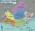
Provence-map.png 2,269 × 2,047; 895 KB
-
Provence-map.svg 704 × 635; 1.42 MB
-
Raadhuis in Hilversum, the Netherlands.jpg 1,956 × 1,488; 2.04 MB
-
Ramkhamhaeng University in Bang Kapi District, Bangkok, Thailand.jpg 3,888 × 2,592; 3.13 MB
-
Ramkhamhaeng-airport-map.png 1,050 × 577; 130 KB
-
Ramkhamhaeng-airport-map.svg 272 × 150; 155 KB
-
Ramkhamhaeng-map.png 3,008 × 1,709; 1.66 MB
-
Ramkhamhaeng-map.svg 780 × 443; 555 KB
-
Ratchada Soi 4 sign in Huai Khwang District, Bangkok, Thailand.jpg 2,592 × 3,888; 3.47 MB
-
Ratchadaphisek-map.png 1,709 × 6,016; 1.55 MB
-
Ratchadaphisek-map.svg 443 × 1,560; 624 KB
-
Rattanakosin-map-new.png 3,418 × 3,008; 2.75 MB
-
Rattanakosin-map-new.svg 887 × 780; 2.67 MB
-
RCA Plaza in Huai Khwang District, Bangkok, Thailand.jpg 3,888 × 2,592; 2.93 MB
-
Rice terraces in Jatiluwih, Tabanan Regency, Bali, Indonesia.jpg 2,592 × 1,944; 1.98 MB
-
Sampeng Lane in Samphanthawong District, Bangkok, Thailand.jpg 2,592 × 1,944; 2.18 MB
-
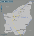
San-marino-map.png 1,066 × 1,124; 202 KB
-
San-marino-map.svg 615 × 648; 472 KB
-
Saxony-regions.png 2,644 × 2,776; 1.33 MB
-
Saxony-regions.svg 619 × 647; 417 KB
-
Siamsquare-map.png 3,418 × 3,008; 1.69 MB
-
Siamsquare-map.svg 887 × 780; 1.41 MB
-
Sieng Kong Zone (Soi Wanit 2) in Samphanthawong District, Bangkok, Thailand.jpg 2,592 × 1,944; 2.1 MB
-
Sierra-leone-regions-map.png 2,083 × 2,566; 1.12 MB
-
Sierra-leone-regions-map.svg 572 × 704; 3.04 MB
-
Silom-map-inkscapesvg.png 2,997 × 1,890; 1.92 MB
-
Silom-map-inkscapesvg.svg 1,237 × 780; 2.83 MB
-
Soi arab.jpg 2,871 × 1,914; 1.3 MB
-
Southern-netherlands-map.png 3,001 × 1,916; 1.31 MB
-
Southern-netherlands-map.svg 433 × 276; 1.11 MB
-
Southern-thailand-regions.png 1,998 × 2,054; 846 KB
-
Southholland regions map.png 1,204 × 1,012; 286 KB
-
Southholland regions map.svg 814 × 684; 244 KB
-
Store in Leeuwenstraat, Hilversum, the Netherlands.jpg 1,200 × 900; 313 KB
-
Sukhumvit-map.png 3,418 × 3,008; 2.44 MB
-
Sukhumvit-map.svg 887 × 780; 1.16 MB
-
Suriname regions map.png 1,999 × 2,453; 915 KB
-
Suriname regions map.svg 535 × 657; 698 KB
-
Switzerland-map.png 2,453 × 1,584; 1.07 MB
-
Switzerland-map.svg 887 × 573; 566 KB
-
Taling Chan Floating Market in Taling Chan District, Bangkok, Thailand 2.jpg 1,600 × 1,200; 451 KB
-
Taling Chan Floating Market in Taling Chan District, Bangkok, Thailand.jpg 1,600 × 1,200; 494 KB
-
Thailand regions map.png 2,000 × 2,919; 2.24 MB
-
Thailand regions map.svg 1,487 × 2,170; 2.45 MB
-
Thailand-regions.svg 777 × 1,379; 1.1 MB
-
Thonburi boat transport.png 2,015 × 3,993; 682 KB
-
Thonburi boat transport.svg 1,343 × 2,662; 355 KB
-
Thonburi-history-map.png 480 × 675; 58 KB
-
Thonburi-history-map.svg 124 × 175; 392 KB
-
Thonburi-map.png 1,709 × 3,008; 1.35 MB
-
Thonburi-map.svg 446 × 782; 862 KB
-
Tom Kha Kai in Phra Nakhon District, Bangkok, Thailand.jpg 1,600 × 1,200; 905 KB
-
Trok Issaranuphap sign in Samphanthawong District, Bangkok, Thailand.jpg 2,592 × 1,944; 1.92 MB
-
Vaartweg in Hilversum, the Netherlands.jpg 1,200 × 900; 465 KB
-
Vatican-map.png 3,008 × 1,709; 1.44 MB
-
Vatican-map.svg 930 × 555; 1.36 MB
-
Vimanmek Mansion in Dusit District, Bangkok, Thailand.jpg 1,600 × 1,200; 509 KB
-
Wat Arun in Bangkok Yai District, Bangkok, Thailand.jpg 1,200 × 900; 405 KB
-
Wat Bowonniwet in Phra Nakhon District, Bangkok, Thailand.jpg 1,200 × 1,600; 543 KB
-
Wat Prayoon in Thon Buri District, Bangkok, Thailand.jpg 2,592 × 1,944; 1.58 MB
-
Watpho-map.png 3,008 × 1,709; 968 KB
-
Watpho-map.svg 780 × 443; 1.12 MB
-
Western-netherlands-map.png 2,999 × 3,527; 2.01 MB
-
Western-netherlands-map.svg 309 × 363; 1.13 MB
-
Western-sahara-map.png 2,401 × 2,871; 1.01 MB
-
Western-sahara-map.svg 1,450 × 1,734; 818 KB
-
Wildlife crossing Zanderij Crailo in Hilversum, the Netherlands.jpg 3,072 × 2,304; 2.49 MB
-
Yaowarat Road in Samphanthawong District, Bangkok, Thailand.jpg 2,592 × 1,944; 1.98 MB
-
Yaowarat-map.png 3,008 × 1,709; 1.69 MB
-
Yaowarat-map.svg 780 × 443; 1.51 MB
-
Yaowarat-tour-map.svg 332 × 349; 1.14 MB
-
Yaowarat-tour-map1.png 480 × 675; 121 KB
-
Yaowarat-tour-map2.png 1,050 × 675; 289 KB
-
Zambia-regions-map.png 521 × 513; 158 KB
-
Zambia-regions-map.svg 643 × 633; 1.95 MB


