File:Theatrum belli in America Septentrionali - II. foliis comprehensum - jussu Acad(emiis) Reg(iis) Scient(iarum) et Eleg(antium) Litt(erarum) exhibet; I.C. Rhode Ac(ademiae?) Geogr(aphus?); NYPL434599.tiff
Jump to navigation
Jump to search

Size of this JPG preview of this TIF file: 799 × 600 pixels. Other resolutions: 320 × 240 pixels | 640 × 480 pixels | 1,023 × 768 pixels | 1,280 × 961 pixels | 2,560 × 1,921 pixels | 5,062 × 3,799 pixels.
Original file (5,062 × 3,799 pixels, file size: 55.02 MB, MIME type: image/tiff)
Captions
Captions
Add a one-line explanation of what this file represents
Summary
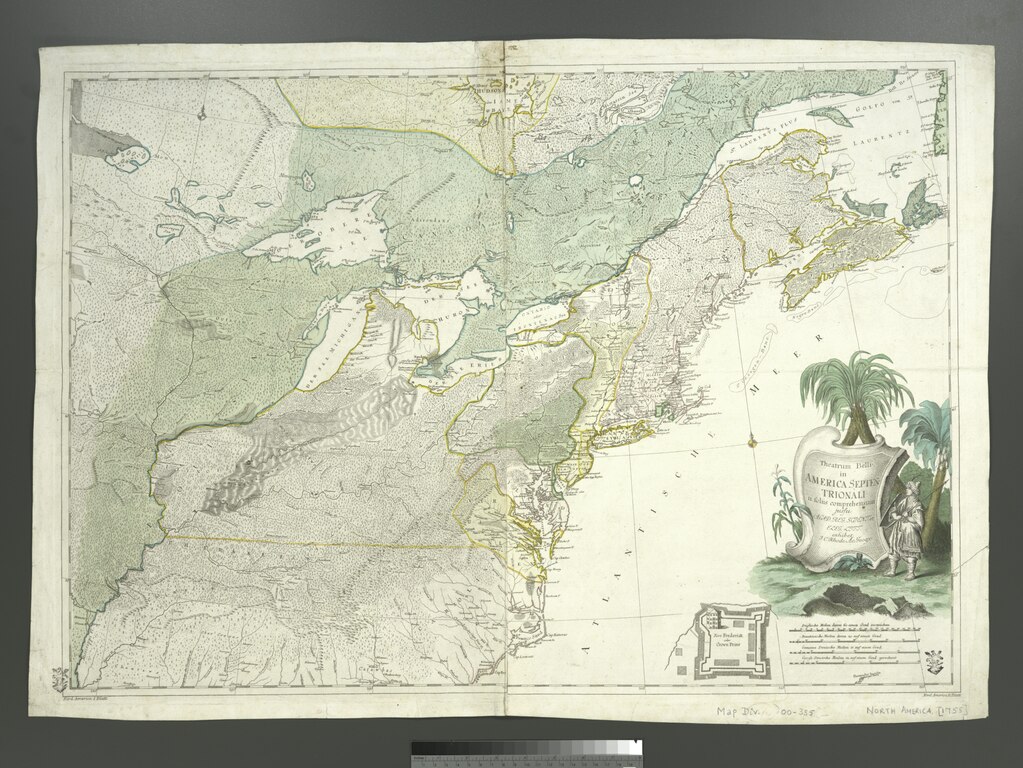
[edit]| Description | Theatrum belli in America Septentrionali : II. foliis comprehensum / jussu Acad[emiis] Reg[iis] Scient[iarum] et Eleg[antium] Litt[erarum] exhibet ; I.C. Rhode Ac[ademiae?] Geogr[aphus?] ; Berger, sculpsit Berol[ini].; Maps of North America. / Parts | |||||||||||||||||||||||
| Notes | Covers the east coast from the Gulf of the St. Lawrence to the Carolinas, and the interior as far west as the Mississippi Valley. ''Note 2.'') Includes ill., decorative cartouche and inset of "Fort Frederick oder Crown Point." ''Note 3.'') Lower left: Nord America I. Blatt; lower right: Nord America II. Blatt. ''Note 4.'') Prime meridian: [Ferro]. ''Note 5.'') Publication date from Richard B. Arkway, Inc., estimate, based on name of fort shown in inset. ''Note 6.'') Relief shown pictorially. ''Note 7.'') Second state, according to Richard B. Arkway, Inc., based on inclusion of inset showing fort. | |||||||||||||||||||||||
| Item physical description | 1 map : hand col. ; 55 x 78 cm. | |||||||||||||||||||||||
| Catalogue call number | Map Div. 00-355 | |||||||||||||||||||||||
| Standard reference | LC Maps of North America, 1750-1789, 59; Richard B. Arkway, Inc. Catalog 69, 23; Brown, L. Early maps of the Ohio Valley, 23 | |||||||||||||||||||||||
| Date | circa 1761 | |||||||||||||||||||||||
| Source |
http://digitalgallery.nypl.org/nypldigital/dgkeysearchdetail.cfm?imageID=434599
|
|||||||||||||||||||||||
| Author | Johann Christoph, 1713-1786 -- Geographer (not in Relator list) Rhode | |||||||||||||||||||||||
| Permission (Reusing this file) |
From The Lionel Pincus and Princess Firyal Map Division. http://maps.nypl.org
|
|||||||||||||||||||||||
| Location | Stephen A. Schwarzman Building / The Lionel Pincus and Princess Firyal Map Division | |||||||||||||||||||||||
| Digital item published | 2-28-2005; updated 3-25-2011 | |||||||||||||||||||||||
| Digital ID | 434599 | |||||||||||||||||||||||

The making of this file was supported by Wikimedia UK.
To see other files made with the support of Wikimedia UK, please see the category Supported by Wikimedia UK.
|
File history
Click on a date/time to view the file as it appeared at that time.
| Date/Time | Thumbnail | Dimensions | User | Comment | |
|---|---|---|---|---|---|
| current | 20:48, 7 May 2014 |  | 5,062 × 3,799 (55.02 MB) | Fæ (talk | contribs) | GWToolset: Creating mediafile for Fæ. Tranche 4 -4989 restart @08:55 BST, 7 May 2014 |
You cannot overwrite this file.
File usage on Commons
There are no pages that use this file.