File:The topography surrounding Sendai.jpg

Original file (6,330 × 5,879 pixels, file size: 4.69 MB, MIME type: image/jpeg)
Captions
Captions
Summary
[edit]
| Description |
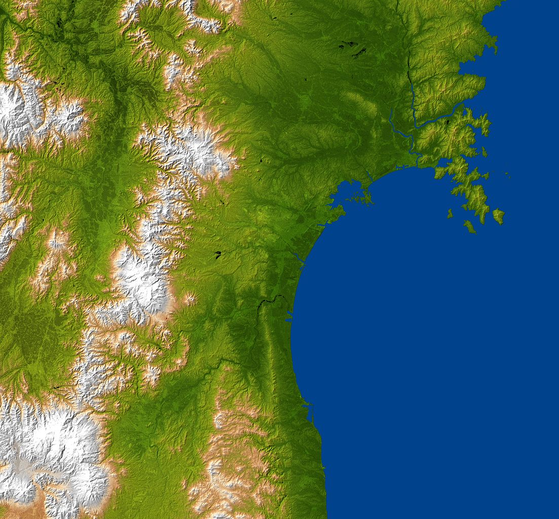
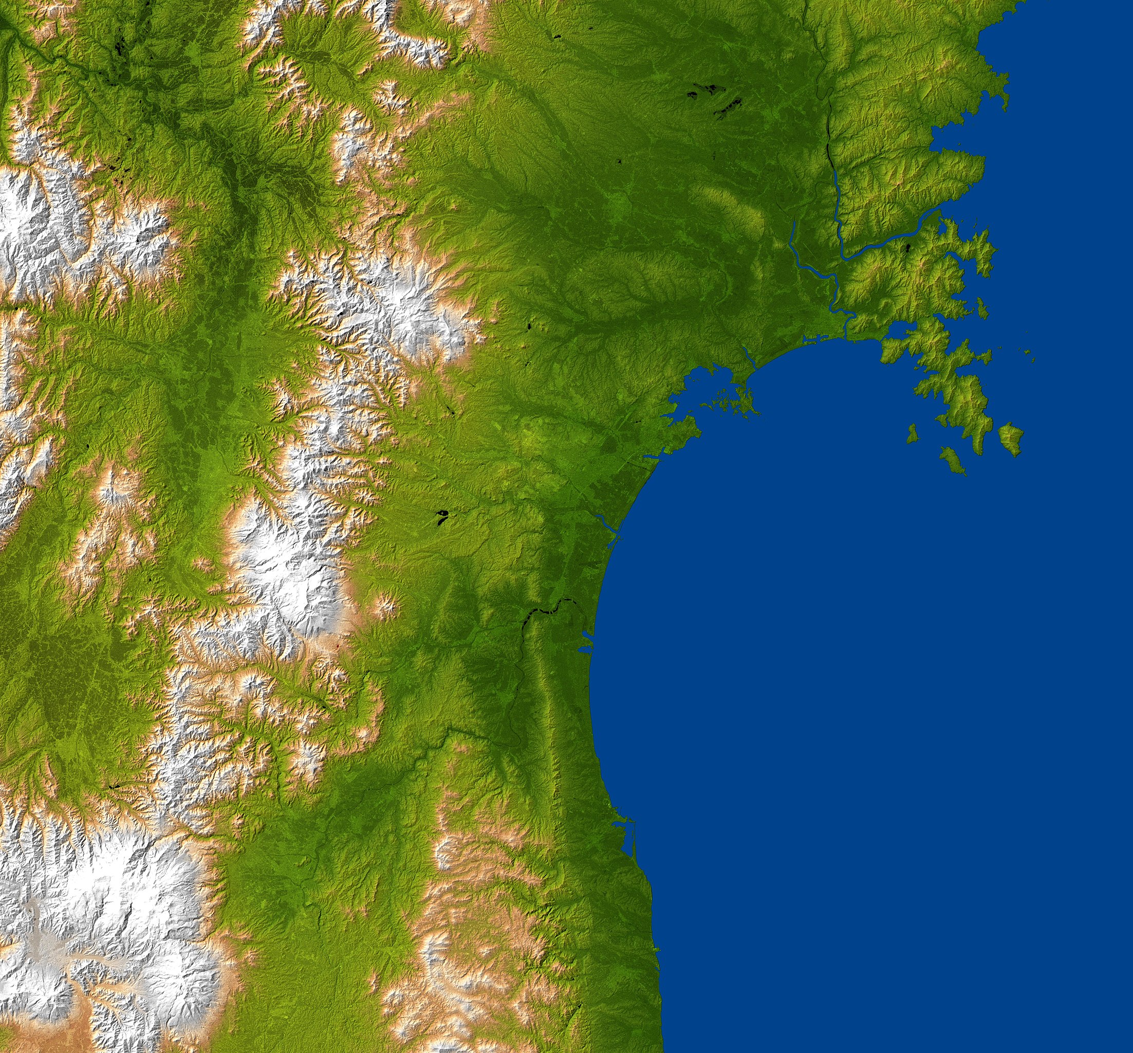
日本語: 仙台湾岸地域の地誌 English: The topography surrounding Sendai. “The city is centered in the image and lies along the coastal plain between the Ohu Mountains and the Pacific Ocean.”
This is a “combined radar image and topographic view generated with data from NASA's Shuttle Radar Topography Mission (SRTM)[1] […] This image combines a radar image acquired in February 2000 during the SRTM mission, and color-coding by topographic height using data from the same mission. […] The mission is a cooperative project between NASA, the National Geospatial-Intelligence Agency (NGA)[2] of the U.S. Department of Defense and the German[3] and Italian[4] space agencies. It is managed by NASA's Jet Propulsion Laboratory[5], Pasadena, Calif., for NASA's Science Mission Directorate, Washington, D.C.” Location: 38°15′N 140°51′E / 38.25°N 140.85°E 2011-03-11 |
| Date | |
| Source | http://photojournal.jpl.nasa.gov/catalog/PIA13912 |
| Author | NASA/JPL/NGA |
Licensing
[edit]
This image uses high-resolution digital topography data from NASA's Shuttle Radar Topography Mission (SRTM) at JPL-Caltech [6]. It is in the public domain in the United States.
|
 | |
This image is a work of the United States National Geospatial-Intelligence Agency or one of its predecessor agencies. As a work of the U.S. federal government, the image is in the public domain.
|
 |
File history
Click on a date/time to view the file as it appeared at that time.
| Date/Time | Thumbnail | Dimensions | User | Comment | |
|---|---|---|---|---|---|
| current | 01:32, 3 September 2011 | | 6,330 × 5,879 (4.69 MB) | Dustsucker (talk | contribs) |
You cannot overwrite this file.
File usage on Commons
There are no pages that use this file.
File usage on other wikis
The following other wikis use this file:
- Usage on de.wikipedia.org
- Usage on fr.wikipedia.org
- Usage on ja.wikipedia.org
- Usage on ko.wikipedia.org
- Usage on ru.wikipedia.org