File:The remains of Blanerne Castle near Edrom - geograph.org.uk - 1288674.jpg
Jump to navigation
Jump to search
No higher resolution available.
The_remains_of_Blanerne_Castle_near_Edrom_-_geograph.org.uk_-_1288674.jpg (640 × 413 pixels, file size: 131 KB, MIME type: image/jpeg)
Captions
Captions
Add a one-line explanation of what this file represents
|
This is a photo of scheduled monument number 4216
|
Summary
[edit]
| Description |
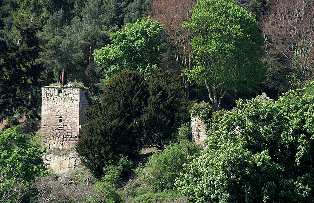
English: The remains of Blanerne Castle near Edrom Set in Crow Wood a short distance to the southwest of Blanerne House and the original seat of the Lumsdaine family. The 16th century castle is a scheduled monument. Viewed from a minor road near Todheugh Farm. |
| Date | |
| Source | From geograph.org.uk |
| Author | Walter Baxter |
| Attribution (required by the license) | Walter Baxter / The remains of Blanerne Castle near Edrom / |
| Camera location | | View this and other nearby images on: OpenStreetMap |
|---|
_heading:315.00&language=en)
| Object location | | View this and other nearby images on: OpenStreetMap |
|---|
_heading:315.00&language=en)
Licensing
[edit]

|
This image was taken from the Geograph project collection. See this photograph's page on the Geograph website for the photographer's contact details. The copyright on this image is owned by Walter Baxter and is licensed for reuse under the Creative Commons Attribution-ShareAlike 2.0 license.
|
This file is licensed under the Creative Commons Attribution-Share Alike 2.0 Generic license.
Attribution: Walter Baxter
- You are free:
- to share – to copy, distribute and transmit the work
- to remix – to adapt the work
- Under the following conditions:
- attribution – You must give appropriate credit, provide a link to the license, and indicate if changes were made. You may do so in any reasonable manner, but not in any way that suggests the licensor endorses you or your use.
- share alike – If you remix, transform, or build upon the material, you must distribute your contributions under the same or compatible license as the original.
File history
Click on a date/time to view the file as it appeared at that time.
| Date/Time | Thumbnail | Dimensions | User | Comment | |
|---|---|---|---|---|---|
| current | 07:30, 27 February 2011 | | 640 × 413 (131 KB) | GeographBot (talk | contribs) | == {{int:filedesc}} == {{Information |description={{en|1=The remains of Blanerne Castle near Edrom Set in Crow Wood a short distance to the southwest of Blanerne House and the original seat of the Lumsdaine family. The 16th century castle is a Category B |
You cannot overwrite this file.
File usage on Commons
There are no pages that use this file.
File usage on other wikis
The following other wikis use this file:
- Usage on de.wikipedia.org
- Usage on en.wikipedia.org
- Usage on pt.wikipedia.org
- Usage on uk.wikipedia.org
- Usage on www.wikidata.org