File:The Canal - geograph.org.uk - 1633923.jpg
Jump to navigation
Jump to search
No higher resolution available.
The_Canal_-_geograph.org.uk_-_1633923.jpg (640 × 480 pixels, file size: 71 KB, MIME type: image/jpeg)
Captions
Captions
Add a one-line explanation of what this file represents
Summary
[edit]
| Description |
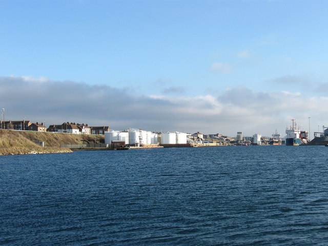
English: The Canal Constructed in the 1850s on the course of the old River Adur whose mouth originally extended as far as Hove before a new entrance was cut at Kingston Buci in 1817. Since then Shoreham has been a successful medium sized port. Texaco Wharf is straight ahead to the left whilst the ship in the distance is docked at Hanson's Terminal. |
| Date | |
| Source | From geograph.org.uk |
| Author | Simon Carey |
| Attribution (required by the license) | Simon Carey / The Canal / |
| Camera location | | View this and other nearby images on: OpenStreetMap |
|---|
_heading:90.00&language=en)
| Object location | | View this and other nearby images on: OpenStreetMap |
|---|
_heading:90.00&language=en)
Licensing
[edit]

|
This image was taken from the Geograph project collection. See this photograph's page on the Geograph website for the photographer's contact details. The copyright on this image is owned by Simon Carey and is licensed for reuse under the Creative Commons Attribution-ShareAlike 2.0 license.
|
This file is licensed under the Creative Commons Attribution-Share Alike 2.0 Generic license.
Attribution: Simon Carey
- You are free:
- to share – to copy, distribute and transmit the work
- to remix – to adapt the work
- Under the following conditions:
- attribution – You must give appropriate credit, provide a link to the license, and indicate if changes were made. You may do so in any reasonable manner, but not in any way that suggests the licensor endorses you or your use.
- share alike – If you remix, transform, or build upon the material, you must distribute your contributions under the same or compatible license as the original.
File history
Click on a date/time to view the file as it appeared at that time.
| Date/Time | Thumbnail | Dimensions | User | Comment | |
|---|---|---|---|---|---|
| current | 17:58, 4 March 2011 | | 640 × 480 (71 KB) | GeographBot (talk | contribs) | == {{int:filedesc}} == {{Information |description={{en|1=The Canal Constructed in the 1850s on the course of the old River Adur whose mouth originally extended as far as Hove before a new entrance was cut at Kingston Buci in 1817. Since then Shoreham has |
You cannot overwrite this file.
File usage on Commons
There are no pages that use this file.