Category:Southwick, West Sussex
Jump to navigation
Jump to search
town in West Sussex, UK .jpg) | |||||
| Upload media | |||||
| Instance of |
| ||||
|---|---|---|---|---|---|
| Location | Adur, West Sussex, South East England, England | ||||
| Area |
| ||||
 | |||||
English: Southwick is a small town and civil parish in the Adur District of West Sussex, England located three miles (5 km) west of Brighton and a suburb of the East Sussex resort City of Brighton & Hove. The civil parish covers an area of 863.7 hectares and has a population of 13,195 persons (2001 census).
Italiano: Southwick è una cittadina di 13.195 abitanti della contea del West Sussex, in Inghilterra.
Subcategories
This category has the following 15 subcategories, out of 15 total.
A
- All Souls Centre, Southwick (3 F)
B
F
O
- Old Town Hall, Southwick (3 F)
P
- Pilot pub, Southwick (3 F)
S
- Ship pub, Southwick (3 F)
- Southwick Community Centre (8 F)
- Southwick Methodist Church (24 F)
Media in category "Southwick, West Sussex"
The following 169 files are in this category, out of 169 total.
-
 11 Southwick Street, Southwick (IoE Code 297355).jpg 2,400 × 1,800; 1.05 MB
-
 16-18 Southwick Street, Southwick (IoE Code 297360).jpg 2,400 × 1,800; 1,003 KB
-
 17-19 Southwick Street, Southwick (IoE Code 297356).jpg 2,000 × 1,800; 830 KB
-
 20 Southwick Street, Southwick, West Sussex (NHLE Code 1027858) (June 2023).jpg 2,600 × 1,600; 1.94 MB
-
 20 Southwick Street.jpg 3,459 × 2,240; 1.91 MB
-
 21 Southwick Street, Southwick (IoE Code 297357).jpg 2,000 × 1,800; 905 KB
-
 41 The Green.jpg 2,721 × 3,165; 1.54 MB
-
 43-45 The Green.jpg 2,968 × 2,751; 1.69 MB
-
 A gloomy day ends at Southwick FC - geograph.org.uk - 1513592.jpg 1,600 × 1,200; 274 KB
-
 A Paddle Boarder - geograph.org.uk - 3849305.jpg 3,072 × 2,048; 3.94 MB
-
 A Paddle Boarder Heading For Open Water - geograph.org.uk - 3849301.jpg 2,345 × 1,576; 812 KB
-

-
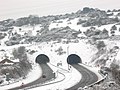
 A27 Southwick Hill Tunnels - geograph.org.uk - 1053864.jpg 640 × 480; 120 KB
-
 Aggregate conveyors by Fisherman's Wharf - geograph.org.uk - 2586990.jpg 640 × 480; 139 KB
-
 Albion Inn, 13-15 Fishersgate Terrace, Fishersgate (December 2019).jpg 3,600 × 2,200; 1.29 MB
-
 Albion Inn, Fishersgate, Sussex - geograph.org.uk - 1814553.jpg 3,872 × 2,592; 3.44 MB
-
 Albion Street, Southwick - geograph.org.uk - 2746807.jpg 4,320 × 3,240; 3.54 MB
-
 Albion Street, Southwick - geograph.org.uk - 3208547.jpg 1,600 × 1,200; 427 KB
-
 Along the Breakwater - geograph.org.uk - 1484858.jpg 640 × 480; 57 KB
-
 Bank and travel agency, Southwick - geograph.org.uk - 2786470.jpg 1,600 × 1,188; 535 KB
-
 Basin Road South - geograph.org.uk - 1146358.jpg 640 × 480; 64 KB
-
 Basin Road South - geograph.org.uk - 651308.jpg 640 × 480; 47 KB
-

-
 Beach Huts near Carat's Cafe - geograph.org.uk - 488847.jpg 479 × 640; 160 KB
-
 Border Checkpoint, Fishersgate, Sussex - geograph.org.uk - 1814569.jpg 3,872 × 2,592; 2.99 MB
-
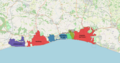 BrightonAndHoveBUA.png 1,618 × 850; 1.15 MB
-
 Britannia Wharf - geograph.org.uk - 2184433.jpg 640 × 480; 63 KB
-
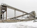 Cemex Aggregates Conveyor - geograph.org.uk - 2184437.jpg 640 × 480; 78 KB
-
 Christmas Lights, Orchard Close, Southwick, West Sussex - geograph.org.uk - 2876117.jpg 1,600 × 1,200; 357 KB
-
 Church Lane - dual carriageway - geograph.org.uk - 1767416.jpg 640 × 428; 94 KB
-
 Church Road - geograph.org.uk - 2184454.jpg 640 × 480; 77 KB
-
 Church Road - geograph.org.uk - 2580666.jpg 640 × 480; 111 KB
-
 Church Road, Portslade - geograph.org.uk - 2540953.jpg 1,600 × 1,200; 350 KB
-
 Coastliner 700, Southwick, Sussex - geograph.org.uk - 1814340.jpg 3,872 × 2,592; 3.78 MB
-
 Construction site, Wellington Road - geograph.org.uk - 3331971.jpg 640 × 480; 105 KB
-
 Conveyor at Aggregates Depot, Portslade, Sussex - geograph.org.uk - 1814592.jpg 3,872 × 2,592; 3.92 MB
-
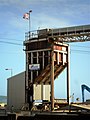 Conveyor end, Shoreham Harbour, Portslade - geograph.org.uk - 3079334.jpg 1,200 × 1,600; 303 KB
-
 Coolant pipes for power station, Portslade - geograph.org.uk - 2633173.jpg 1,600 × 1,200; 241 KB
-
 Derelict site, Shoreham Harbour - geograph.org.uk - 3331969.jpg 640 × 480; 64 KB
-
 East and Inner Breakwaters - geograph.org.uk - 488827.jpg 640 × 468; 143 KB
-
 East Breakwater - geograph.org.uk - 1484769.jpg 640 × 480; 64 KB
-
 East Breakwater, Shoreham Harbour - geograph.org.uk - 5278706.jpg 640 × 572; 70 KB
-

-
 Eastbrook Primary School, Southwick - geograph.org.uk - 2605138.jpg 1,600 × 1,200; 530 KB
-
 Eastern Breakwater - geograph.org.uk - 488804.jpg 640 × 473; 104 KB
-
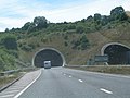
 Eastern portals of Southwick Hill Tunnel - geograph.org.uk - 2754674.jpg 4,000 × 3,000; 3.25 MB
-
 Empty Factory - geograph.org.uk - 750291.jpg 453 × 640; 103 KB
-
-
 Entrance, Shoreham Harbour - geograph.org.uk - 5278695.jpg 640 × 480; 60 KB
-
 Falcon Close - geograph.org.uk - 1767596.jpg 640 × 428; 67 KB
-
 Firewood Depot, Wellington Road, Portslade, Sussex - geograph.org.uk - 1814582.jpg 3,872 × 2,592; 1.76 MB
-
 Flats at Rock Close, Southwick (January 2010).jpg 2,500 × 1,500; 849 KB
-
 Flats in Whiterock Place, Southwick - geograph.org.uk - 2785196.jpg 1,600 × 1,182; 342 KB
-
 Footpath, Southwick Hill - geograph.org.uk - 2185322.jpg 640 × 480; 56 KB
-
 Foreshore at Southwick - geograph.org.uk - 1013375.jpg 640 × 480; 171 KB
-
 Former Industrial Works, Gardner Road, Fishersgate (December 2019).jpg 3,600 × 2,200; 1.38 MB
-
-
 Gates at the top of Southwick Hill - geograph.org.uk - 2256193.jpg 4,000 × 3,000; 3.57 MB
-

-
 Grazing land on South Downs - geograph.org.uk - 712685.jpg 640 × 480; 70 KB
-
 Historic connections - geograph.org.uk - 648920.jpg 640 × 480; 99 KB
-
 Humphrey's Gap - geograph.org.uk - 1148007.jpg 640 × 480; 58 KB
-
 In the Southwick Tunnel, A27 - geograph.org.uk - 2868414.jpg 640 × 430; 36 KB
-

-

-
 Inner Breakwater, Shoreham Harbour - geograph.org.uk - 5278716.jpg 640 × 436; 49 KB
-
 Ivy Lodge, 55 The Green, Southwick (NHLE Code 1193356) (July 2020).jpg 2,600 × 1,800; 1.77 MB
-
 Jetty at the south side of Southwick - geograph.org.uk - 5094635.jpg 800 × 600; 109 KB
-
-
 Main Lock - geograph.org.uk - 488768.jpg 640 × 475; 121 KB
-
 Marina at Southwick - geograph.org.uk - 641671.jpg 640 × 426; 70 KB
-
 Middle Street - geograph.org.uk - 2184398.jpg 474 × 640; 80 KB
-
 Mile Oak Farm in the shadow of Southwick Hill - geograph.org.uk - 2754662.jpg 4,000 × 3,000; 3.47 MB
-
 Mile Oak from Southwick Hill - geograph.org.uk - 2183173.jpg 3,264 × 2,448; 3.36 MB
-
 Mile Oak from Southwick Hill - geograph.org.uk - 54121.jpg 640 × 479; 207 KB
-
 Monarch's Way descending to Southwick Hill - geograph.org.uk - 2256182.jpg 4,000 × 3,000; 3.54 MB
-
 Monarch's Way joins mini-promenade - geograph.org.uk - 649788.jpg 640 × 480; 71 KB
-
 Nautilus House, Albion Street - geograph.org.uk - 1146465.jpg 640 × 480; 70 KB
-
 North Canal Bank - geograph.org.uk - 1633965.jpg 640 × 480; 71 KB
-
 Northern end of Mile Oak from Southwick Hill - geograph.org.uk - 2754718.jpg 4,000 × 3,000; 3.35 MB
-
 Offices on North Street - geograph.org.uk - 2587804.jpg 640 × 480; 151 KB
-
 Old Malt Cottage, Connaught Avenue, Old Shoreham (IoE Code 297286).jpg 2,400 × 1,800; 965 KB
-
 Old Rectory Cottage.jpg 3,496 × 2,761; 2.94 MB
-
 Ominous cloud over Southwick Hill - geograph.org.uk - 2754734.jpg 4,000 × 3,000; 3.74 MB
-
 On the Embankment - geograph.org.uk - 1633985.jpg 640 × 480; 77 KB
-
 Ottima, Wellington Road - geograph.org.uk - 2586996.jpg 640 × 480; 101 KB
-
 Overlooking the Marina, Southwick, Sussex - geograph.org.uk - 1814302.jpg 3,872 × 2,592; 2.43 MB
-

-
 Portslade Dental Centre - geograph.org.uk - 3667816.jpg 1,600 × 1,200; 449 KB
-
 Portslade Health Centre - geograph.org.uk - 3667770.jpg 1,600 × 1,200; 479 KB
-
 Portslade looking East. - geograph.org.uk - 1210232.jpg 640 × 480; 59 KB
-
 Portslade looking West. - geograph.org.uk - 1210231.jpg 640 × 480; 67 KB
-
 Portslade-by-Sea, silos - geograph.org.uk - 5870969.jpg 1,024 × 761; 114 KB
-
 Pylons, Southwick Hill - geograph.org.uk - 2185305.jpg 640 × 480; 34 KB
-
 R233 HCD (Route 46) at Downsway, North Southwick (8296366701).jpg 2,048 × 1,536; 1.34 MB
-

-
 Rest and Be Thankful - geograph.org.uk - 27444.jpg 640 × 480; 151 KB
-
 Ripraps - geograph.org.uk - 488835.jpg 640 × 479; 213 KB
-
 Riverside - geograph.org.uk - 1633974.jpg 453 × 640; 119 KB
-
 Riverside - geograph.org.uk - 750261.jpg 479 × 640; 88 KB
-
 Riverside Moorings - geograph.org.uk - 1633961.jpg 640 × 480; 70 KB
-
 Riverside Moorings - geograph.org.uk - 1633972.jpg 480 × 640; 75 KB
-
 Road works on St Andrew's Road - geograph.org.uk - 2584724.jpg 640 × 480; 138 KB
-
 Sand Harrier by Fisherman's Wharf - geograph.org.uk - 2581089.jpg 640 × 480; 124 KB
-
 Sea Defences and Outfall - geograph.org.uk - 488900.jpg 473 × 640; 184 KB
-
 Seaview Estate, Albion Street - geograph.org.uk - 1633987.jpg 640 × 480; 73 KB
-
 Shelter next to the A259 - geograph.org.uk - 1633992.jpg 640 × 480; 61 KB
-
 Shoreham Harbour Entrance - geograph.org.uk - 2360110.jpg 1,600 × 1,200; 272 KB
-
 Shoreham Harbour entrance - geograph.org.uk - 3156948.jpg 640 × 428; 115 KB
-
 Shoreham Harbour from the air - geograph.org.uk - 6241241.jpg 1,600 × 1,200; 355 KB
-
 Shoreham Port - geograph.org.uk - 2587789.jpg 5,759 × 2,684; 5.26 MB
-
 Shoreham Power Station seen from Downsway, North Southwick (July 2009).jpg 2,000 × 1,400; 834 KB
-
 Southward view of Shoreham Harbour at Albion Street, Southwick (January 2010).jpg 2,500 × 1,900; 892 KB
-
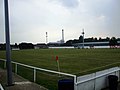 Southwick FC (8575366691).jpg 3,296 × 2,472; 4.16 MB
-
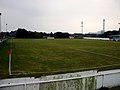 Southwick FC (8576465556).jpg 3,296 × 2,472; 4.62 MB
-
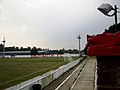 Southwick FC (8576467818).jpg 3,296 × 2,472; 4.06 MB
-
 Southwick Green - geograph.org.uk - 2786462.jpg 1,600 × 887; 206 KB
-
 Southwick Hill Tunnel - geograph.org.uk - 2185749.jpg 640 × 480; 97 KB
-
 Southwick Hill Tunnel - geograph.org.uk - 2584777.jpg 640 × 480; 89 KB
-
 Southwick Hill Tunnel - geograph.org.uk - 497180.jpg 640 × 479; 162 KB
-
 Southwick Hill Tunnel heading south - geograph.org.uk - 2436265.jpg 640 × 480; 128 KB
-
 Southwick Hill Tunnel, A27 - geograph.org.uk - 2868410.jpg 640 × 430; 49 KB
-
 Southwick Locks - geograph.org.uk - 1484711.jpg 640 × 480; 68 KB
-
 Southwick Locks Station - geograph.org.uk - 1485032.jpg 640 × 480; 53 KB
-
 Southwick Recreation Ground - geograph.org.uk - 1738958.jpg 1,600 × 1,200; 361 KB
-
 Southwick Seafront - geograph.org.uk - 1484894.jpg 640 × 480; 57 KB
-
 Southwick Square - geograph.org.uk - 1484654.jpg 640 × 480; 65 KB
-
 Southwick Square - geograph.org.uk - 2184930.jpg 640 × 480; 74 KB
-
 Southwick Square - geograph.org.uk - 2185195.jpg 640 × 480; 82 KB
-
 Southwick Square - geograph.org.uk - 2605117.jpg 1,600 × 1,200; 340 KB
-
 Southwick Street, Southwick - geograph.org.uk - 2786474.jpg 1,600 × 1,200; 331 KB
-
 Southwick Wheel and Tyre Centre - geograph.org.uk - 750293.jpg 479 × 640; 89 KB
-
 St Andrew's Road - geograph.org.uk - 2584723.jpg 640 × 480; 119 KB
-
 St Peter's Road - geograph.org.uk - 2587138.jpg 640 × 480; 148 KB
-
 Station Road (B2167), Southwick - geograph.org.uk - 648167.jpg 640 × 480; 72 KB
-
 Steel Yard - geograph.org.uk - 1767959.jpg 1,280 × 853; 301 KB
-
 Stormy Seas off Southwick - geograph.org.uk - 1564125.jpg 640 × 480; 46 KB
-
 Summer Down, Devil's Dyke Car Park - geograph.org.uk - 582142.jpg 640 × 480; 92 KB
-
 Survey Vessel "Adurni" - geograph.org.uk - 3849272.jpg 2,218 × 1,479; 445 KB
-
 Sussex Yacht Club Boat Store.jpg 4,487 × 3,365; 2.72 MB
-
 The Canal - geograph.org.uk - 1633923.jpg 640 × 480; 71 KB
-
 The Canal - geograph.org.uk - 1633956.jpg 480 × 640; 63 KB
-
 The Canal - geograph.org.uk - 750300.jpg 640 × 479; 96 KB
-
 The Green, Southwick - geograph.org.uk - 1484669.jpg 640 × 480; 76 KB
-
 The Green, Southwick - geograph.org.uk - 47535.jpg 640 × 479; 118 KB
-
 The Hall, The Green, Southwick.jpg 4,608 × 3,456; 5.47 MB
-
 The Manor House, 24 Southwick Street, Southwick (IoE Code 297358).jpg 2,400 × 1,800; 1,019 KB
-
-
 The Portslade Gassie - geograph.org.uk - 2534626.jpg 1,600 × 1,200; 909 KB
-
 The Romans Pub, Southwick - geograph.org.uk - 2605130.jpg 1,600 × 1,200; 275 KB
-
 Timber stacks - geograph.org.uk - 649759.jpg 640 × 480; 67 KB
-
 Timber, Wharf 10 - geograph.org.uk - 488840.jpg 479 × 640; 152 KB
-
 Turberville Wharf - geograph.org.uk - 488739.jpg 479 × 640; 123 KB
-
 Upper Kingston Lane - geograph.org.uk - 497189.jpg 640 × 467; 130 KB
-
 Vale Park, Portslade - geograph.org.uk - 3667681.jpg 1,600 × 1,200; 534 KB
-
 Waiting for the Lock Gates (2) - geograph.org.uk - 488762.jpg 640 × 479; 146 KB
-
 Waiting for the Lock Gates - geograph.org.uk - 488749.jpg 640 × 479; 143 KB
-
 Wellington Road - geograph.org.uk - 2587003.jpg 640 × 480; 109 KB
-
 Wellington Road - geograph.org.uk - 2587800.jpg 640 × 480; 124 KB
-
 West Pier, Shoreham Harbour - geograph.org.uk - 5278698.jpg 640 × 508; 62 KB
-
 Wood spill at Southwick Beach - geograph.org.uk - 1535481.jpg 640 × 480; 94 KB
-
 Albion Street - geograph.org.uk - 1146437.jpg 640 × 487; 65 KB
-
 Albion Street, Southwick - geograph.org.uk - 1013615.jpg 640 × 480; 154 KB
-
 Arrow Tyre Services - geograph.org.uk - 750315.jpg 479 × 640; 91 KB
-
 Bridge under railway - geograph.org.uk - 1484687.jpg 640 × 435; 126 KB
-
 Former Sea Cliffs - geograph.org.uk - 750284.jpg 479 × 640; 109 KB
-

-
 Southwick harbour arm.Breakwater. - geograph.org.uk - 321432.jpg 640 × 480; 54 KB
-

.jpg)
.jpg)
.jpg)
_(June_2023).jpg)

.jpg)


.jpg)


.jpg)


.jpg)
,_Fishersgate_Terrace,_Fishersgate_(NHLE_Code_1027851)_(December_2019).jpg)


_in_Wellington_Road,_Portslade-by-Sea_-_geograph.org.uk_-_4997559.jpg)

_(July_2020).jpg)


.jpg)


_at_Downsway,_North_Southwick_(8296366701).jpg)


.jpg)
.jpg)
.jpg)
.jpg)
.jpg)


,_Southwick_-_geograph.org.uk_-_648167.jpg)


.jpg)


_-_geograph.org.uk_-_488762.jpg)


_and_Station_Road_(B2167)_-_geograph.org.uk_-_648176.jpg)
