File:The Aral Sea (NESDIS 2016-04-04).png
Jump to navigation
Jump to search
Size of this preview: 800 × 450 pixels. Other resolutions: 320 × 180 pixels | 640 × 360 pixels | 1,024 × 576 pixels | 1,280 × 720 pixels | 1,920 × 1,080 pixels.
Original file (1,920 × 1,080 pixels, file size: 3.07 MB, MIME type: image/png)
Captions
Captions
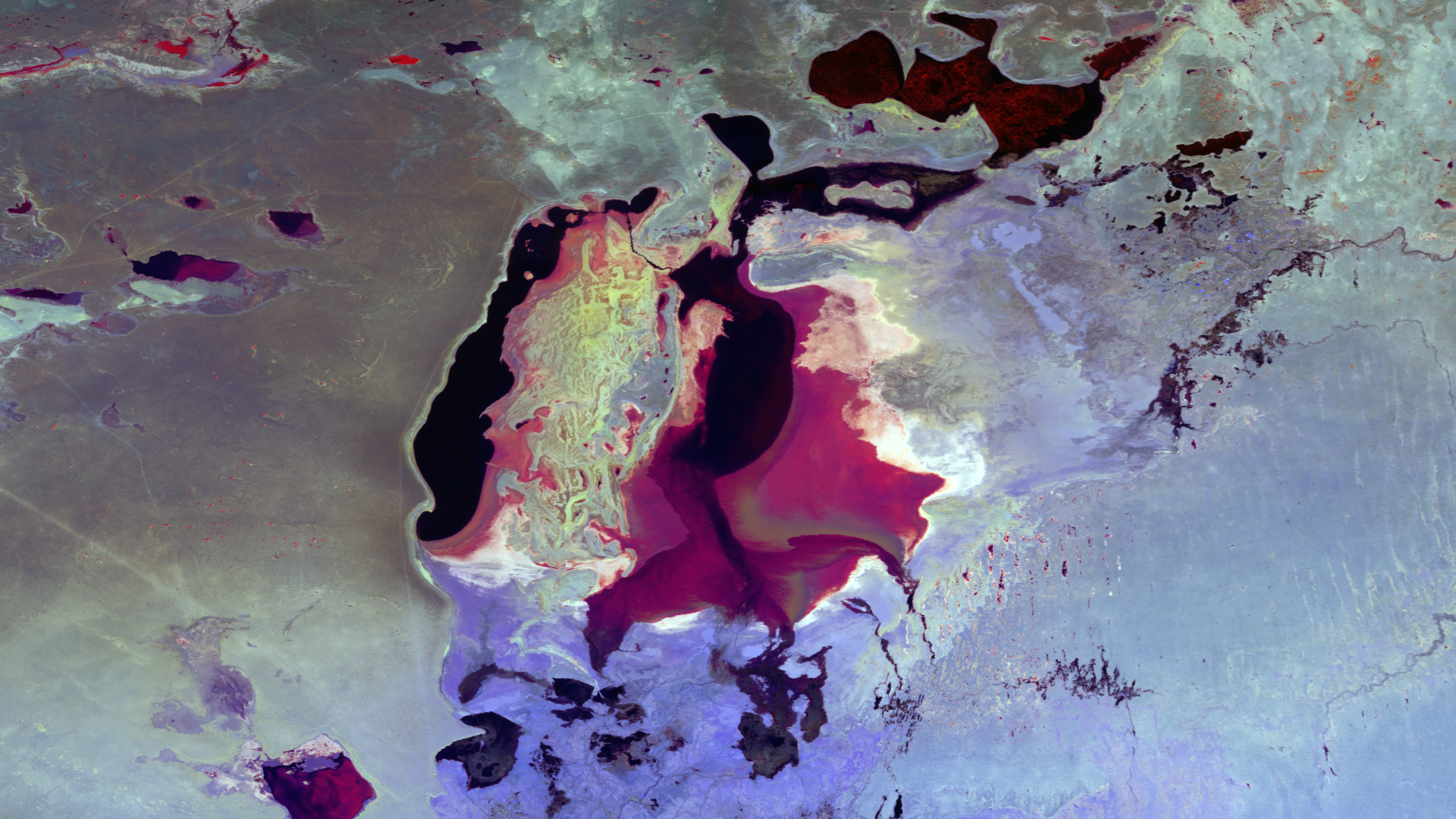
The Aral Sea, split between Uzbekistan to the south and Kazakhstan to the north, used to be one of the largest lakes in the world. Now, after years of water loss, it is mostly dried up lake beds.
Summary
[edit].png&action=edit§ion=1)
| Description |
English: The Aral Sea, split between Uzbekistan to the south and Kazakhstan to the north, used to be one of the largest lakes in the world. Now, after years of water loss, it is mostly dried up lake beds. This image, taken on March 4, 2016, uses multiple spectral bands (SVI 4, 1, 3) from the VIIRS instrument on the Suomi NPP satellite that are sensitive to subtle differences in surface temperature, condition, and vegetation. Dark areas are where water still stands, blues are the surrounding barren lands, and greens are associated with the wetlands that feed the inland sea. |
| Date | 4 April 2016 (upload date) |
| Source | The Aral Sea |
| Author | NOAA |
Licensing
[edit].png&action=edit§ion=2)
This image is in the public domain because it contains materials that originally came from the U.S. National Oceanic and Atmospheric Administration, taken or made as part of an employee's official duties.
|
File history
Click on a date/time to view the file as it appeared at that time.
| Date/Time | Thumbnail | Dimensions | User | Comment | |
|---|---|---|---|---|---|
| current | 13:22, 2 June 2024 | | 1,920 × 1,080 (3.07 MB) | OptimusPrimeBot (talk | contribs) | #Spacemedia - Upload of https://nesdis-prod.s3.amazonaws.com/migrated/20160304-AralSea-SVI413.png via Commons:Spacemedia |
You cannot overwrite this file.
File usage on Commons
There are no pages that use this file.
.png&oldid=880837909)