File:The Aral Sea (MODIS 2019-10-11).jpg

Original file (2,555 × 1,939 pixels, file size: 833 KB, MIME type: image/jpeg)
Captions
Captions
Summary
[edit].jpg&action=edit§ion=1)
| Description |
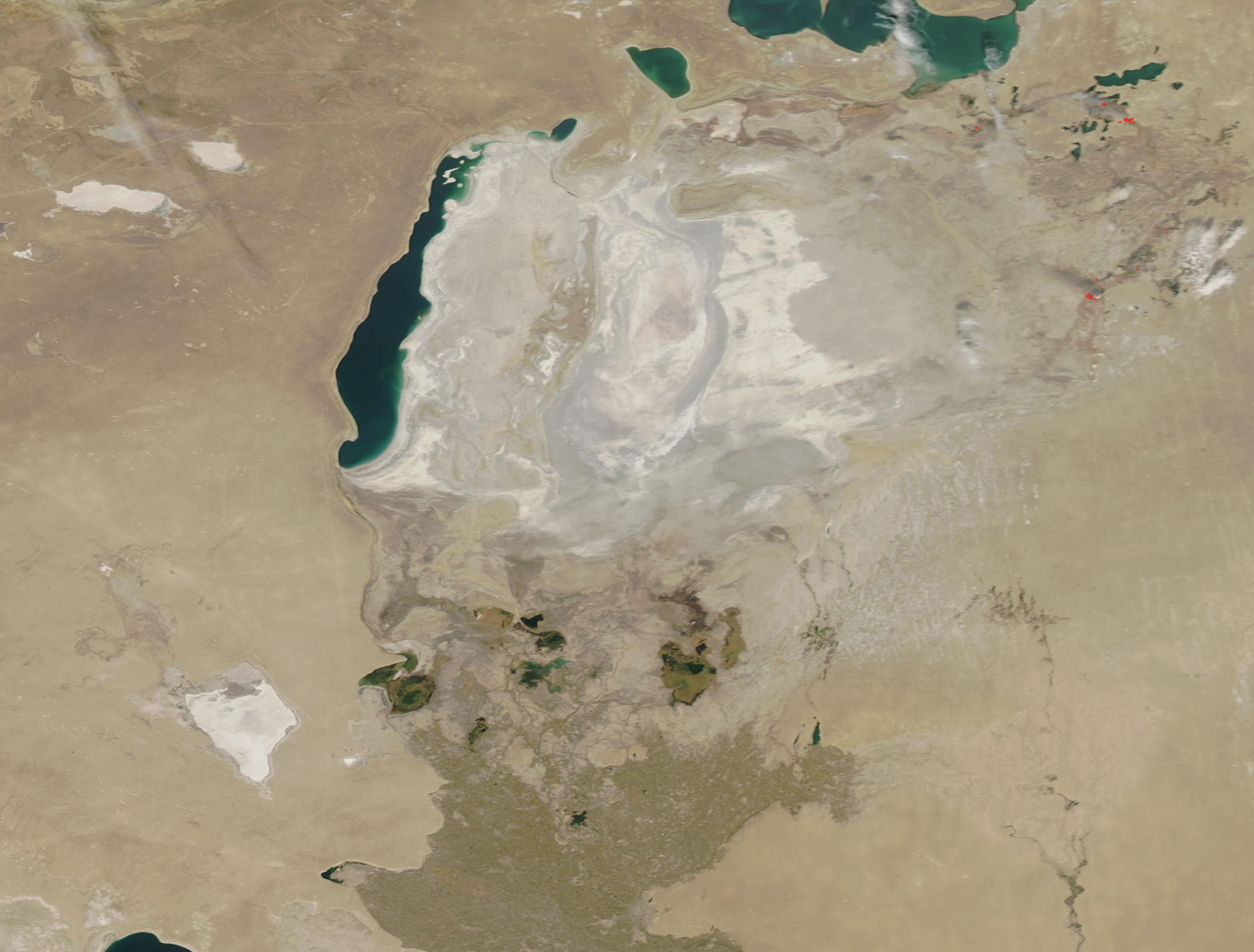
English: Once one of the four largest lakes on Earth, the Aral Sea has shrunk dramatically in recent years, with only about 10 percent of the original waters remaining. For thousands of years the Aral Sea was an expansive land-locked lake spanning more than 68,000 square kilometers (26,255 sq. mi), a size just a little smaller than the Republic of Ireland. It measured almost 435 km (270 mi) at its longest north-south extent, and measured just over 290 km (180 mi) at its widest spot. The average depth was only about 16 meters (53 feet), but it plunged to a depth of 69 meters (226 feet) near the western shore.
In the 1960s, the Soviet Union undertook a major water diversion project on the arid plains of Kazakhstan, Uzbekistan, and Turkmenistan. The region’s two major rivers, the Syr Darya and Amu Darya, which flowed from the mountains to feed the Aral Sea, were diverted to transform the desert into farms for cotton and other crops. While a success for farming, the diversion of the rivers proved disastrous for the Aral Sea and the people who have made their living from it and who enjoyed the vast waters and the fish, birds, and beautiful seashores the lake supported. On October 7, 2019, the Moderate Resolution Imaging Spectroradiometer (MODIS) on board NASA’s Aqua satellite acquired a true-color image of the modern Aral Sea. The former lakebed is covered with saline mineral precipitate and dust, coloring it in light tans and grays. |
||
| Date | Taken on 7 October 2019 | ||
| Source |
|
||
| Author | MODIS Land Rapid Response Team, NASA GSFC |
| This media is a product of the Aqua mission Credit and attribution belongs to the mission team, if not already specified in the "author" row |
Licensing
[edit].jpg&action=edit§ion=2)
| This file is in the public domain in the United States because it was solely created by NASA. NASA copyright policy states that "NASA material is not protected by copyright unless noted". (See Template:PD-USGov, NASA copyright policy page or JPL Image Use Policy.) | ||
 |
Warnings:
|
File history
Click on a date/time to view the file as it appeared at that time.
| Date/Time | Thumbnail | Dimensions | User | Comment | |
|---|---|---|---|---|---|
| current | 02:59, 17 February 2024 | | 2,555 × 1,939 (833 KB) | OptimusPrimeBot (talk | contribs) | #Spacemedia - Upload of http://modis.gsfc.nasa.gov/gallery/images/image10112019_250m.jpg via Commons:Spacemedia |
You cannot overwrite this file.
File usage on Commons
There are no pages that use this file.
.jpg&oldid=909381099)