File:Taal Volcano in the Philippines (Copernicus).jpg

Original file (4,000 × 2,540 pixels, file size: 6.19 MB, MIME type: image/jpeg)
Captions
Captions
Summary
[edit].jpg&action=edit§ion=1)
| Description |
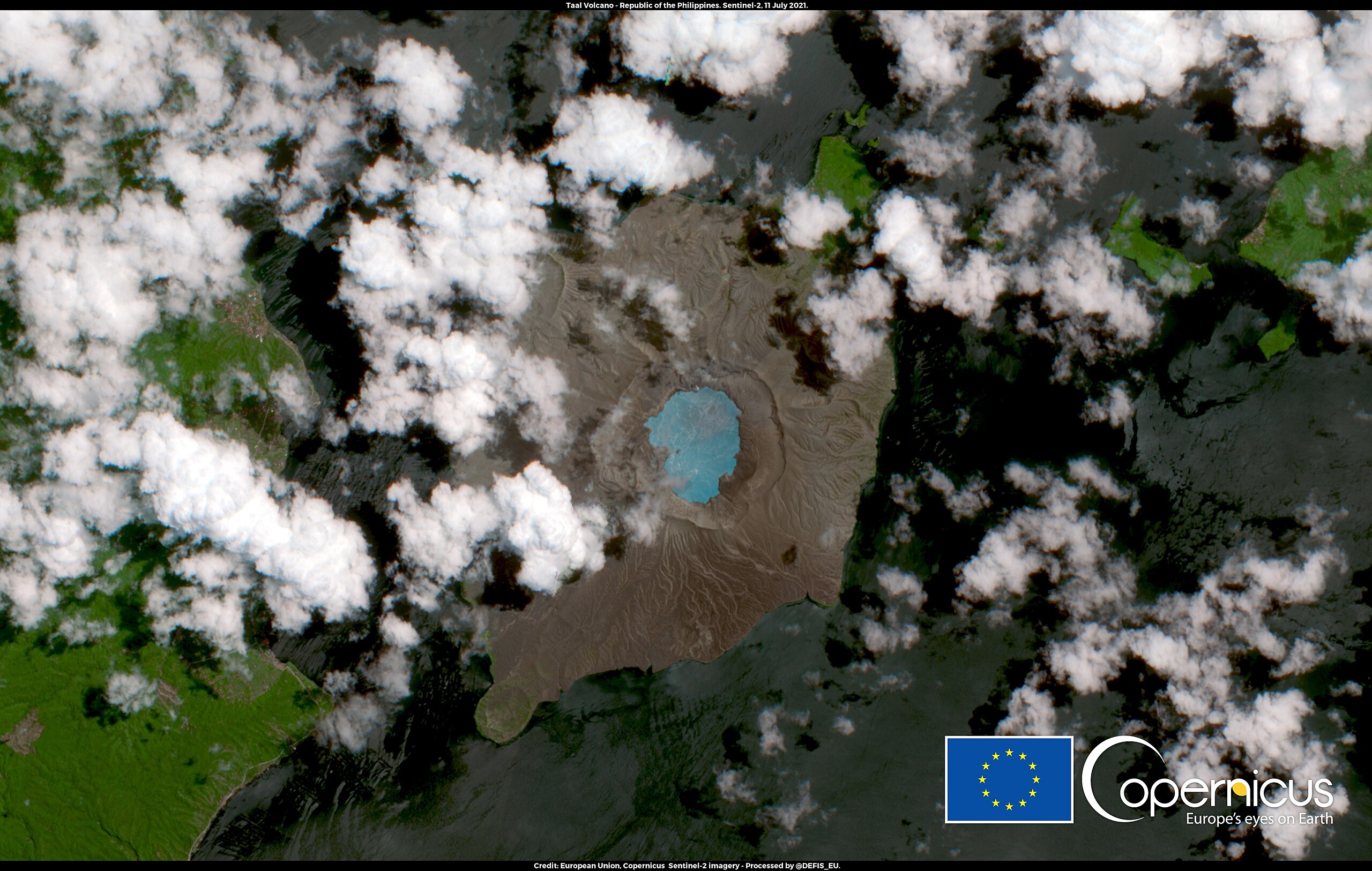
English: This image, acquired by one of the Copernicus Sentinel-2 satellites on 11 July 2021, shows the Taal volcano. Taal is one of the most active and dangerous volcanoes in the Philippines. After a disastrous eruption in 2020, it returned to a state of unrest in the 2021 summer. After a phreatomagmatic eruption which occurred on 1 July, the Philippine Institute of Volcanology and Seismology (Phivolcs) raised the alert to level 3 (on a scale of 5), and about 10,000 people were displaced. On 11 July, the day this image was acquired, the alert was still in force, and 185 volcanic earthquakes were recorded in just 24 hours. The open data from the Copernicus missions allow monitoring the world's volcanoes with high spatial and temporal resolution. |
| Date | Taken on 11 July 2021 |
| Source | Taal Volcano in the Philippines |
| Author | European Union, Copernicus Sentinel-2 Imagery |
Licensing
[edit].jpg&action=edit§ion=2)

|
This image contains data from a satellite in the Copernicus Programme, such as Sentinel-1, Sentinel-2 or Sentinel-3. Attribution is required when using this image.
Attribution: Contains modified Copernicus Sentinel data 2021
The use of Copernicus Sentinel Data is regulated under EU law (Commission Delegated Regulation (EU) No 1159/2013 and Regulation (EU) No 377/2014). Relevant excerpts:
Free access shall be given to GMES dedicated data [...] made available through GMES dissemination platforms [...].
Access to GMES dedicated data [...] shall be given for the purpose of the following use in so far as it is lawful:
GMES dedicated data [...] may be used worldwide without limitations in time.
GMES dedicated data and GMES service information are provided to users without any express or implied warranty, including as regards quality and suitability for any purpose. |
File history
Click on a date/time to view the file as it appeared at that time.
| Date/Time | Thumbnail | Dimensions | User | Comment | |
|---|---|---|---|---|---|
| current | 14:27, 9 September 2023 | | 4,000 × 2,540 (6.19 MB) | OptimusPrimeBot (talk | contribs) | #Spacemedia - Upload of https://www.copernicus.eu/system/files/2021-07/image_day/20210712_TaalVolcano.jpg via Commons:Spacemedia |
You cannot overwrite this file.
File usage on Commons
There are no pages that use this file.
.jpg&oldid=828692080)